- A Thermal Landscape Unlike Any Other
- Common Features: Fumaroles and Mudpots
- Discovery of the Caldera
- Hot Springs
- Geysers
- Studying Geysers
- Where does this water come from?
- Subterranean Rivers
- Dynamic and Vulnerable
- Conclusion: Wonders Worth Protecting
- References
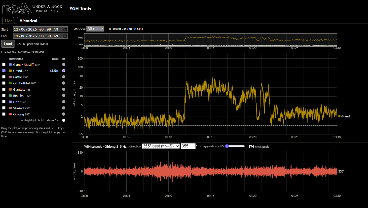
YGH Monitor App - Pt. 3: Use Cases
A living document showcasing examples of verified eruptions and their YGH traces
Published on: Thursday, 12 November 2026 at 00:55 UTC
YGH Monitor App - Pt. 2: How to Use the Tools
Instructions on how to navigate and use the YGH Monitor App for various forms of geyser gazing.
Published on: Saturday, 07 November 2026 at 00:55 UTC
YGH Monitor App - Pt. 1: Introduction
A new instrument in Yellowstone can be used for geyser gazing
Published on: Saturday, 07 November 2026 at 00:55 UTC
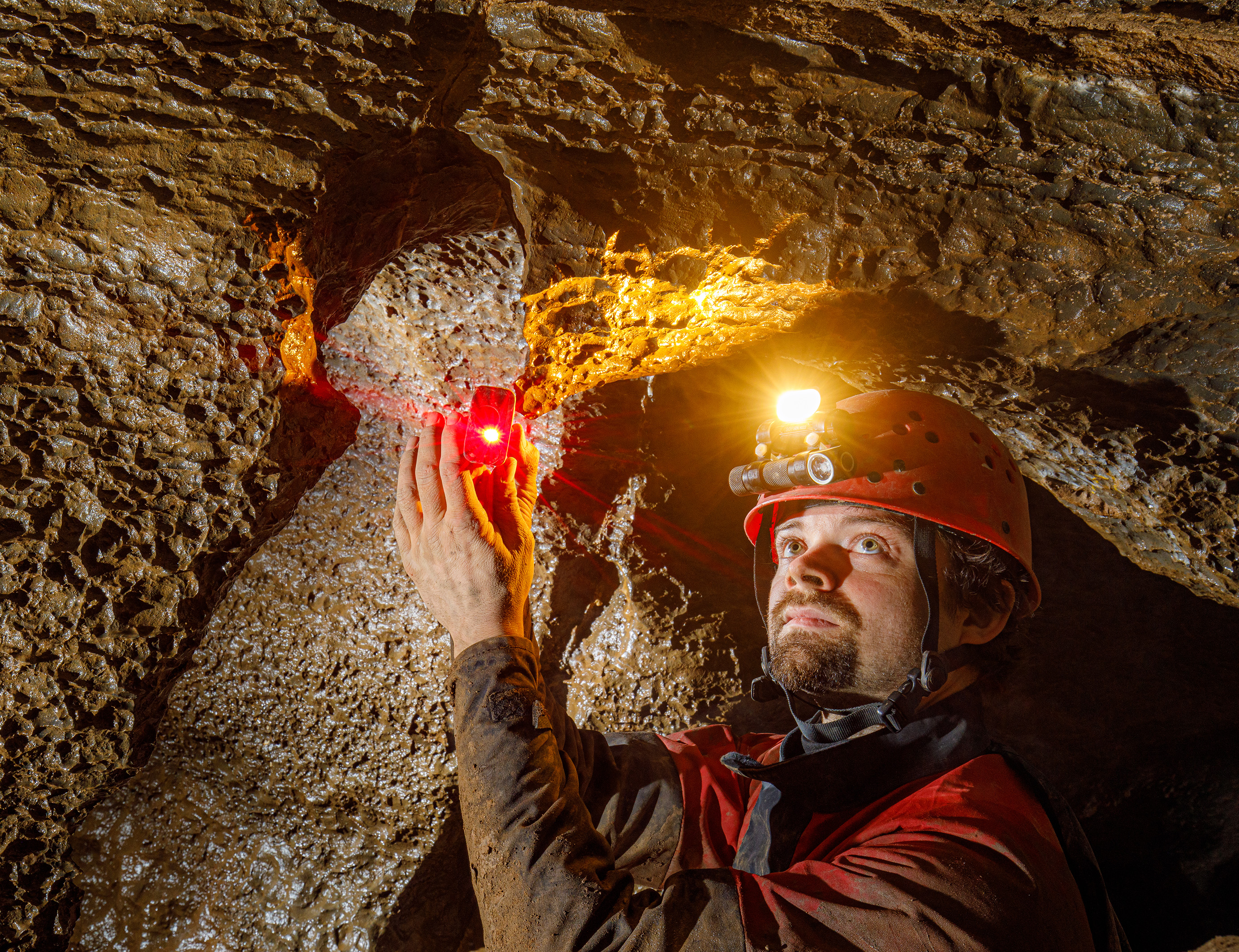
Sofirn's HS22 and SP40A Headlamps
For cavers, this is like having a sub-$150 Scurion
Published on: Wednesday, 17 December 2025 at 11:55 UTC
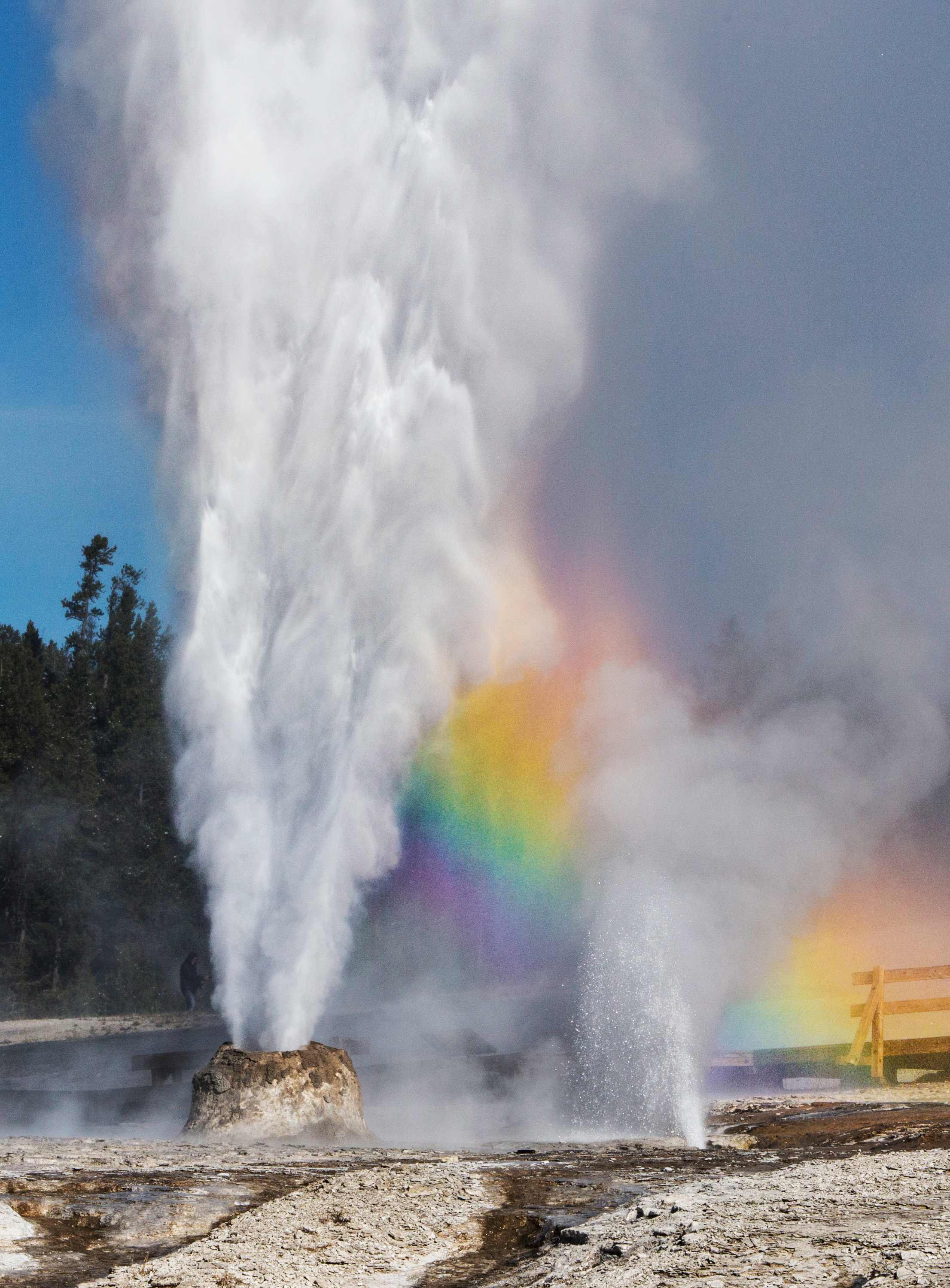
The Thermals Features of Yellowstone
Just over 3,000 words you didn't know you wanted to read.
Published on: Tuesday, 07 October 2025 at 11:55 UTC
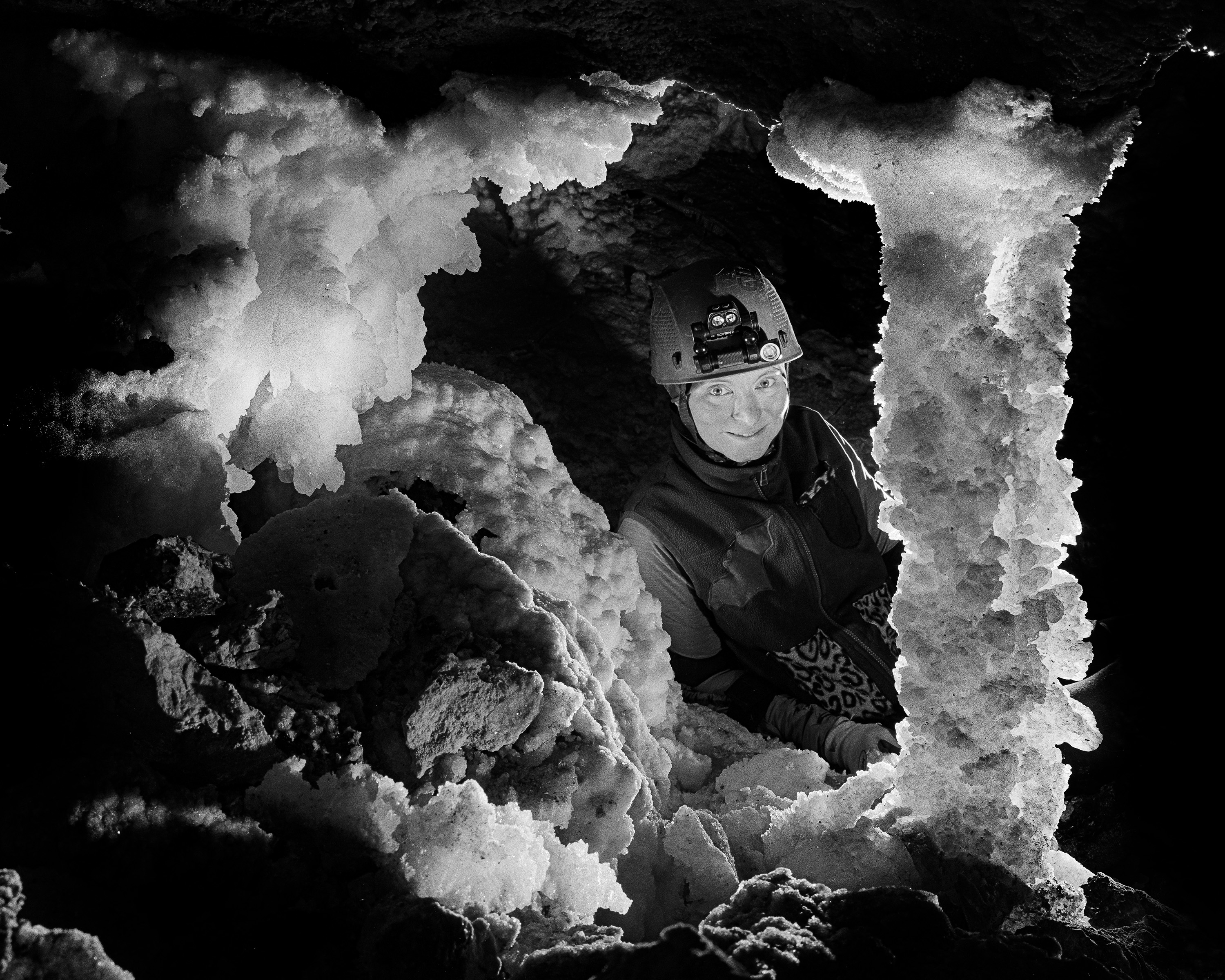
Trip Report: Bighorn-Horsethief Cave System
Surveying and photography during the August 2025 project weekend.
Published on: Wednesday, 01 October 2025 at 11:55 UTC
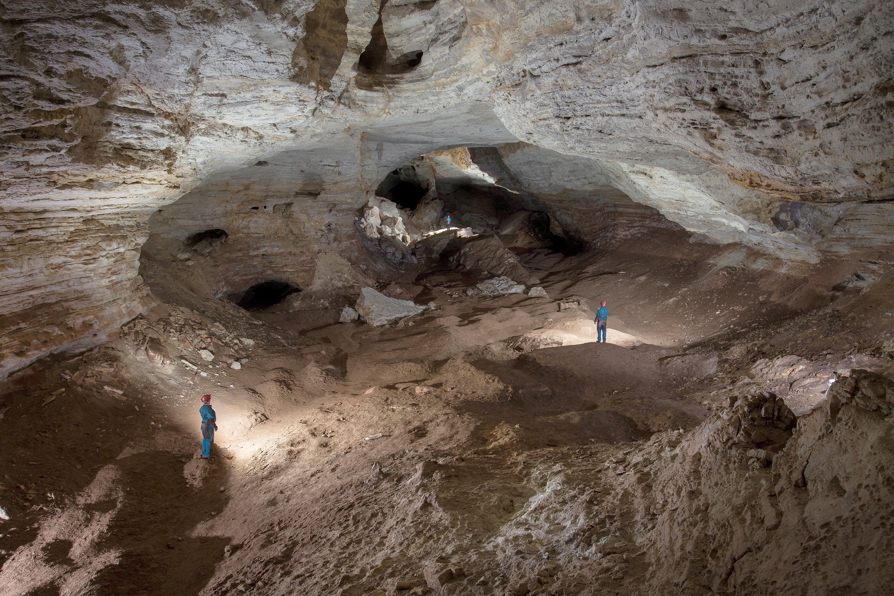
Bighorn-Horsethief Cave System
An introduction to the longest known cave in Wyoming and Montana
Published on: Tuesday, 23 September 2025 at 11:55 UTC
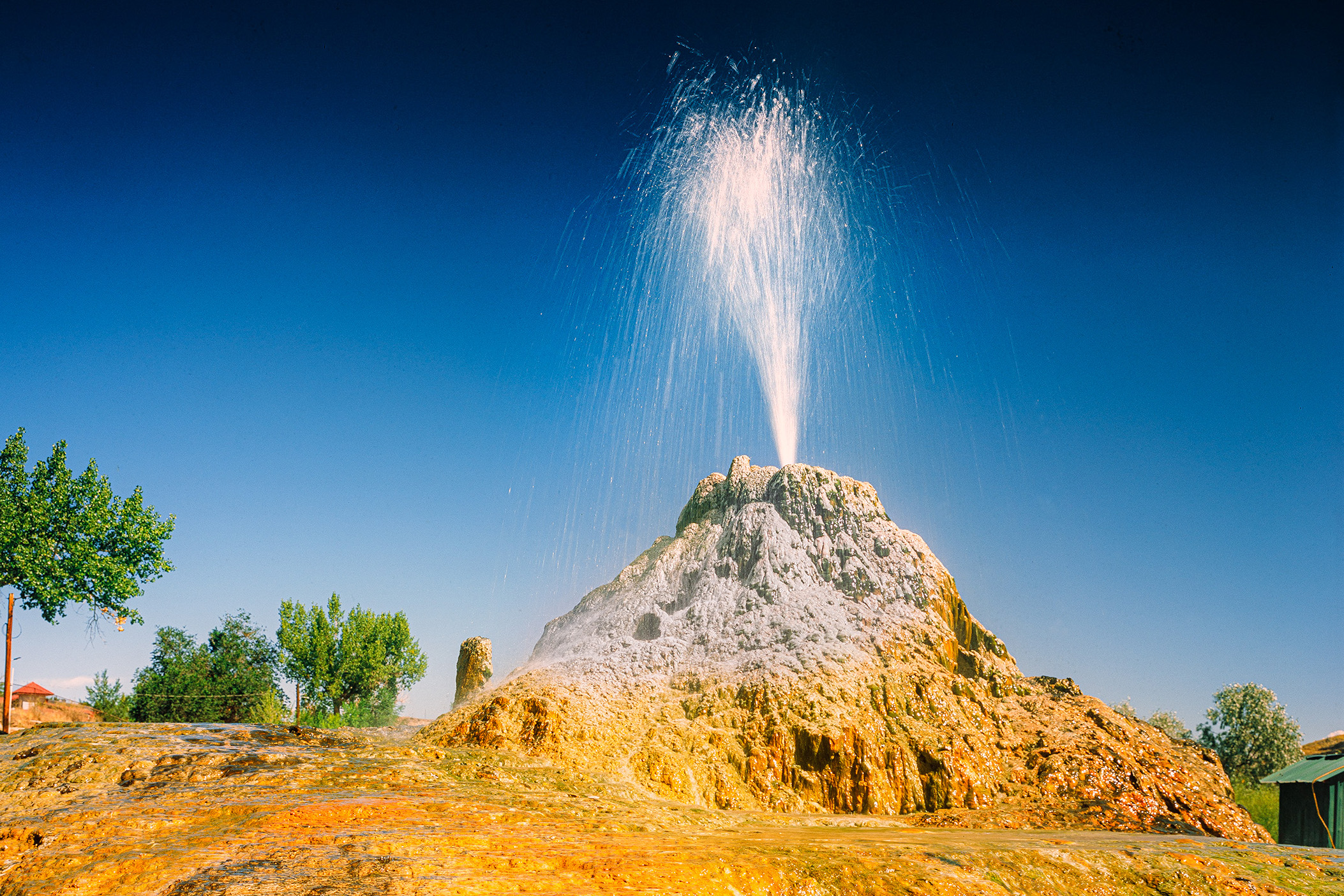
Thermopolis, WY, August 2025
Large travertine hot springs in central Wyoming
Published on: Friday, 19 September 2025 at 11:55 UTC
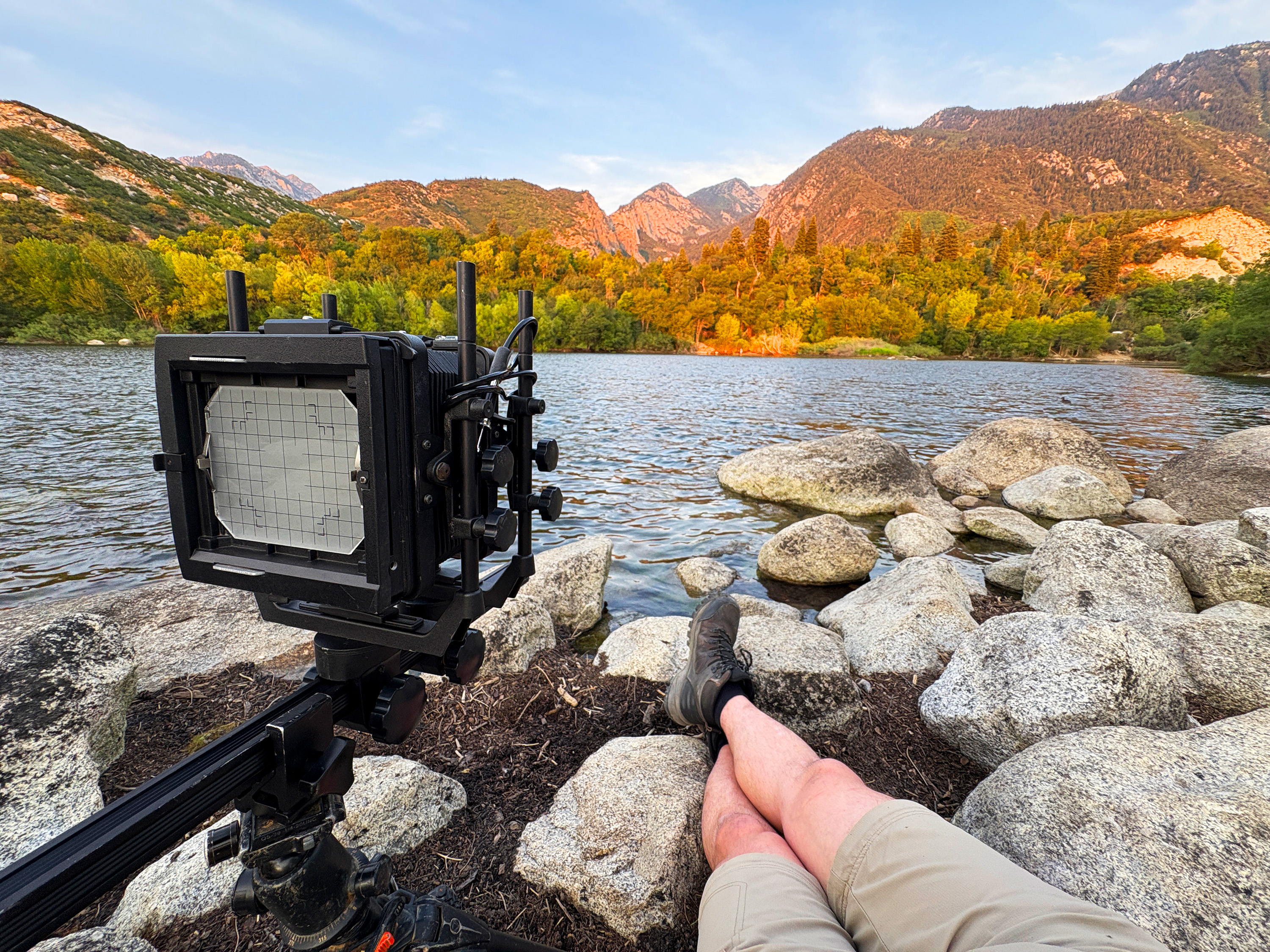
Lazy Photography in the Wasatch Range
Easy hiking and drive up sunsets from suburban Salt Lake City
Published on: Thursday, 11 September 2025 at 12:26 UTC
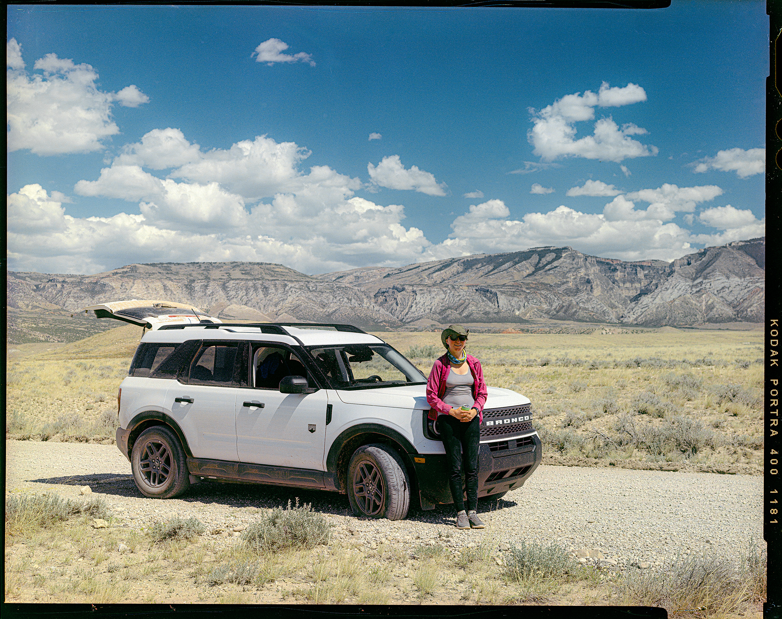
Car Review: 2026 Ford Bronco Sport
1500 miles of driving and camping with the 2026 Ford Bronco Sport
Published on: Wednesday, 10 September 2025 at 11:55 UTC
Wyoming, August 2025
Logistics and gear for eleven days of caving and photography in Big Sky Country
Published on: Wednesday, 10 September 2025 at 11:55 UTC
.jpg)
Tonto Natural Bridge
Massive travertine formation in central Arizona
Published on: Wednesday, 29 November 2023 at 11:55 UTC

Building This Website
Part 1: Lessons learned in mentally herding cats.
Published on: Friday, 14 July 2023 at 19:48 UTC
The Thermals Features of Yellowstone
Just over 3,000 words you didn't know you wanted to read.
Published: Tuesday, 07 October 2025 at 11:55 UTC
Contents:
The thermal areas of Yellowstone National Park provide some of the most overt displays of the volcanic system which underlies the region. The massive magma chamber, almost all of which is too solid to erupt, imparts immense amounts of heat into the subsurface – in some places the ground is hot enough to cook eggs only a few feet below the surface. At the same time, Yellowstone sits at the end of a geographic funnel which channels moist air from the Pacific Northwest and makes the Yellowstone Plateau one of the wettest areas in the Rocky Mountains. This moisture falls as rain and snow, most of which runs off to feed rivers and lakes, but some sinks deep into the ground and becomes heated by the volcano. This superheated water then rises and resurges to form hot springs, geysers, mudpots, and fumaroles – the hydrothermal features which made Yellowstone famous in the first place..
Yellowstone National Park is politically defined as the area in the northwest corner of Wyoming bounded on the north, west, and south mostly by geographic lines of latitude and longitude and bounded on the east by the high peaks of the Absaroka Mountains. This is the final result of decades of shifting boundaries which began with the establishment of the park in 1872[1]. The original boundaries were defined to encompass all of the major hydrothermal regions discovered in the 1860s and 1870s. These regions are scattered throughout the park, with a roughly circular distribution of the major geyser basins and hot springs..
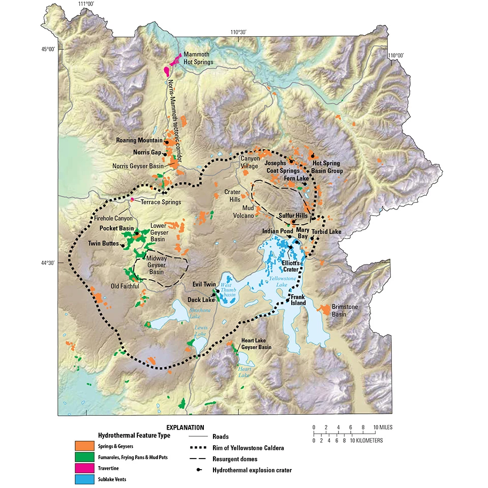
Distribution of thermal areas through Yellowstone National Park. Graphic sourced: NPS
These hydrothermal features were the driving force behind the establishment of Yellowstone as a national park – a previously unheard-of designation for land in the United States2. Decades of rumor and mystery shrouded the region, and it was not until 1869 that a reputable party launched an expedition through the area and returned to support the tales of mountain men and First Peoples alike. Expeditions in 1870 and 1871 returned with photographs and paintings of these spectacular natural wonders and, despite fierce local opposition, spurred Congress to set aside this immense tract of land out in the remote Rockies from future commercial development.
A Thermal Landscape Unlike Any Other

Old Faithful Geyser, 1872. William Henry Jackson was the photographer who accompanied the 1870 Washburn expedition to the Yellowstone region. His photographs helped spur Congress into radical action to protect the tract of land that is now Yellowstone National Park. He took this photo in 1872, replacting a scene he had documented two years prior with greater clarity and depth. Image accessed from https://www.nps.gov/museum/exhibits/whj/expeditions/1872/SCBL779_Old_Faithful_Eruption_WHJ.jpg
What these expeditions found was a region of geothermal activity on a scale never before seen on Earth. Hot springs, which are simply springs of water heated to an arbitrary temperature, were relatively common in human awareness. Geysers, hot springs which occasionally erupt and eject their water forcefully, were less common and the average person was unlikely to have heard of them unless they lived near the ones which existed in Iceland, New Zealand, or Russia. Here, in the headwaters of the Yellowstone, were hundreds of geysers – some of which erupted to heights of over 200 feet. The hydrothermal fields of Yellowstone have had nearly 1,300 springs recorded as having erupted as geysers, well over half of the known geysers throughout the entire world[3],[4].
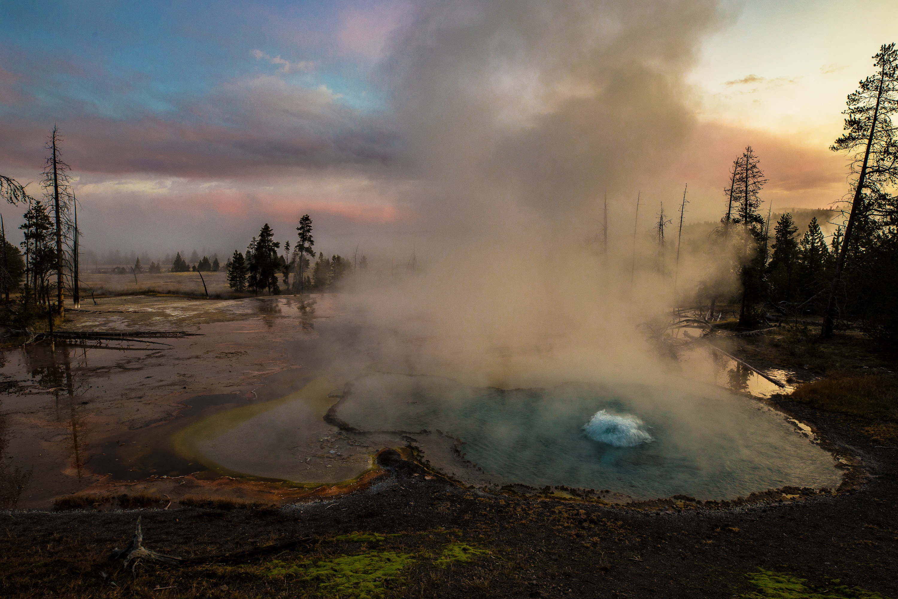
Common Features: Fumaroles and Mudpots
These early explorers only vaguely realized they were standing on top of a huge volcano. They recognized this in part because the hydrothermal features found in Yellowstone generally only occur on top of or very close to active volcanoes.[5] The magma which feeds volcanoes contains fluids: liquids and gases trapped within the molten rock. Most of this fluid is just water, with smaller amounts of hydrogen sulfide, carbon dioxide, and a few other compounds. As magma rises, the pressure on it by overlying rock decreases, and these fluids begin to escape from the magma chamber and rise toward the surface.[6] In almost every active volcano these gases then emerge through cracks in the ground as fumaroles – steam vents from which the extremely hot and high-pressure gases and fluids flow into the atmosphere.[7]
Fumaroles are found throughout Yellowstone – they are perhaps the most common hydrothermal expression in the park. Anywhere that fractures allow the fluids from the magma chamber to escape, there are fumaroles which eject them. Sometimes these vents are loud, violent jets of steam and sometimes fine water spray like what is found at Beryl Spring. Sometimes they are not even visible; the gases simply rise up out of the ground and the only thing marking their presence is a bare patch of soil where no trees and vegetation can survive.
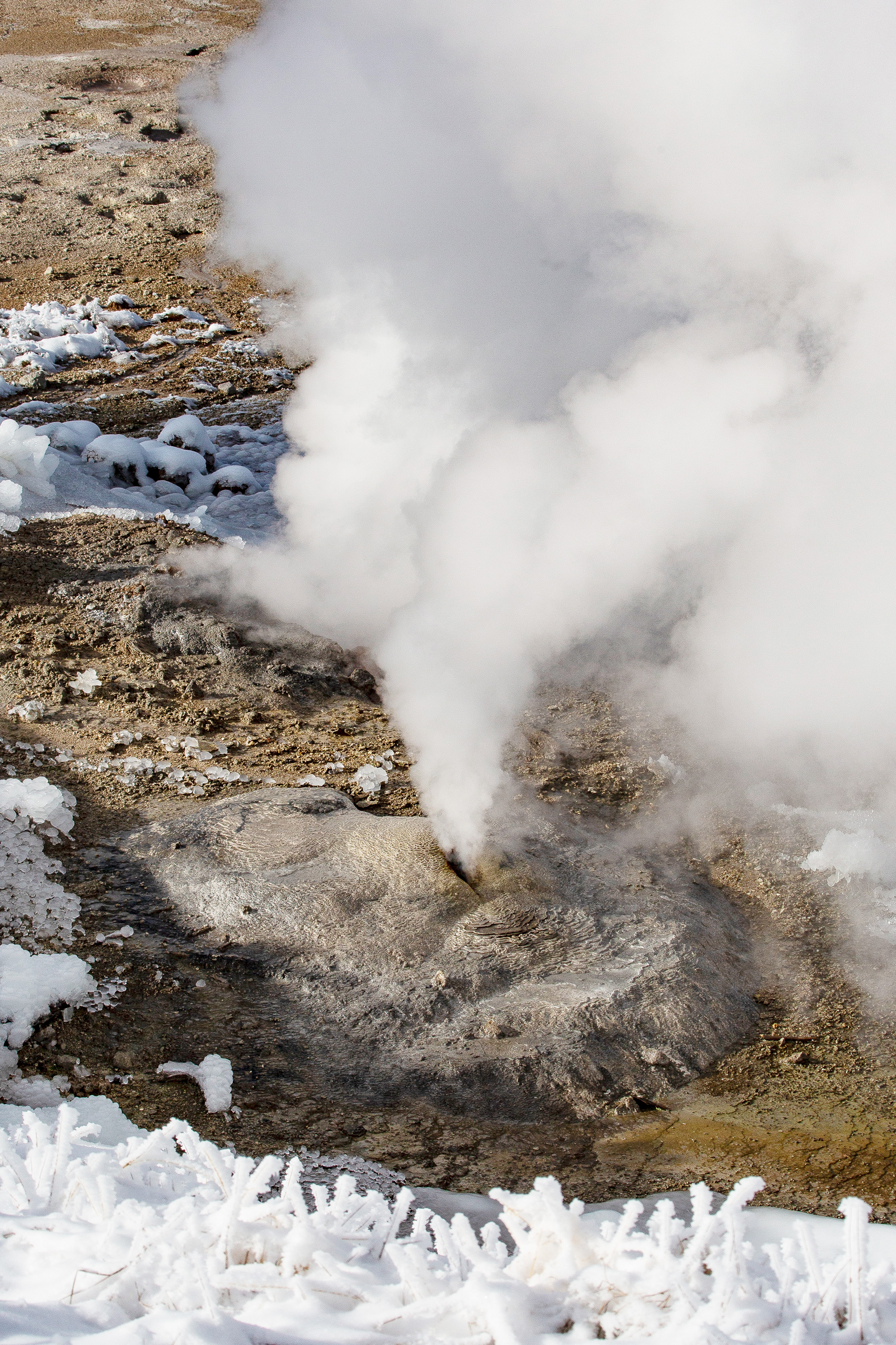
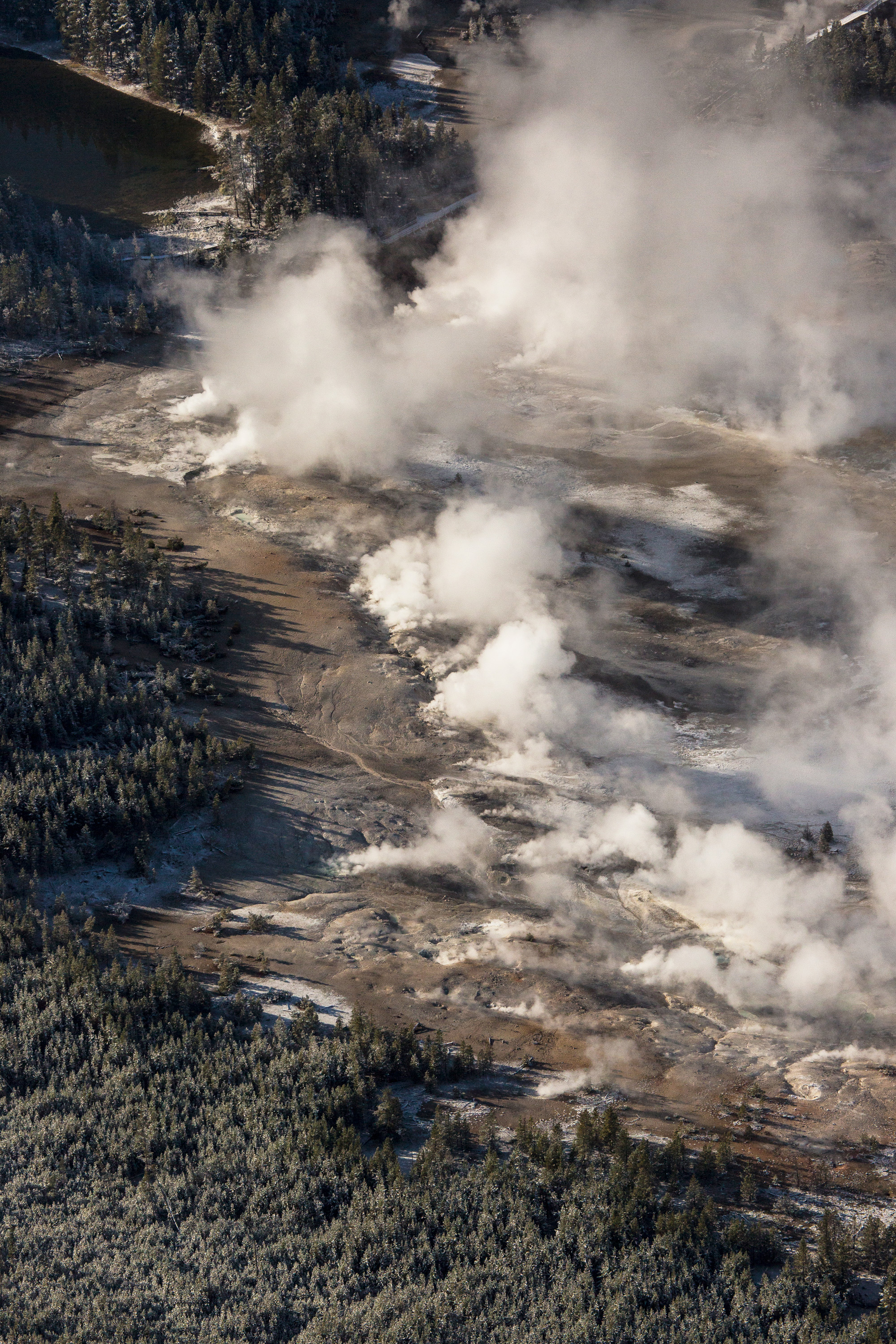
These gases carry with them hydrogen sulfide, a compound which forms sulfuric acid when it interacts with water and oxygen. Sulfuric acid is capable of decomposing the bedrock into a fine clay-like substance which is also common on most active volcanoes. Many hydrothermal areas are rather dangerous locations to explore on foot because the ground can suddenly be this acidic, corroded clay. When this clay-like substance enters the fumaroles it gets carried upward where it emerges in the form of mudpots[8]. Mudpots are also found throughout Yellowstone – anywhere escaping acidic gases have been able to corrode the ground and then mix with local groundwater. Mudpots are very dependent on the amount of local groundwater available to them and many change seasonally from soupy, wet, bubbling stews in the winter and spring, to popping and bursting explosions of mud in the summer, and sometimes all the way to fumaroles in the fall when all the moisture dries up.
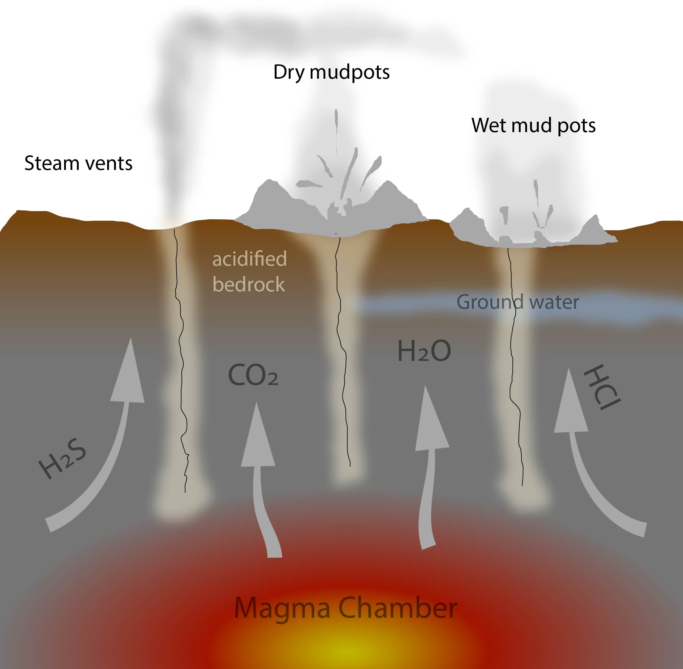
Rising volcanic gases and fluids such as water (H2O), hydrogen sulfide (H2Cl), hydrogen chloride (HCl), and carbon dioxide (CO2) vent to the surface via cracks and fissures. Sometimes the acidified bedrock is carries along these fractures and ejected on the surface as mud pots, where the relative amount of ground water can make them very wet like soup, or thick like peanut butter. Graphic made by the author, with no copyrights.
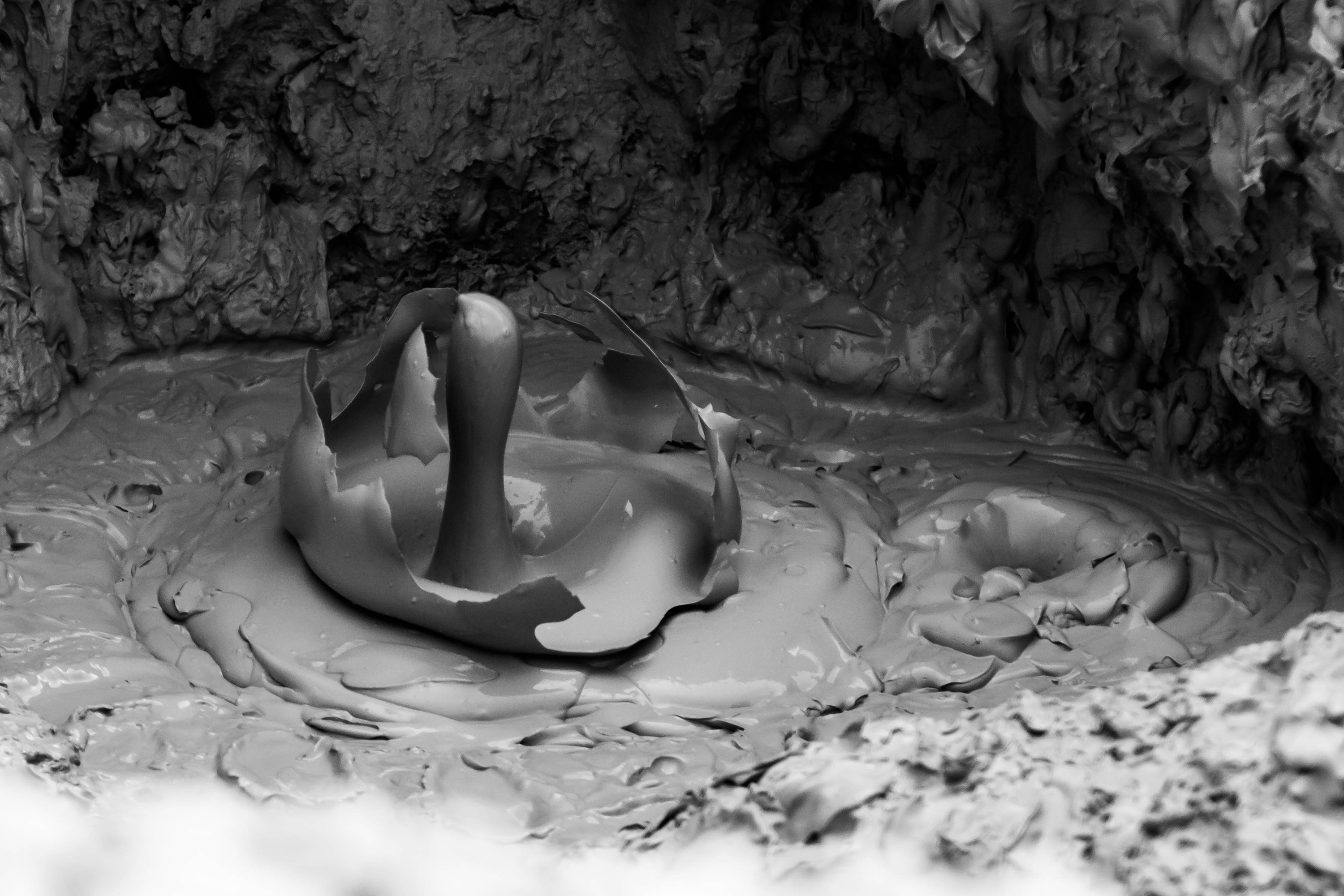
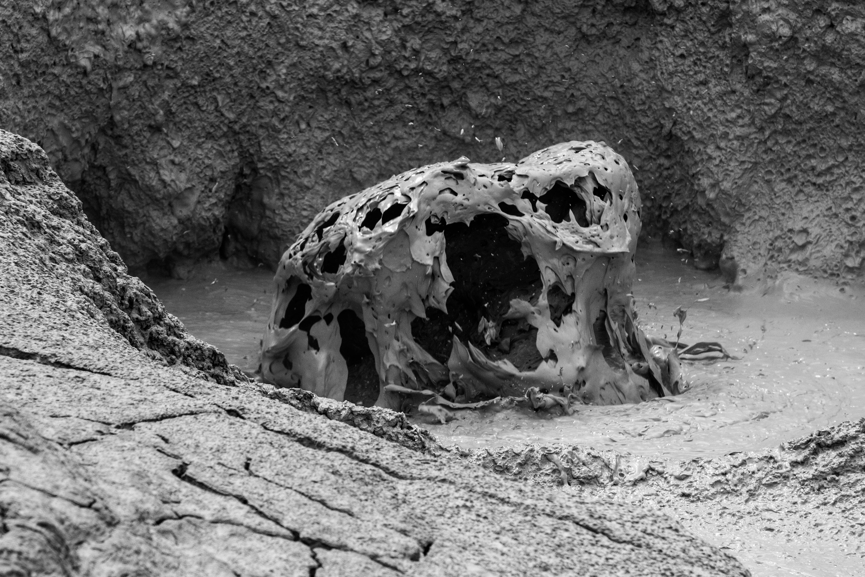
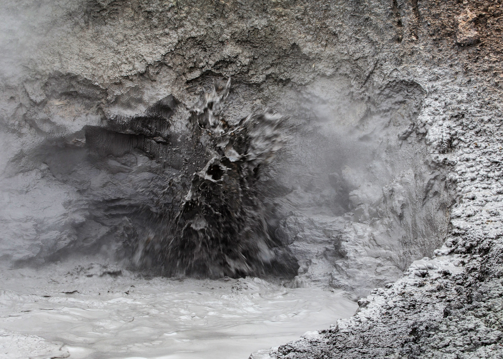
These are the "common" hydrothermal features found on almost any active volcano. Yellowstone is not famous for its fumaroles and mudpots – it is famous for its hot springs and geysers. To create both features, Yellowstone has something most other active volcanoes do not have: a massive supply of subterranean water. This water comes from a unique combination of Yellowstone's location on the North American continent and the topography the massive volcano created.
Discovery of the Caldera
Yellowstone was first recognized as a gigantic volcano on one of those early expeditions into the region. During the 1870 expedition headed by General Henry Washburn, their party climbed to the peak of one of the taller mountains in the region (which they named Mount Washburn) and was able to view the Yellowstone area and observed that the central part was a relatively flat depression surrounded by mountain peaks. Their reports noted that they surmised this was the result of an extinct volcano:
Observations were taken from the summit of the peak which we named Mount Washburn… Turning southward, a new and strange scene bursts upon the view. Filling the whole field of vision, and with its boundaries in the verge of the horizon, lies the great volcanic basin of the Yellowstone. Nearly circular in form, from fifty to seventy-five miles in diameter, and with a general depression of about 2,000 feet below the summits of the great ranges which forms its outer rim… The great basin has been formerly one vast crater of a now extinct volcano.
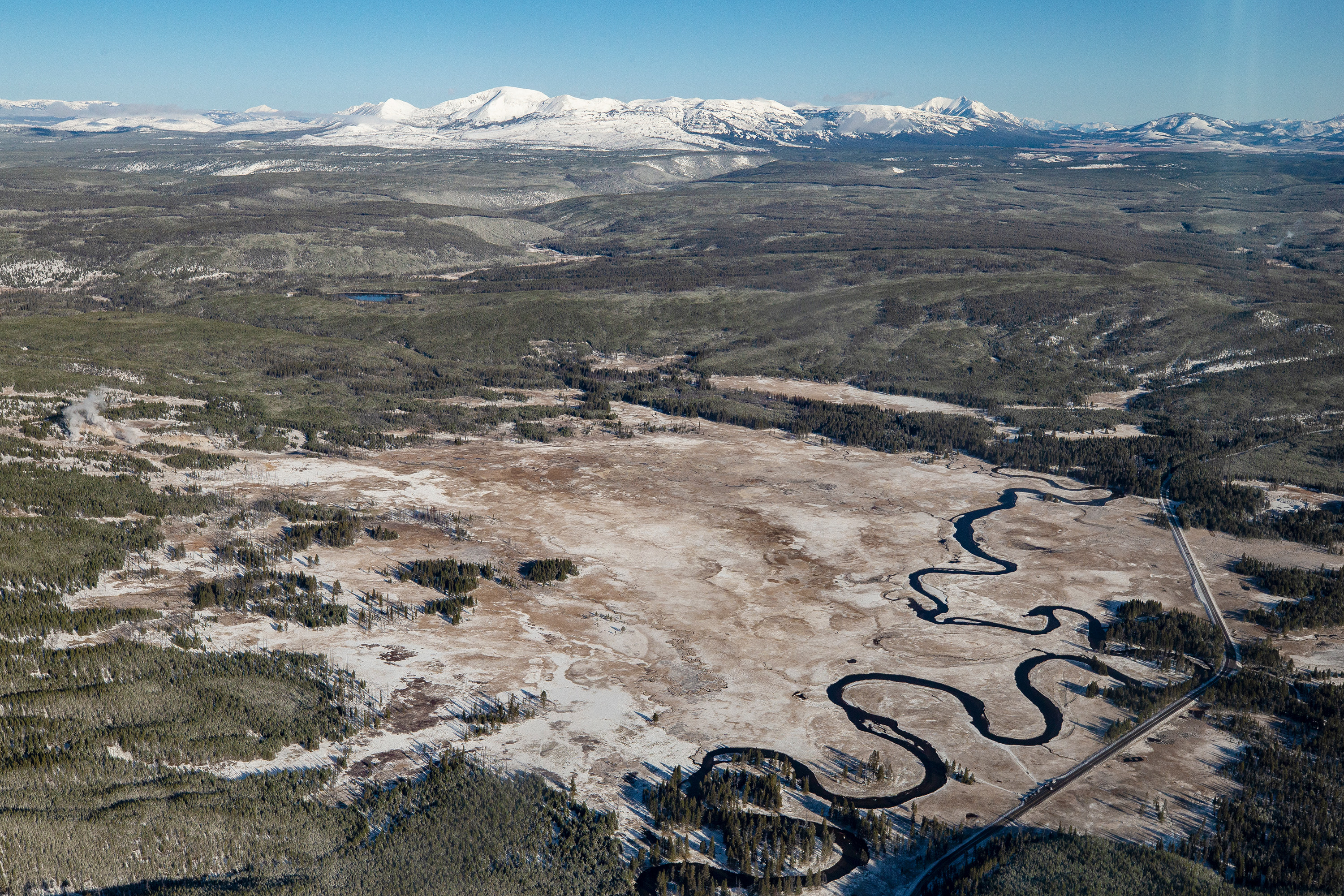
Of course, we now know the volcano is not extinct. It is very much alive and active, albeit in a quiet phase. The discovery and mapping of the extent of the giant crater came about after extensive studies in the 1960s and 1970s primarily by geologist Bob Christiansen. These studies determined that there were not just one, but at least three overlapping calderas from large eruptions that occurred roughly 2.4, 1.3, and 0.6 million years ago.[9] Later studies have shown that these three form a complex that is just one of several that are known across southern Idaho into Oregon. As the North American plate presumably moved over the Yellowstone Hotspot, the repeated eruptions have formed overlapping calderas which have largely merged to form the modern day Snake River Plain, with the Yellowstone Plateau at its eastern terminus.[10]
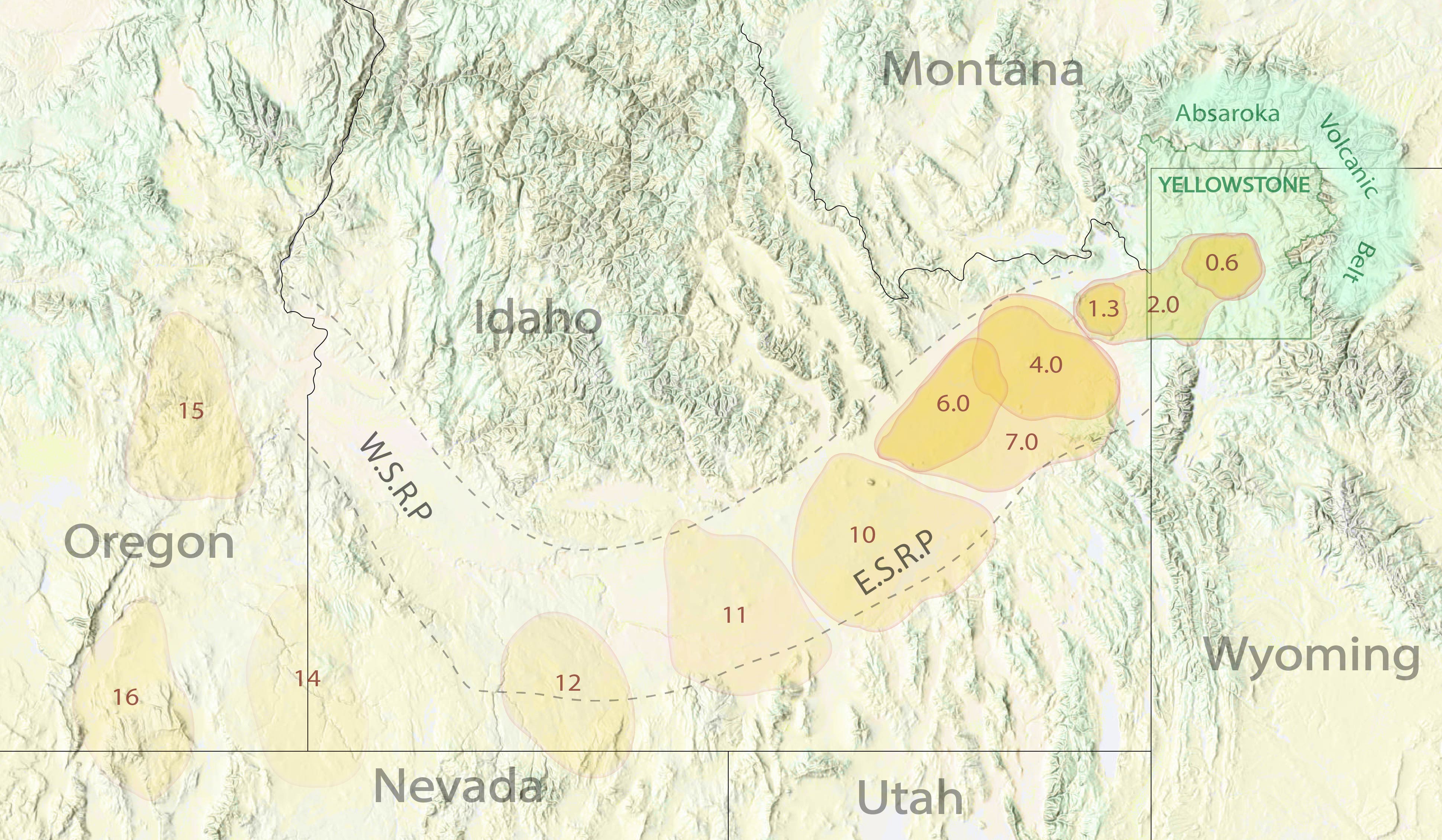
The Yellowstone hot spot has generated at least 13 calderas over the last 17 million years. Of these, the last 9 have contributed to the creation of the eastern half of the Snake River Plain (E.S.R.P.), while the western half (W.S.R.P.) is the result of rifting in western Idaho. The Yellowstone eruptions are more recent than the events that built the Absaroka Volcanic Belt and the central Rockies, and the hotspot has carved its way through these pre-existing mountains. This graphic shows 12 of the 13 calderas, each one is marked by a numebr representing its age in millions of years. The 13th caldera is out of frame just to the west. Graphic is based on https://www.nps.gov/yell/learn/nature/volcano.htm Graphic made by the author, with no copyrights.
As a quick aside, because this is necessary in today's alarmist world, the Yellowstone Volcano is not only not "due" to erupt, it's entirely possible that it cannot erupt. Recent studies have shown that perhaps only 5-15% of the magma chamber is actually molten and capable of erupting. The rest is solid – albeit extremely hot. It's also possible that not every caldera-forming eruption was a catastrophic supereruption – though the three current calderas certainly were formed by them. Calderas can form any time enough material is removed from the underlying magma chamber to allow collapse, and the resulting caldera can be larger than expelled material on the surface if the magma is able to move underground. Indeed, Yellowstone has erupted numerous times since the last supereruption ~630,000 years ago, most recently around 70,000 years ago. These eruptions are frequently effusive in nature, where thick lava flows across the surface in massive sheets. These eruptions, and associated intrusions of magma, have formed resurgence domes within the existing caldera, creating a pronounced raised plateau through the center of the park.[11]
Hot Springs
Hot springs are simply spots where heated water emerges from the ground. That's it. Nothing specific or special. In fact there is no real definition of just how "hot" the spring needs to be. All springs emerge at the temperature of the rocks from which they issue, so to some degree any spring carrying water that is hotter than the ground is a hot spring. Some definitions require the spring to be some arbitrary temperature like over 100°F. The springs in Yellowstone are often extremely hot – often well over 190°F and approaching the local boiling point of 199°F. The boiling point of water increases with pressure, and at depth that water can be substantially hotter than the boiling point at the surface. When that water rises to the surface it becomes superheated - it is hotter than the local boiling point - and spontaneously begins to boil and drives the bubbling and boiling action seen in many of the pools. Some features, such as Crested Pool near Old Faithful, have cyclical episodes of boiling when pockets of this superheated water are released into the spring and suddenly begin bubbling.
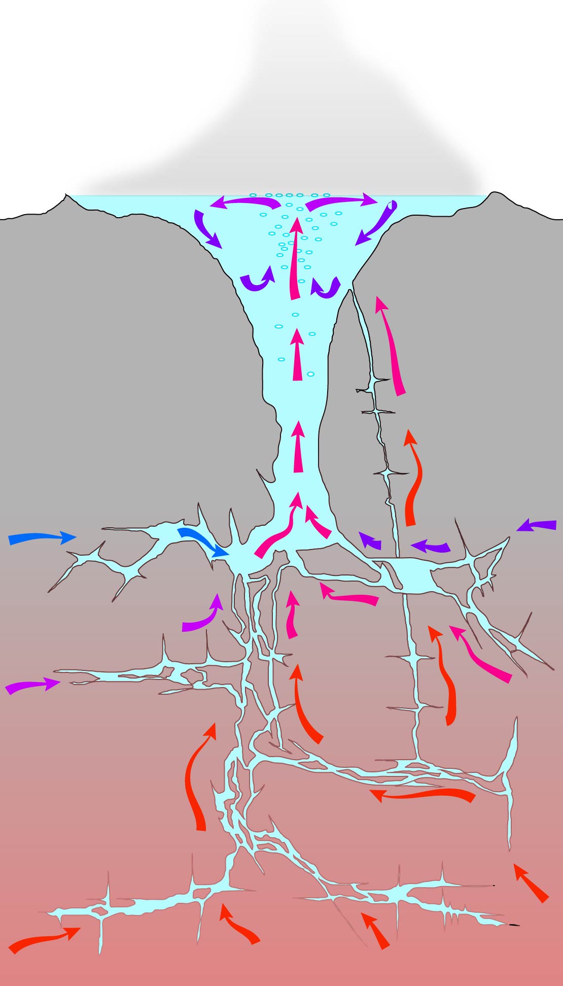
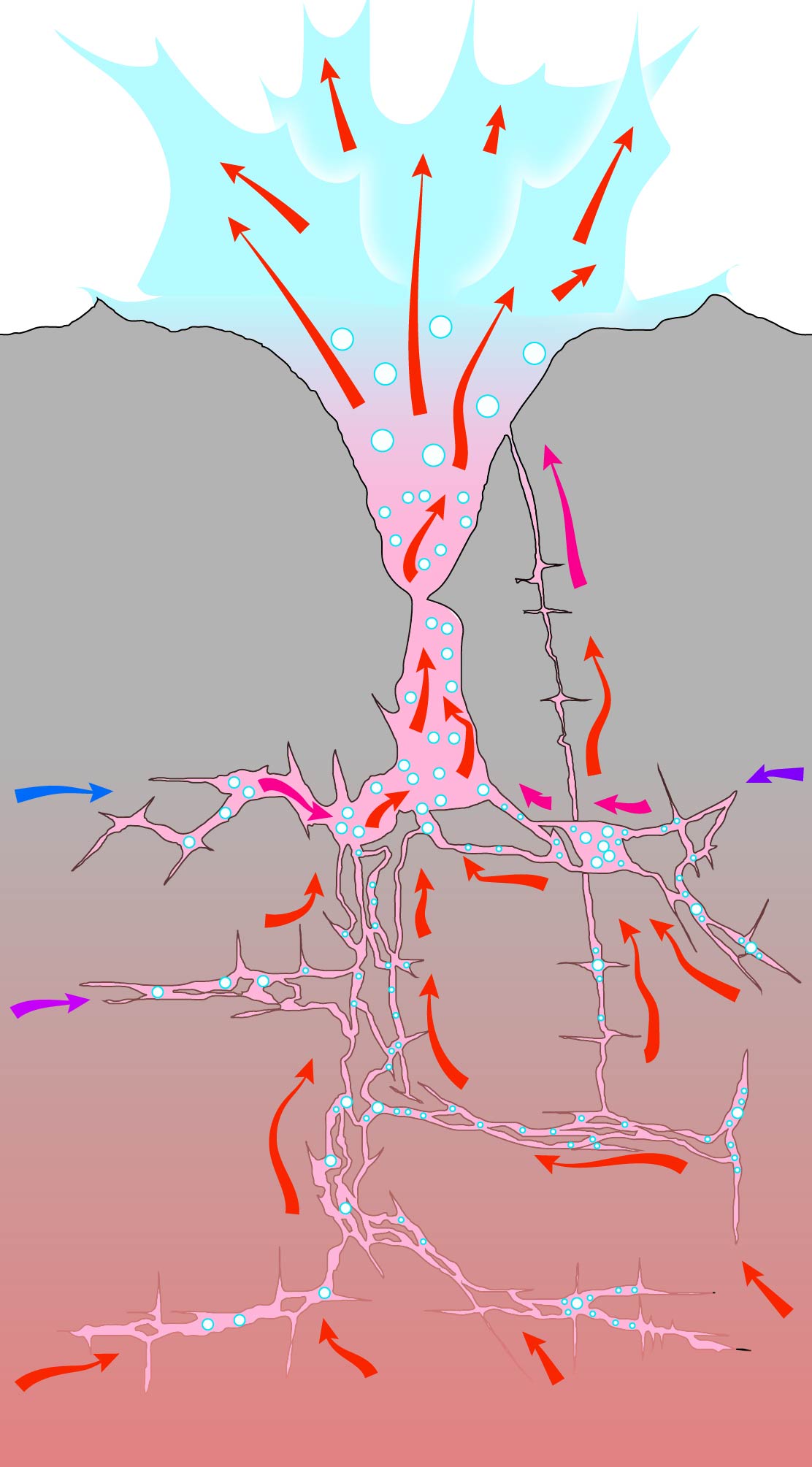
A concept of what lies below a hot spring. No one really knows what the plumbing systems look like, so this is the current best guess. Myriad fractures and crevices allow deep seated rising hot water to coalesce into a single conduit which brings that water to the surface. As it rises, cooler and shallower water mixes in. Only near the very top does it begin to boil as pressure drops. Once the hot water has risen and cooled it sinks back down into the spring to be reheated, or it runs off out of the spring as discharge.
Many hot springs in Yellowstone are small - less than 10 feet in diameter, and not very deep. Yet they still carry extremely hot water at or near boiling. Almost nothing can live in water that hot, and as such the springs are often a clear blue color. The dissolved sinter gets deposited within the hot spring, creating delicate terraces and rock formations that are bleached white from the extreme heat.
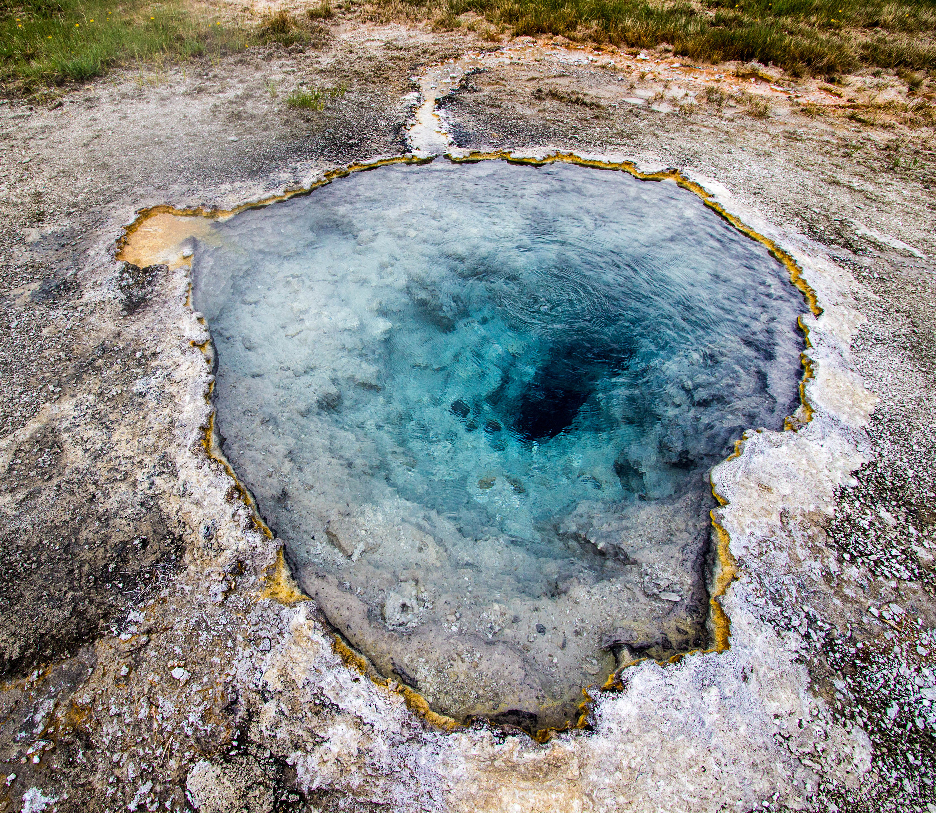
A small hot spring in the Lower Geyser Basin, only 3 feet in diameter and with only a couple of feet visible into it - yet still at boiling, suggesting that extremely hot water lies not very far below the ground.
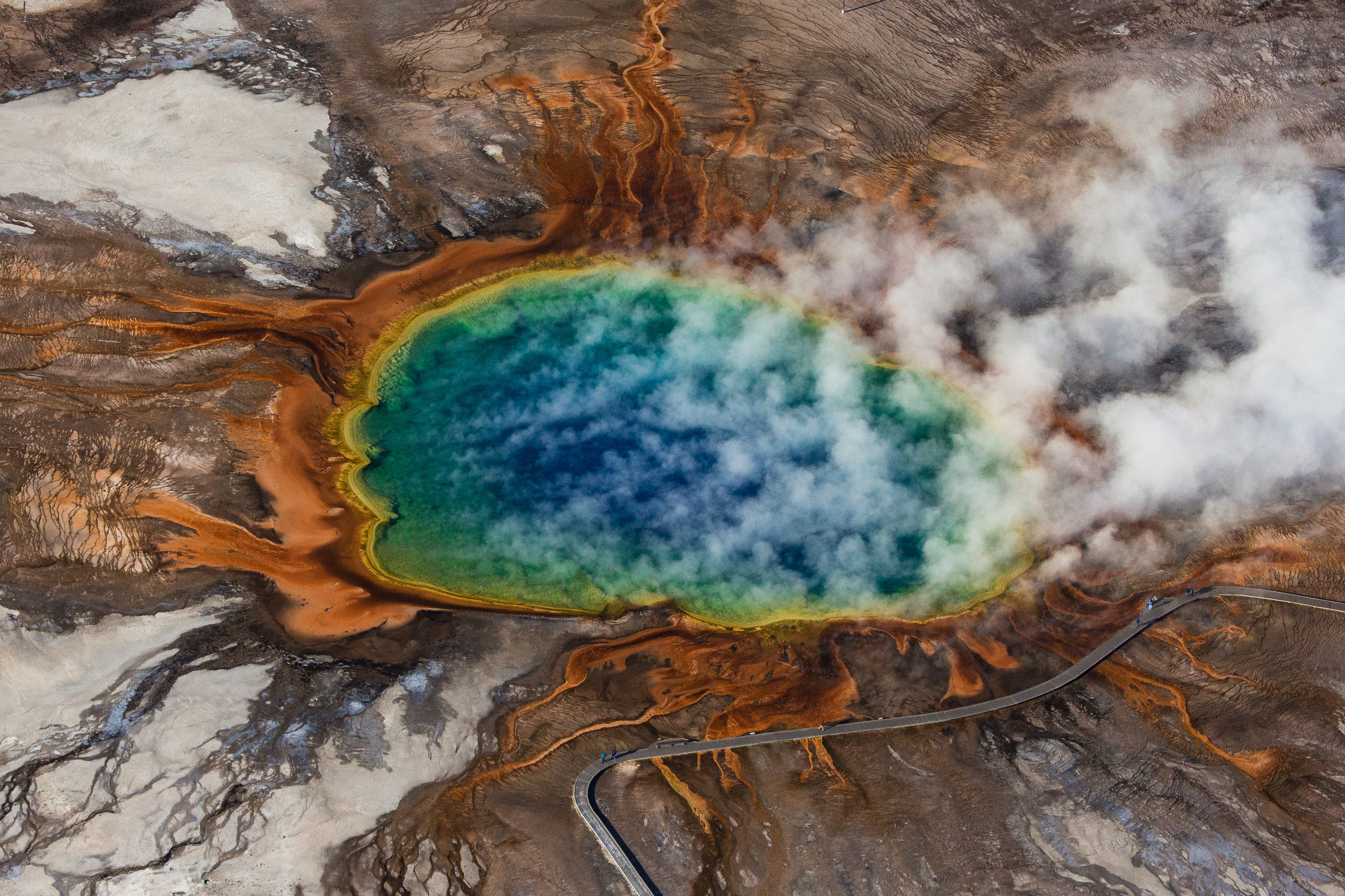
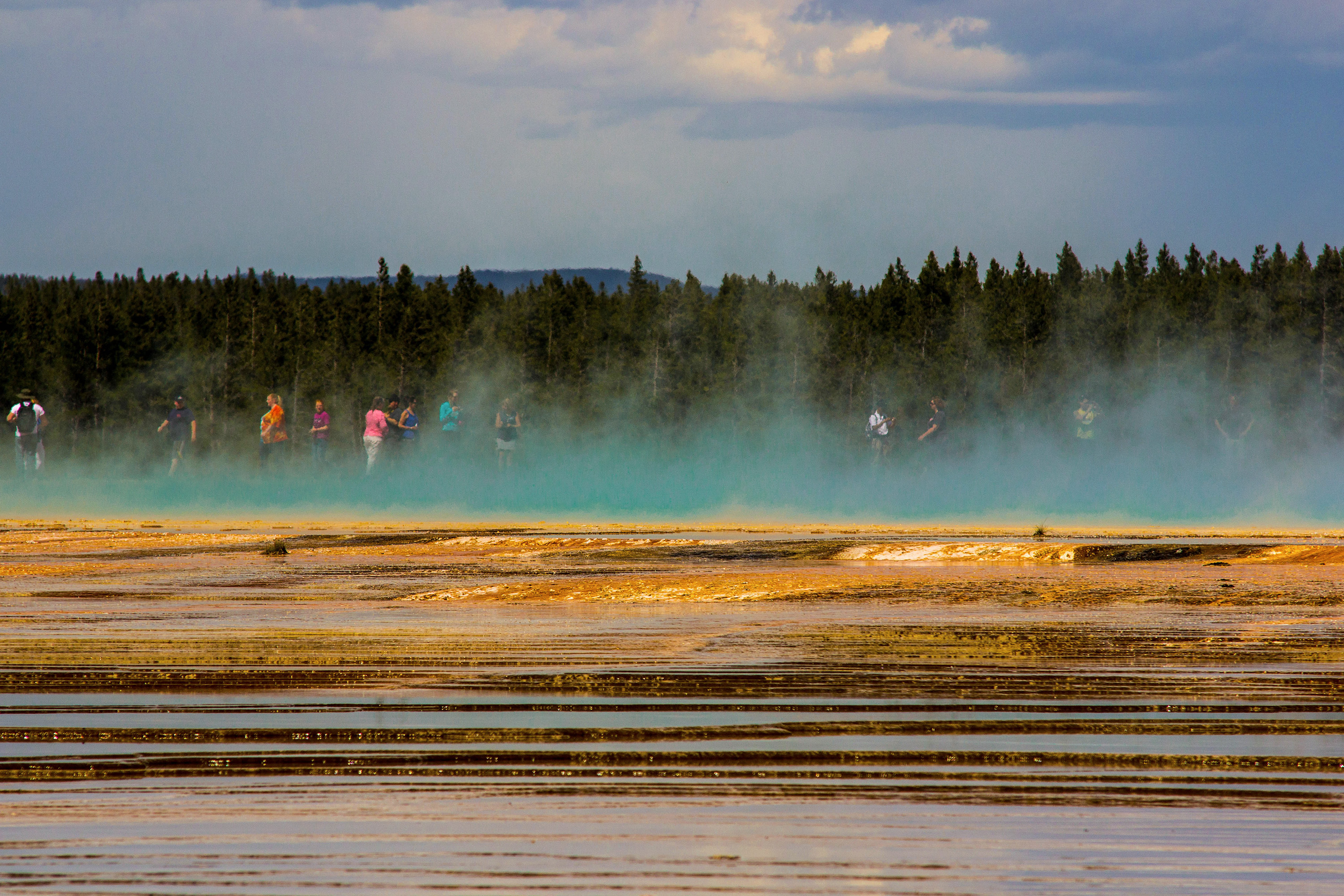
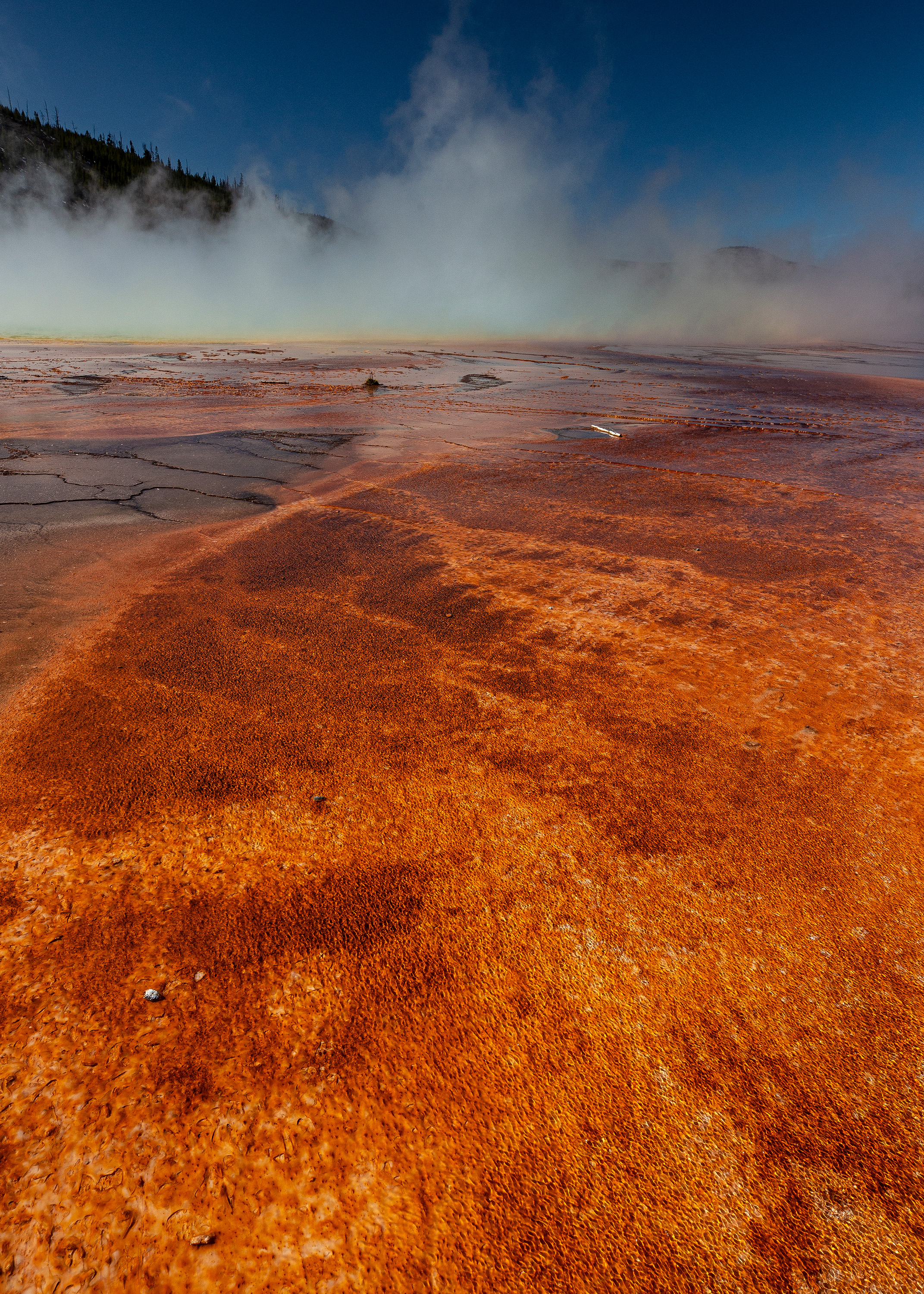
Some hot springs in Yellowstone are gigantic. Grand Prismatic Spring is well over 300 feet across and over 200 feet deep. It carries immense amounts of boiling water to the surface. The steady flow of water has deposited sinter terraces for hundreds of feet in all directions. The steady flow also allows colonies of cyanobacteria to grow which color the sinter all shades of red, orange, and sometimes green.
Geysers
Hot springs remain steady in their discharge of water because they can balance the heat and energy entering their system at depth with the loss on the surface by cooling and runoff. Geysers form when that cycle is interrupted. Something prevents the very hot water entering the system from escaping. Exactly what this "something" is is different for each feature and not entirely understood - it could be a constriction in the plumbing which prevents the water from rising, it could also be that enough cold water enters the system at the top to create a "cap" of cold water which also prevent the hot water from escaping. That water sits there, gradually building in volume and temperature. This creates a system which is stratified. That is, the temperature of the water is of different intensities throughout the depth of the system and it allows an excess of water to accumulate at the bottom of the system. Hot fluids want to rise, and that they can't rise causes large amounts of thermal energy to accumulate. Something – again, exactly what this "something" is varies and is not fully understood – drops the pressure in the system and suddenly there is a volume of superheated water which begins boiling. This starts a chain reaction – as the water boils it ejects water at the surface, further dropping the pressure and making even more water boil. Eventually the entire system is boiling and on the surface this manifests as an eruption: a turbulent and forceful ejection of water and steam.
The process is counterintuitive to what most people imagine. A geyser does not "build up pressure", it actually builds heat. The eruption itself is actually a drop in pressure. There are a number of mechanisms by which this happens, one of which is the Bunsen model which is shown below in a series of diagrams. This model, I think, is best for visualizing the process of how and why a geyser erupts. Recent observations, however, indicate that the majority of geysers initiate (steps 3 and 4 below) their eruptions in a different manner - something I will expand upon in a future article.
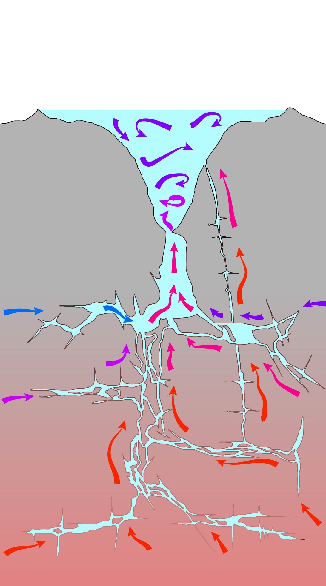
1 - The same hot spring system as before, but now we put a constriction in the main conduit. Rising hot water is unable to effectively escape and now there is a distinct layer of cold water at the surface and hot water at depth.
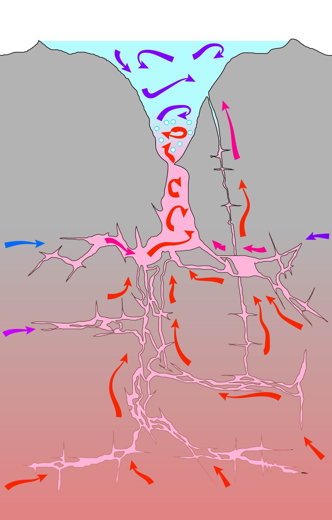
2 - Eventually some of that water is able to move past the constriction and begin boiling. OFten the boiling near the bottom rising and then disappears when it hits cold water - an action known as flaming. We can actually see this in many features. Firehole Spring in the Lower Geyser Basin, and Flaming Pool at Artist Paint Pots, are great examples of this behavior.
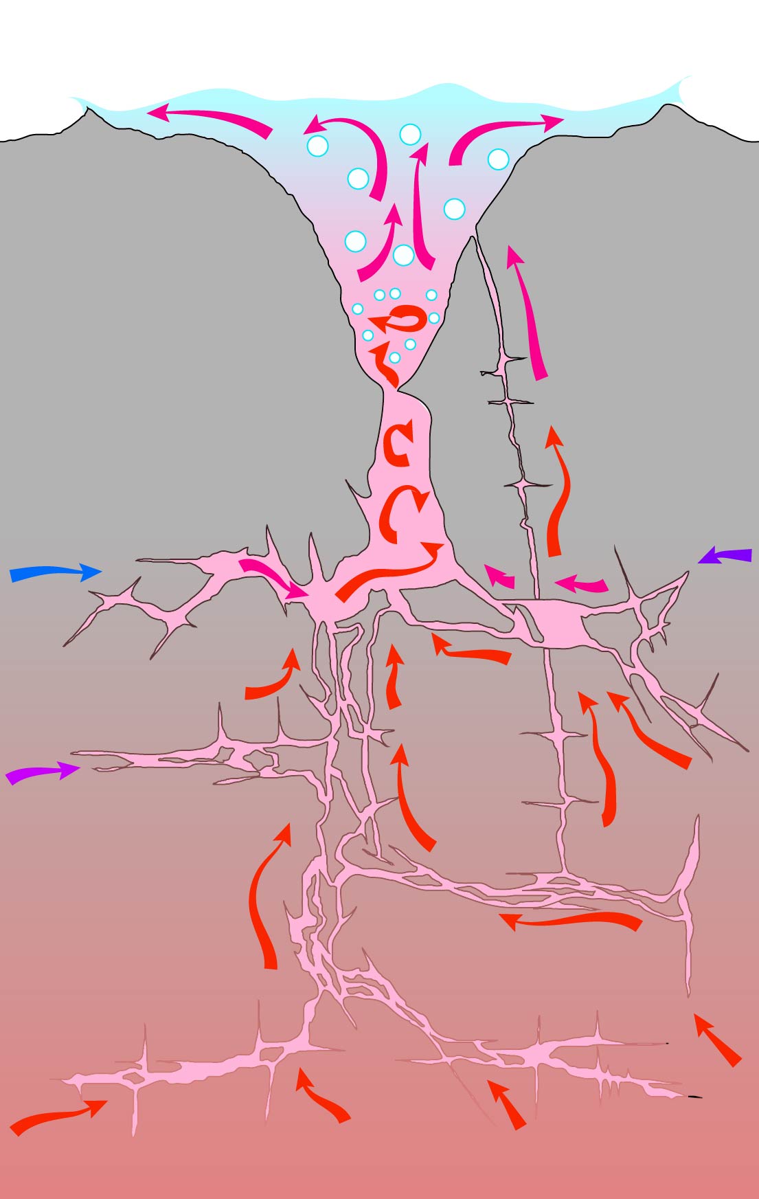
3 - Eventually that boiling begins to rise up through the system as it heats the cold water cap. This causes the surface of the geyser to agitate, swell, and show signs of this boiling. For some features this surface agitation is the only indicator that the geyser is about to erupt and is quite pronounced. Other times this behavior is only a slight increase in runoff - only noticeable to trained observers.
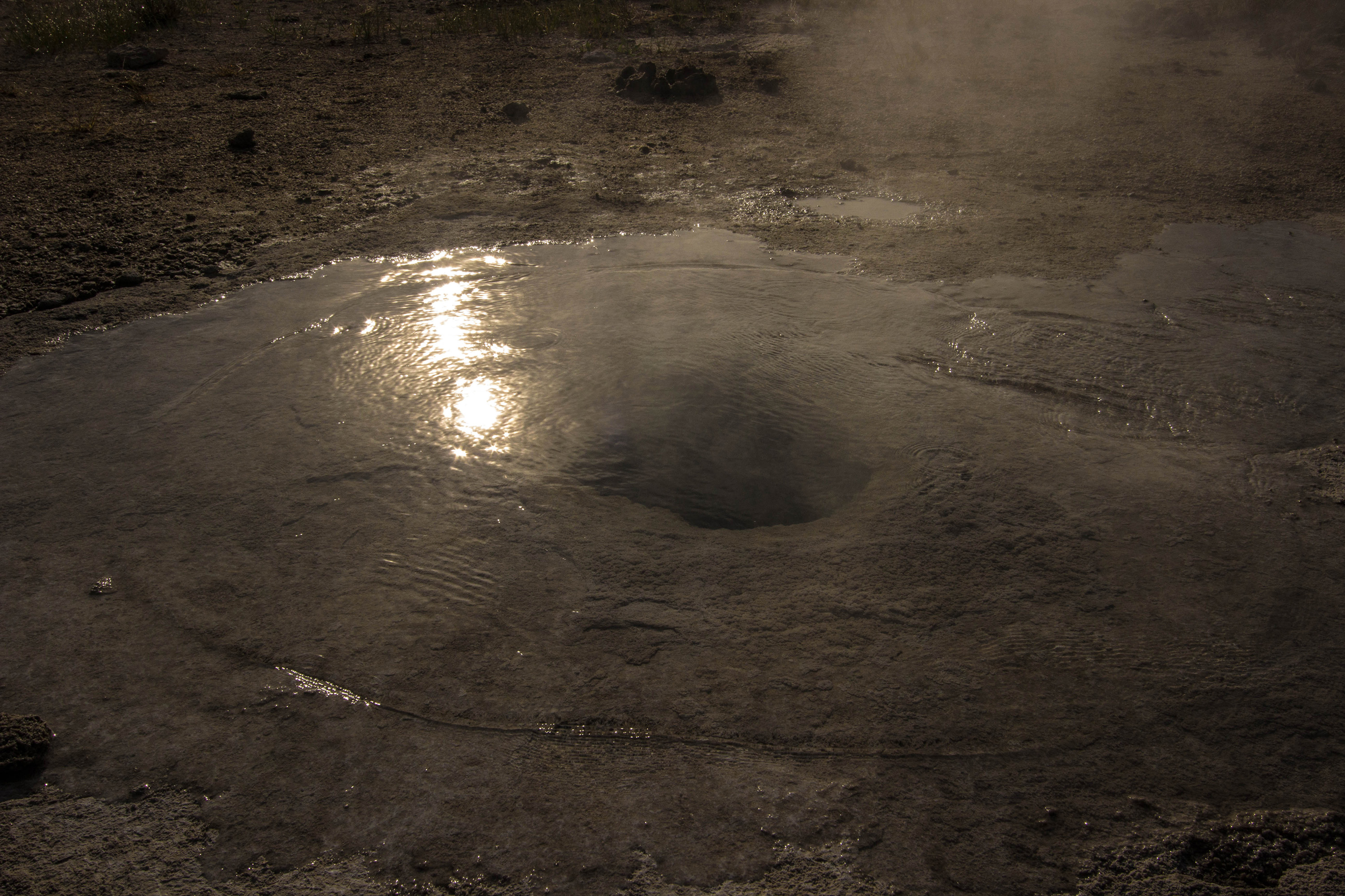
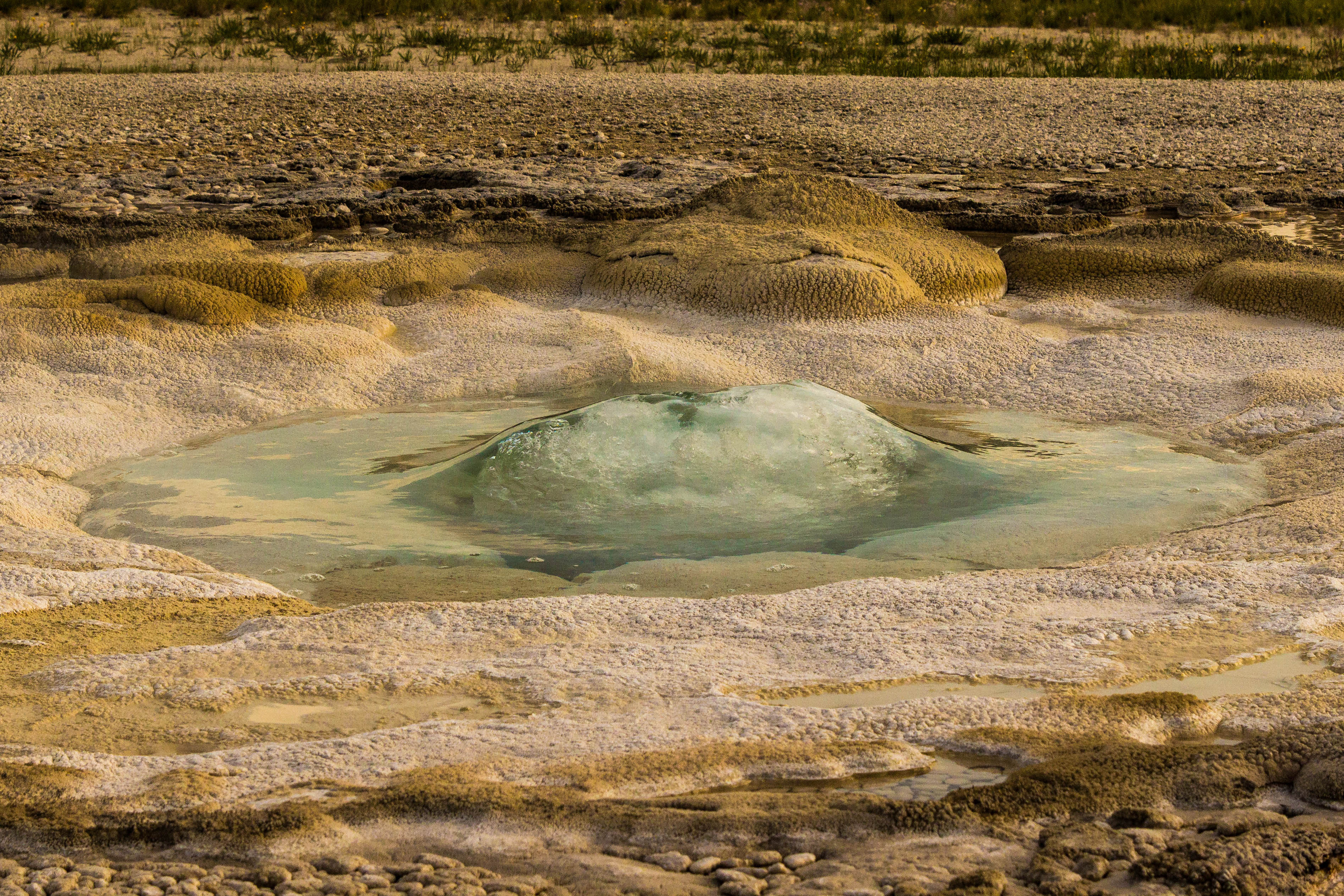
Here is a small feature, previously quiet, that is now gently ebbulating as boiling begins at depth. This geyser is trying to erupt.
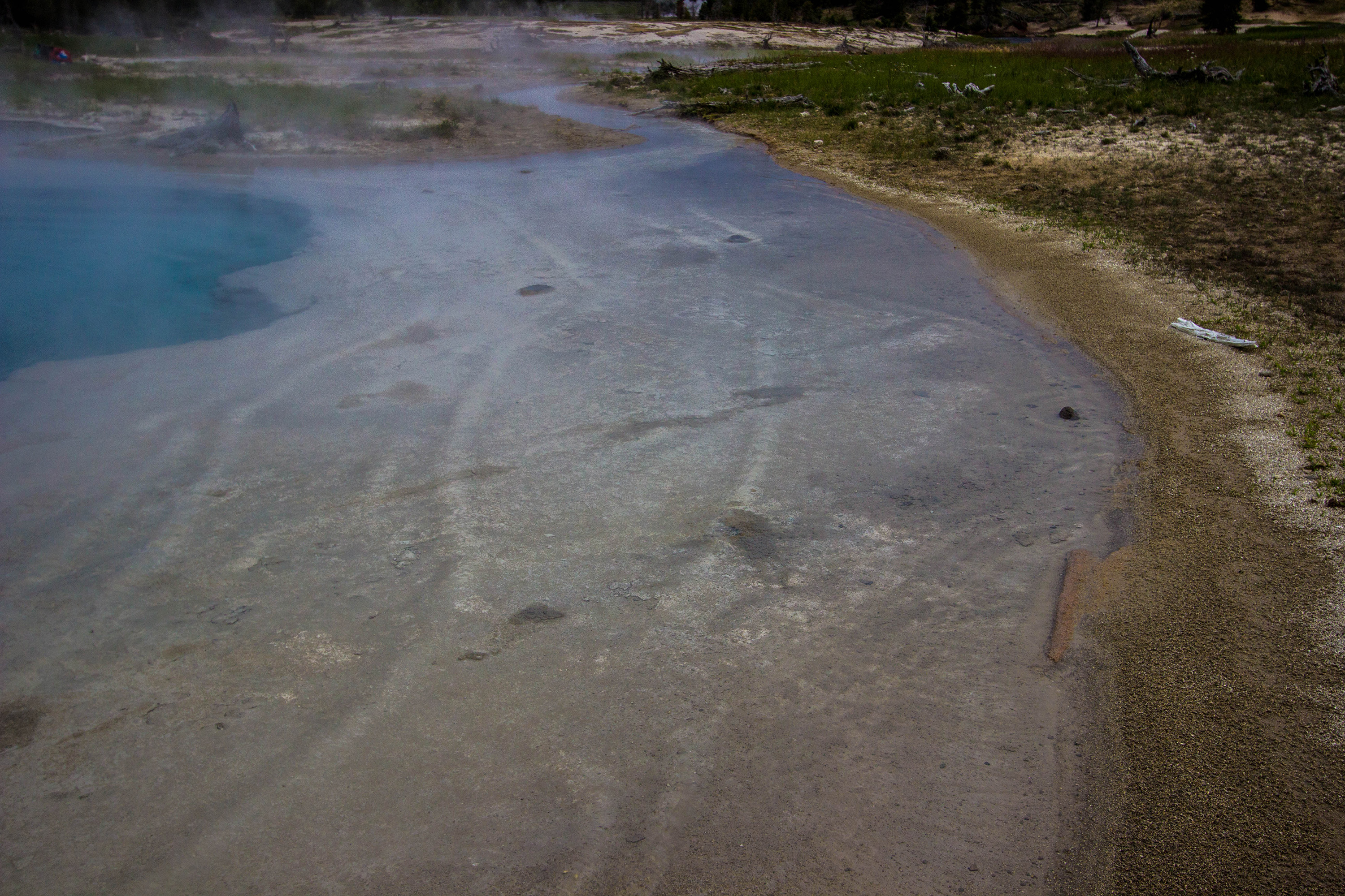
In larger features this ebbulation can be dramatic - making large waves which lap on the surface of the pool. Even more impressive is a behavior called thumping where large bubbles of steam at depth hit cold water and collapse so suddenly they make a loud pounding noise which can be heard and felt. Black Sand Pool and Oblong Geyser in the Upper Geyser Basin are known for this behavior.
4 - Finally this agitation is enough to remove enough water that the pressure in the system is lowered. Superheated water at depth begins to boil in a runaway reaction that begins to forcefully expel water and steam at the surface: an eruption.
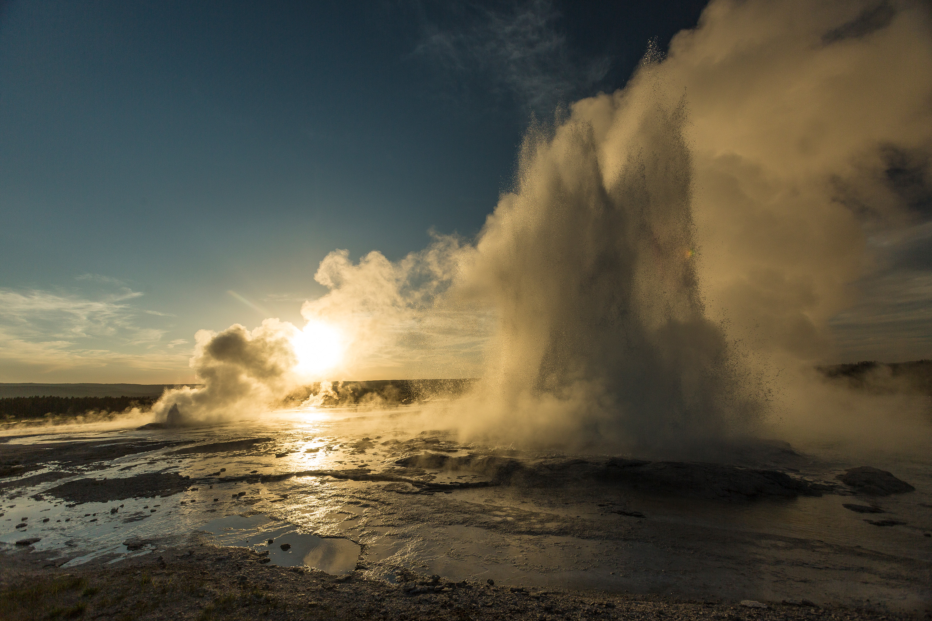
Geysers come in all shapes and sizes. Many erupt from pools of water and their eruptions are a series of explosive bursts of water that are mostly upward but can be in any direction. Some have built up cones of sinter such that they have no pool of water and their eruptions issue from a nozzle like vent producing a steady jet of water - this is the kind of geyser that Old Faithful is. Still others have the ability to do both: Splendid Geyser and Giantess Geyser, both in the Upper Geyser Basin, begin erupting from pools of water and then transition into steady jetting after the pool has been cleared.
This boiling process continues until something causes it to stop. Sometimes it simply boils off all of the water in the system until nothing is left. Sometimes there is an influx of colder water which quenches the boiling. In the case of the former this causes the eruption to end with a steam phase – a period of forceful ejection of steam. In the case of the latter the eruption simply just stops.
The eruption, as we know it, is just the surface expression of this interaction of superheated and cold water at depth. Each geyser is different, because each has different inputs of hot and cold water, and different shapes of their subsurface. Accordingly, the frequency of eruptions of most geysers is highly variable. Some geysers, like Old Faithful, are isolated and their behavior is almost completely influenced by only themselves. Often, one single geyser is actually but one of a collection of springs which are all connected underground and the eruption of one feature affects the behavior of another. Large features have disproportionately larger effects on the behavior of those around them. For example, just north of Old Faithful is Geyser Hill. Geyser Hill contains over 100 hydrothermal features including dozens of erupting geysers – including one particularly large feature called Giantess Geyser. Giantess Geyser has infrequent – but large – eruptions. When it erupts the behavior of each feature on Geyser Hill is often notably affected. Likewise, it's entirely possible that the constant activity of the features around Giantess bleeds hot water and energy away from Giantess – causing its eruptions to be irregular and infrequent.
Studying Geysers
The surface behaviors of these collections of geysers are the subject of passionate study by members of the Geyser Observation and Study Association – volunteers who spend their free time watching, noting, and documenting the behaviors of features throughout the park. Unfortunately their observations are often limited to only the surface – they can't see into the ground, indeed most people can't. Recent studies using ground-penetrating radar and sensitive seismometers have begun to get glimpses into what the subsurface of the geysers truly looks like – giving critical insights into why they behave the way they do.
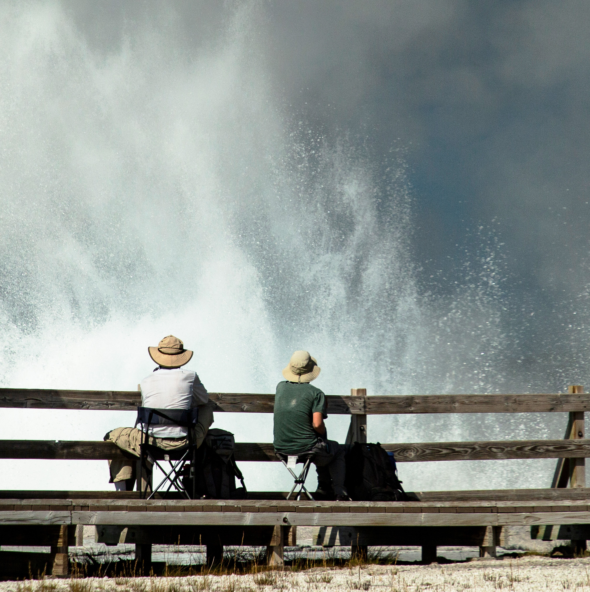
Geyser Gazers, members of the Geyser Observation and Study Association, watch an eruption of Fountain Geyser. If you see folks sitting around a geyser like this, then they are probably geyser gazers. They may be expecting a geyser to erupt, or they may just be watching it between eruptions. Sometimes they are in a space to answer questions and talk about what they are doing, and sometimes they are not. They are volunteers!
Yellowstone's geysers and hot springs tend to form in clusters where those faults and fractures carry the flow of deep and hot water to the surface. These areas are locally referred to as geyser basins – which simply describes groups of hydrothermal features roughly separated by geographic features which may or may not actually be literal basins. The features within these groups are the collective manifestations of the plume of water emerging from the surface. Very recent studies indicate that the features in the center of the groups carry water from deep sources – water which fell probably a century ago or more – while the features on the edges and margins of the groups carry water that is younger, somewhat cooler, and likely from more localized sources. The deeper waters, loaded with dissolved silica, can deposit this silica in the form of sinter both on the walls of the conduits in the ground and on the surface above ground. This silica deposition seals the plumbing system of both geysers and hot springs, stabilizing their behavior to some degree and allowing the collection of superheated water which drives the eruptions of geysers.
Where does this water come from?
Weather systems moving eastward off the Pacific Ocean generally drop their moisture along the western fronts of the Cascade Range and the Sierra Nevada as the warm, moist air gets lifted into the cold, dry air above the mountains. On the eastern sides of these mountains lie the vast deserts of the Great Basin, Arizona, and Idaho. However, there is somewhat of a gap between the Cascades and the Sierras – this gap lines up in an east-west line with the Snake River Plain.
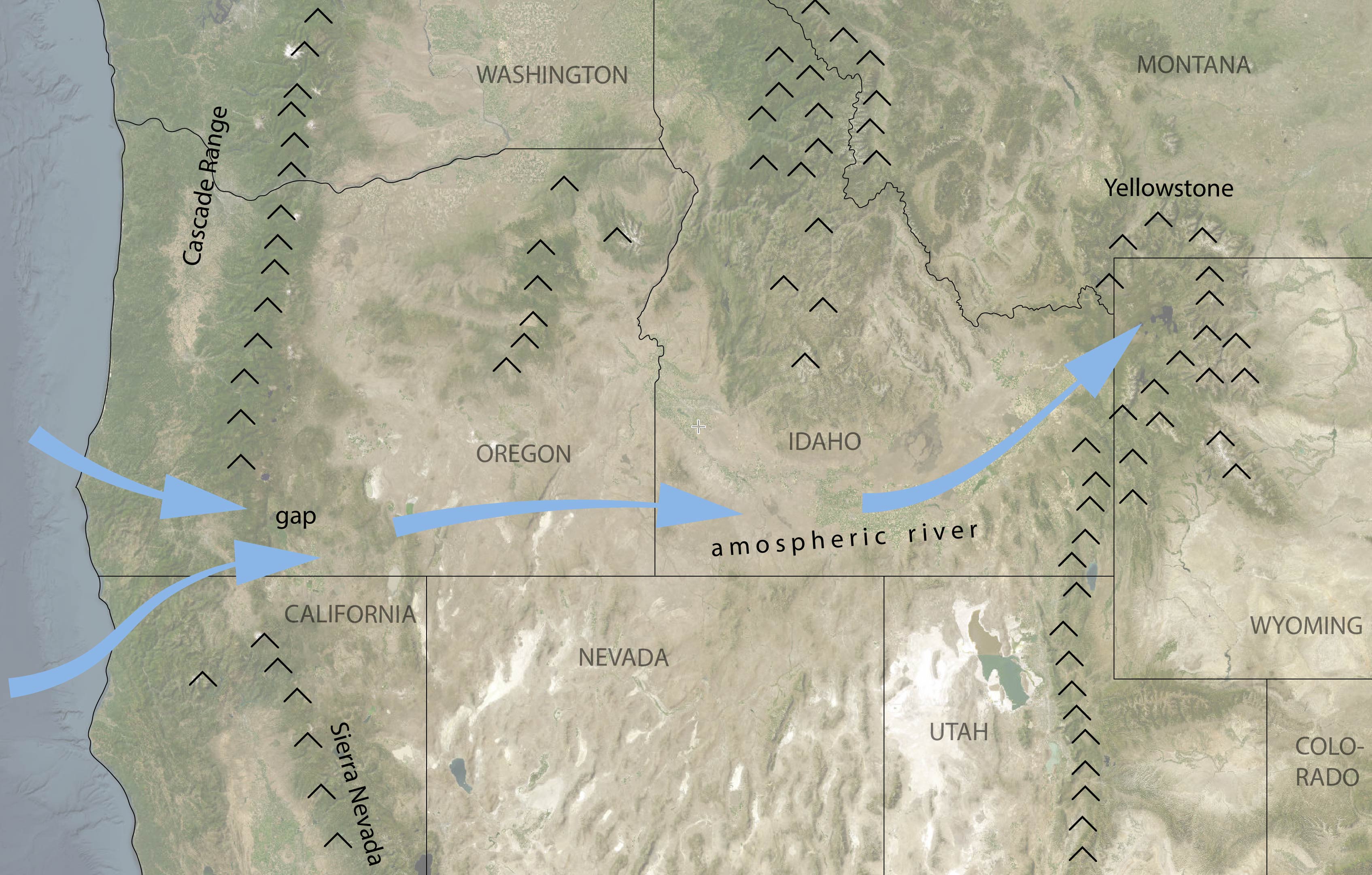
A gap between the Cascade Range in the north and the Sierra Nevada in the south allows moist air off the Pacific Ocean to penetrate inland. Funnelled by topography, this moist air rides in a current up the Snake River Plain where it gets lifted into the cold, dry, air above Yellowstone. Here it dumps all that moisture - making Yellowstone one of the wettest environments in central North America.
Moisture moving off the Pacific Ocean is able to largely cross the mountains in southern Oregon without falling out of the sky and is able to move with the trade winds where it gets funneled through the Snake River Plain in the form of an atmospheric river all the way to the highlands of the Yellowstone Plateau where that moisture is then deposited in the form of rain and snow. This makes the Yellowstone region one of the wettest areas in central North America and gives rise to two highly important natural phenomena.
The first is the Greater Yellowstone Ecosystem. This is the area surrounding Yellowstone where the consistent precipitation and federal protected lands have preserved the largest intact and diverse temperate ecosystem in the world.
The second is that significant portions of that water then descend into the subsurface and feed the thousands of hydrothermal features which made Yellowstone famous in the first place.
Subterranean Rivers
As mentioned earlier, the central region of Yellowstone is composed of a series of large lava flows and resurgent domes formed of a very hard, highly siliceous rock called rhyolite. Uplifted in the middle of the caldera, the rhyolite contains large numbers of subsurface fractures which extend deep into the ground toward the hot belly of the volcano and also radiate outwards toward the edges of the flows and domes near the sides of the caldera. Water which enters the subsurface in the middle of the plateau is able to collect in deep aquifers which heat the water to temperatures in the several hundreds of degrees Fahrenheit. This extremely hot water is able to dissolve the silica in the rhyolite, something that can only happen at high temperatures and pressures found in these deep zones.
Gravity, and to a lesser extent, hydrologic pressure then push this water outwards to the margins of the caldera where they encounter the faults and fractures associated with the edges of the rhyolites. Buoyancy and rising gases and fluids from the magma chamber force these deep-seated hydrothermal fluids upwards along these faults and fractures to emerge as the features which made Yellowstone famous.
Same graphic as above, note that the green areas, which note areas of springs and geysers, are around the edges of the caldera and near the edges of rhyolite flows where faults and fractures allow the deep-seated aquifer water a place to escape. The central locations tend to be drier thermal areas full of mudpots and fumaroles. Graphic sourced: NPS
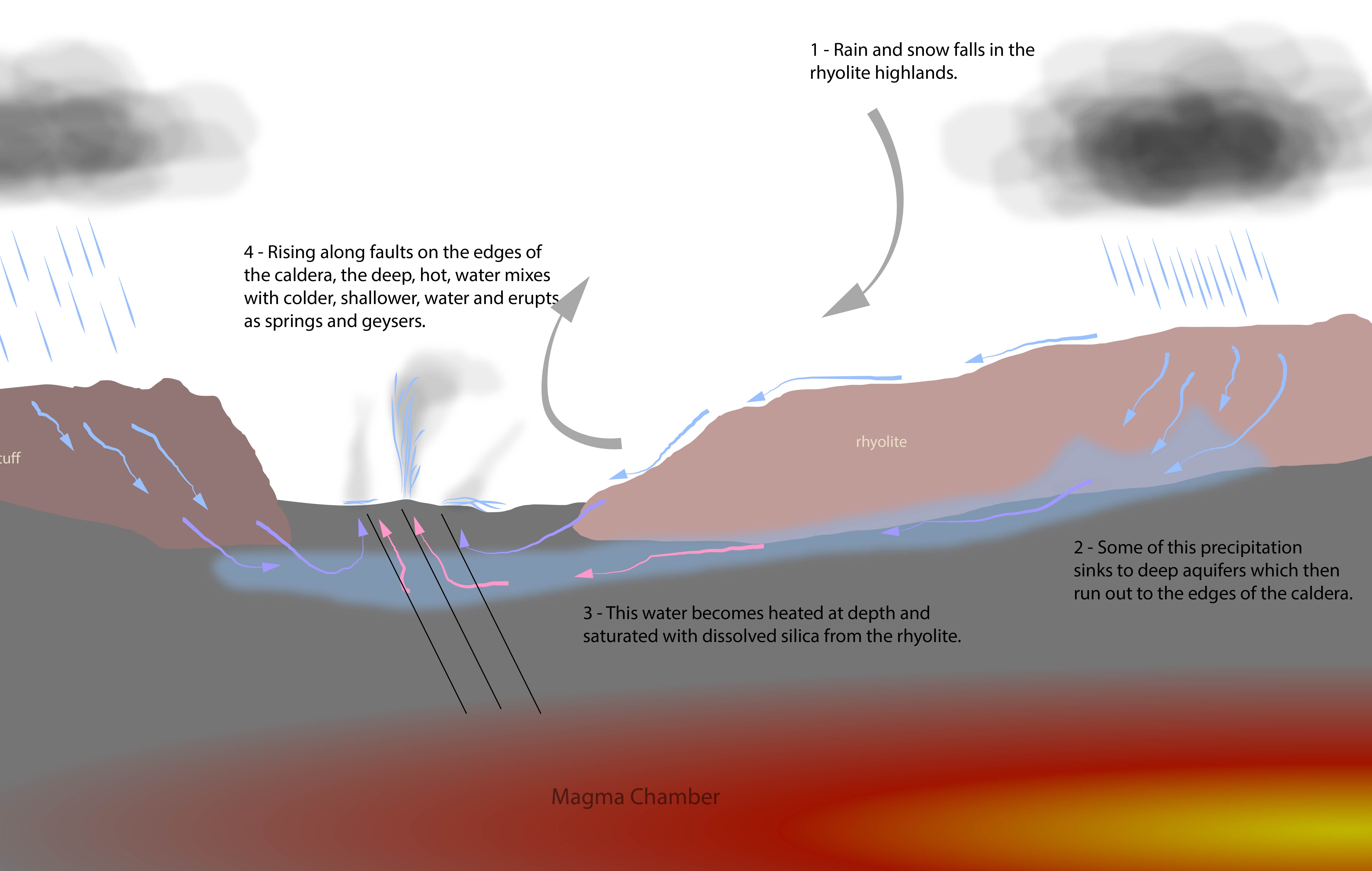
A very idealized diagram of how water falls as rain and snow in the rhyolite plateaus of Yellowstone, sinks to depth where it is heated by the magma chamber, and then resurges as geysers and hot springs at the margins of the caldera. Recent studies indicate that water rises into a geyser complex as a "plume", with deeper, hotter, and silica laden water in the middle and shallower, cooler, water near the outside edges of the complex.
Dynamic and Vulnerable
Changes in both the subsurface injection of deep-seated hot water and the shallower injection of cold water can and do have notable effects on the hydrothermal fields in Yellowstone. The broad behavior of a given area depends on the interaction between these two water sources. In some places, like Norris Geyser Basin, there is a routine disturbance of these two water sources which causes the behavior of features through the geyser basin to very suddenly, and sometimes dramatically, change. Some geysers and hot springs have seasonal variations where they are more or less active in the fall or spring depending on the amount of shallow surface water entering their systems. Even more dramatically, some geysers exhibit diurnal and other short-term changes in behavior when heavy rains, or cold nighttime temperatures alter their activity hour by hour.
These features are also endangered by two existential threats – both of which are manageable by humanity. The first is drilling – drilling, for any kind of extraction – alters the flow of hot water in the subsurface. Hydrothermal areas in Nevada, Iceland, and New Zealand have been completely wiped out of existence by drilling. The features in Yellowstone are protected by laws which prohibit drilling within the park boundaries and within a reasonable distance around the park.
The other threat is climate change. Because geyser basins are the collective expression of water from the subsurface, many features show long-term cycles of intense behavior and periods of little or no activity – this pulse-pause cycle is possibly connected to long-term climate changes as well as the gradual changes in the structure of the aquifers caused by the rising and falling of the Yellowstone caldera. However, recent changes in the amount of snowfall and increasing temperatures have reduced the snowpacks that form in the winter. The snowpack is a critical source of water which feeds the aquifers both at depth and near the surface. Unlike rain, snowpack generally adds water to the ground more slowly over a period of months – stabilizing the behavior of many features. Absent this steady injection of cold water, the geysers of Yellowstone will become increasingly more erratic and less frequent. Geysers are not linear features; a little bit less water does not mean a little bit less eruption. It's entirely possible that some features could simply stop erupting because some unknown threshold is crossed.
Conclusion: Wonders Worth Protecting
What would we do if we woke up to find out Old Faithful stopped erupting? Would we be okay with throwing it away? These questions cut to the heart of what Yellowstone represents: a geological marvel that exists nowhere else on Earth at this scale and complexity. The park contains nearly half of the world's geysers, and each one is the product of an intricate dance between geology, hydrology, and climate that has taken hundreds of thousands of years to establish.
The loss of these features would be irreversible. Once a geyser's plumbing system collapses or dries up, it cannot be restored. The silica deposits that seal their conduits, the precise balance of water inputs, the timing of pressure releases – these are not things we can engineer or replicate. They are natural phenomena that emerged from a unique confluence of volcanic activity, topography, and atmospheric conditions.
We are the first generation to truly understand how these systems work, and we may be the last generation that can ensure their survival. The choices we make about climate change, land use, and resource extraction in and around Yellowstone will determine whether future generations will stand in awe before erupting geysers, or read about them in history books as wonders we failed to protect. Yellowstone's thermal features are not just tourist attractions or scientific curiosities – they are irreplaceable natural treasures that deserve our stewardship.
References
1.
National Park Service. (2025, September 22). Birth of a National Park. National Park Service. https://www.nps.gov/yell/learn/historyculture/yellowstoneestablishment.htm
Almost as soon as the park was established, people began suggesting that the boundaries be revised to conform more closely to natural topographic features, such as the ridgeline of the Absaroka Range along the east boundary. Although these people had the ear of influential politicians, so did their opponents— which at one time included the United States Forest Service. Eventually a compromise was reached, and, in 1929, President Hoover signed the first bill changing the park’s boundaries: The northwest corner now included a significant area of petrified trees; the northeast corner was defined by the watershed of Pebble Creek; the eastern boundary included the headwaters of the Lamar River and part of the watershed of the Yellowstone River. (The Yellowstone’s headwaters remain outside the park in Bridger-Teton National Forest.)
In 1932, President Hoover issued an executive order that added more than 7,000 acres between the north boundary and the Yellowstone River, west of Gardiner. These lands provided winter range for elk and other ungulates.
2.
Haines, A. L. (1996). The Yellowstone story: A history of our first national park (Rev. ed., Vol. 1). University Press of Colorado.
When Dr. Hayden arrived at his office in Washington with the raw material for a scientific report on the Yellowstone country, he found on his desk a letter that suddenly made his data far more important than he had realized. That letter, dated October 27, 1871, on the stationery of "Jay Cooke & Co., Bankers, Financial Agents, Northern Pacific Railroad Company" and signed by A. B. Nettleton, was as follows:
"Dear Doctor: Judge Kelley has made a suggestion which strikes me as being an excellent one, viz.: Let Congress pass a bill reserving the Great Geyser Basin [emphasis added] as a public park forever—just as it has reserved that far inferior wonder the Yosemite Valley and big trees. If you approve this would such a recommendation be appropriate in your official report?" Dr. Hayden did approve, and immediately set about laying the foundation for a New Creation (p. 155).
"Dear Doctor: Judge Kelley has made a suggestion which strikes me as being an excellent one, viz.: Let Congress pass a bill reserving the Great Geyser Basin [emphasis added] as a public park forever—just as it has reserved that far inferior wonder the Yosemite Valley and big trees. If you approve this would such a recommendation be appropriate in your official report?" Dr. Hayden did approve, and immediately set about laying the foundation for a New Creation (p. 155).
3.
Bryan, T. S. (2018). The geysers of Yellowstone (5th ed.). University Press of Colorado.
...the number of geysers actually observed to be active in Yellowstone in any given year might exceed 500. Studies by independent researcher Jeffery Cross ... indicate that a minimum of 1,283 springs have erupted as true geysers since the national park was established in 1872 (p. 12).
4.
Bryan, T. S. (2018). The geysers of Yellowstone (5th ed.). University Press of Colorado.
Taken together, the entire world outside of Yellowstone might total only 500 geysers (p. 13).
5.
Fumarole. (2025, October 8). In Wikipedia. https://en.wikipedia.org/wiki/Fumarole#Description
Fumaroles are normally associated with the late stages of volcanic activity,[10] although they may also precede volcanic activity[4] and have been used to predict volcanic eruptions.[5]
6.
Fumarole. (2025, October 8). In Wikipedia. https://en.wikipedia.org/wiki/Fumarole
The predominant vapor emitted by fumaroles is steam, formed by the circulation of groundwater through heated rock. This is typically accompanied by volcanic gases given off by magma cooling deep below the surface. These volcanic gases include sulfur compounds, such as various sulfur oxides and hydrogen sulfide, and sometimes hydrogen chloride, hydrogen fluoride, and other gases.
7.
Fumarole. (2025, October 8). In Wikipedia. https://en.wikipedia.org/wiki/Fumarole
A fumarole (or fumerole)[1] is a vent in the surface of the Earth or another rocky planet from which hot volcanic gases and vapors are emitted, without any accompanying liquids or solids.
8.
Mudpots. (n.d.). Yellowstone Forever. https://www.yellowstone.org/mudpots/
Formed by standing surface water acidic enough to dissolve surrounding rock into clay, the mudpots have a similar structure to hot springs, but with a lower water supply.
9.
U.S. Geological Survey. (n.d.). How do we know about the calderas at Yellowstone? Yellowstone Volcano Observatory. https://www.usgs.gov/observatories/yvo/news/how-do-we-know-about-calderas-yellowstone
10.
National Park Service. (n.d.). Volcano. National Park Service. https://www.nps.gov/yell/learn/nature/volcano.htm
About 16.5 million years ago, an intense period of volcanism initiated near the borders of present-day Nevada, Oregon, and Idaho. Subsequent volcanic eruptions can be traced across southern Idaho towards Yellowstone. This 500-mile trail of more than 100 calderas was created as the North American plate moved in a southwestern direction over a shallow body of magma. About 2.1 million years ago, the movement of the North American plate brought the Yellowstone area closer to the shallow magma body. This volcanism remains a driving force in Yellowstone today.
11.
U.S. Geological Survey. (n.d.). Is Yellowstone overdue for an eruption? When will Yellowstone erupt? U.S. Geological Survey. https://www.usgs.gov/faqs/yellowstone-overdue-eruption-when-will-yellowstone-erupt
Most volcanic systems that have a supereruption do not have them multiple times. When supereruptions do occur more than once in a volcanic system, they are not evenly spaced in time. Although another catastrophic eruption at Yellowstone is possible, scientists are not convinced that one will ever happen. The rhyolite magma chamber beneath Yellowstone is only 5-15% molten (the rest is solidified but still hot), so it is unclear if there is even enough magma beneath the caldera to feed an eruption. If Yellowstone does erupt again, it need not be a large eruption. The most recent volcanic eruption at Yellowstone was a lava flow that occurred 70,000 years ago.

 v.2026.11.12.A
%20--%3e%3cdefs%3e%3cstyle%3e%20.st0%20{%20fill:%20%23fff;%20}%20%3c/style%3e%3c/defs%3e%3cg%3e%3cpath%20class='st0'%20d='M55.7,107.69h-11.41l-2.1,5.82h-3.6l9.46-26.01h3.94l9.42,26.01h-3.6l-2.1-5.82ZM54.73,104.91l-4.73-13.21-4.73,13.21h9.46Z'/%3e%3cpath%20class='st0'%20d='M80.79,100.43c-1.49,1.44-3.76,2.16-6.81,2.16h-5.03v10.92h-3.42v-26.16h8.45c2.95,0,5.2.71,6.74,2.14,1.54,1.43,2.31,3.27,2.31,5.52s-.74,3.98-2.23,5.42ZM78.19,98.53c.9-.83,1.35-2,1.35-3.53,0-3.23-1.85-4.84-5.56-4.84h-5.03v9.61h5.03c1.9,0,3.3-.41,4.2-1.24Z'/%3e%3cpath%20class='st0'%20d='M102.53,100.43c-1.49,1.44-3.76,2.16-6.81,2.16h-5.03v10.92h-3.42v-26.16h8.45c2.95,0,5.2.71,6.74,2.14,1.54,1.43,2.31,3.27,2.31,5.52s-.74,3.98-2.23,5.42ZM99.92,98.53c.9-.83,1.35-2,1.35-3.53,0-3.23-1.85-4.84-5.56-4.84h-5.03v9.61h5.03c1.9,0,3.3-.41,4.2-1.24Z'/%3e%3cpath%20class='st0'%20d='M112.66,112.85c-1.36-.61-2.43-1.46-3.21-2.55-.78-1.09-1.18-2.35-1.2-3.77h3.64c.13,1.23.63,2.26,1.52,3.1.89.84,2.18,1.26,3.88,1.26s2.91-.41,3.85-1.22c.94-.81,1.41-1.86,1.41-3.13,0-1-.28-1.81-.83-2.44s-1.24-1.1-2.06-1.43c-.83-.32-1.94-.68-3.34-1.05-1.73-.45-3.11-.9-4.15-1.35s-1.93-1.16-2.66-2.12c-.74-.96-1.11-2.26-1.11-3.88,0-1.43.36-2.69,1.09-3.79.72-1.1,1.75-1.95,3.06-2.55,1.31-.6,2.82-.9,4.52-.9,2.45,0,4.46.61,6.02,1.84,1.56,1.23,2.45,2.85,2.65,4.88h-3.75c-.13-1-.65-1.88-1.58-2.65-.93-.76-2.15-1.14-3.68-1.14-1.43,0-2.59.37-3.49,1.11s-1.35,1.77-1.35,3.1c0,.95.27,1.73.81,2.33.54.6,1.2,1.06,1.99,1.37.79.31,1.9.67,3.32,1.07,1.73.48,3.12.94,4.17,1.41,1.05.46,1.95,1.18,2.7,2.14s1.13,2.27,1.13,3.92c0,1.28-.34,2.48-1.01,3.6-.68,1.13-1.68,2.04-3,2.74-1.33.7-2.89,1.05-4.69,1.05s-3.27-.31-4.64-.92Z'/%3e%3c/g%3e%3cpath%20class='st0'%20d='M115.19,16.11C105.67.35,85.18-4.71,69.42,4.8c-15.76,9.52-20.82,30.01-11.31,45.77s30.01,20.82,45.77,11.31c15.76-9.52,20.82-30.01,11.31-45.77ZM81.9,49.87c0,1.65-1.34,2.98-2.98,2.98h-8.89c-1.65,0-2.98-1.34-2.98-2.98v-8.89c0-1.65,1.34-2.98,2.98-2.98h8.89c1.65,0,2.98,1.34,2.98,2.98v8.89ZM81.9,24.92c0,1.65-1.34,2.98-2.98,2.98h-8.89c-1.65,0-2.98-1.34-2.98-2.98v-8.89c0-1.65,1.34-2.98,2.98-2.98h8.89c1.65,0,2.98,1.34,2.98,2.98v8.89ZM107.24,49.87c0,1.65-1.34,2.98-2.98,2.98h-8.89c-1.65,0-2.98-1.34-2.98-2.98v-8.89c0-1.65,1.34-2.98,2.98-2.98h8.89c1.65,0,2.98,1.34,2.98,2.98v8.89ZM107.24,24.92c0,1.65-1.34,2.98-2.98,2.98h-8.89c-1.65,0-2.98-1.34-2.98-2.98v-8.89c0-1.65,1.34-2.98,2.98-2.98h8.89c1.65,0,2.98,1.34,2.98,2.98v8.89Z'/%3e%3c/svg%3e)


