- Getting Started
- Into the Cave
- Closing Out the Weekend
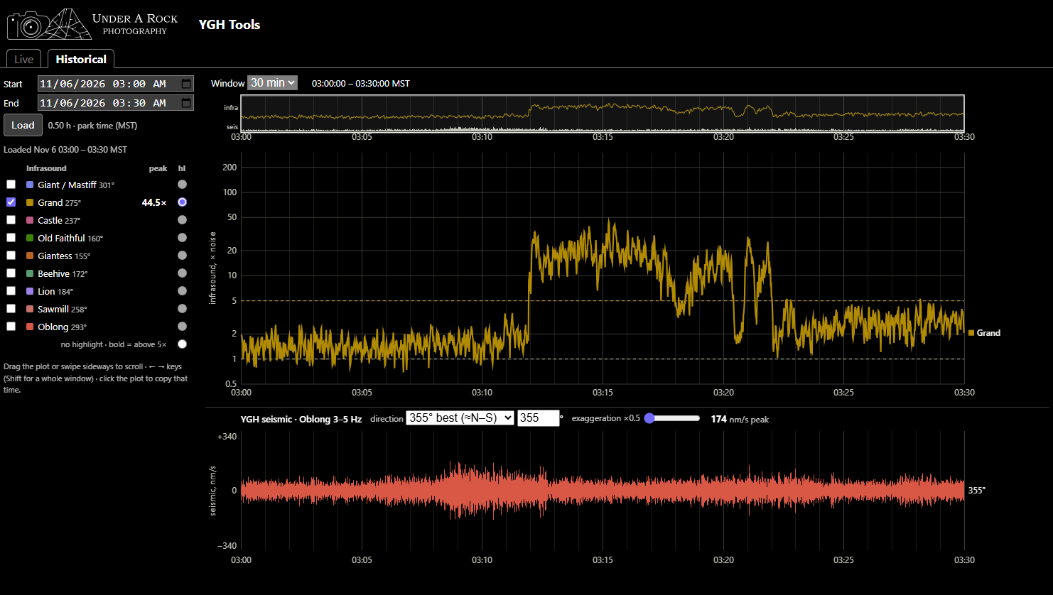
YGH Monitor App - Pt. 3: Use Cases
A living document showcasing examples of verified eruptions and their YGH traces
Published on: Thursday, 12 November 2026 at 00:55 UTC
YGH Monitor App - Pt. 2: How to Use the Tools
Instructions on how to navigate and use the YGH Monitor App for various forms of geyser gazing.
Published on: Saturday, 07 November 2026 at 00:55 UTC
YGH Monitor App - Pt. 1: Introduction
A new instrument in Yellowstone can be used for geyser gazing
Published on: Saturday, 07 November 2026 at 00:55 UTC
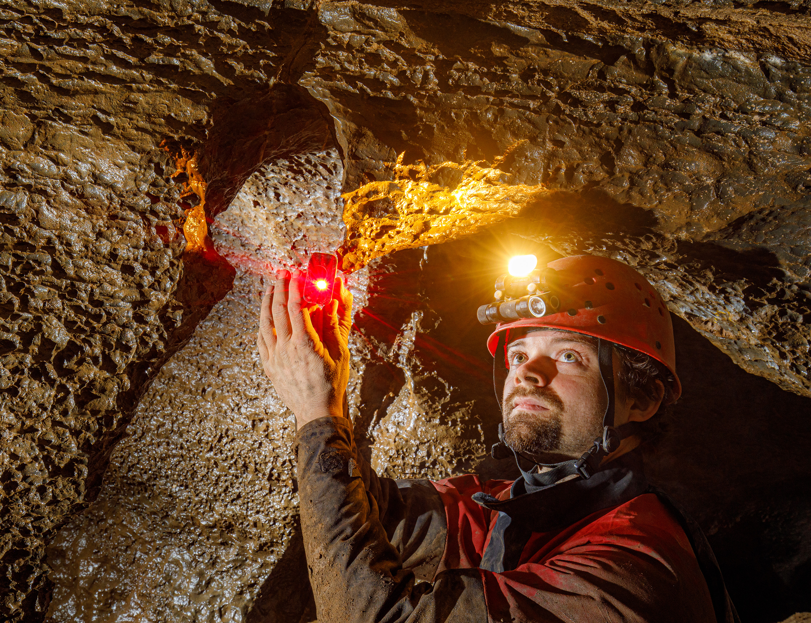
Sofirn's HS22 and SP40A Headlamps
For cavers, this is like having a sub-$150 Scurion
Published on: Wednesday, 17 December 2025 at 11:55 UTC
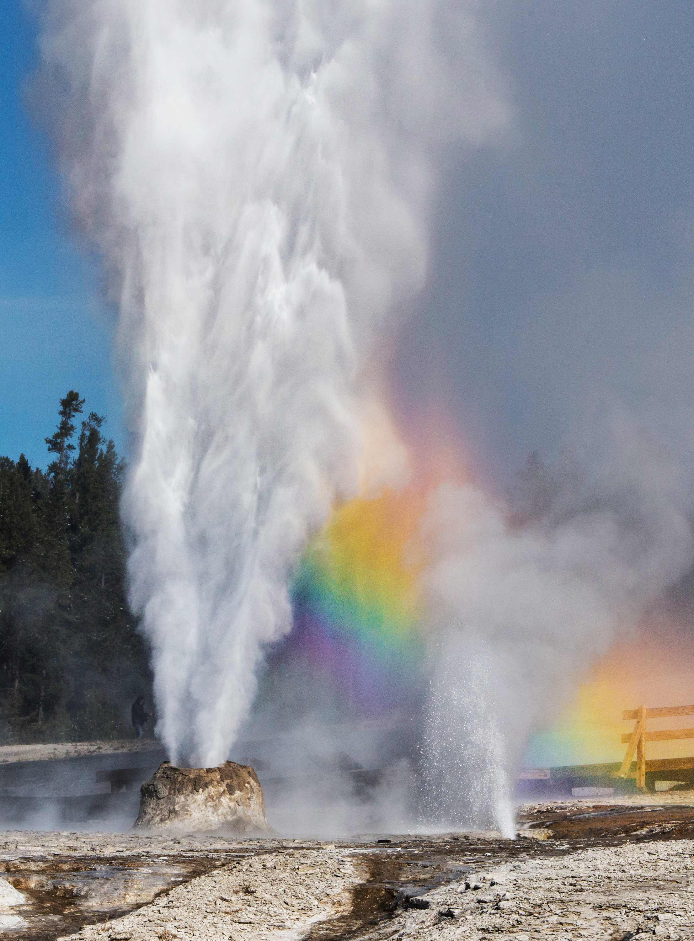
The Thermals Features of Yellowstone
Just over 3,000 words you didn't know you wanted to read.
Published on: Tuesday, 07 October 2025 at 11:55 UTC
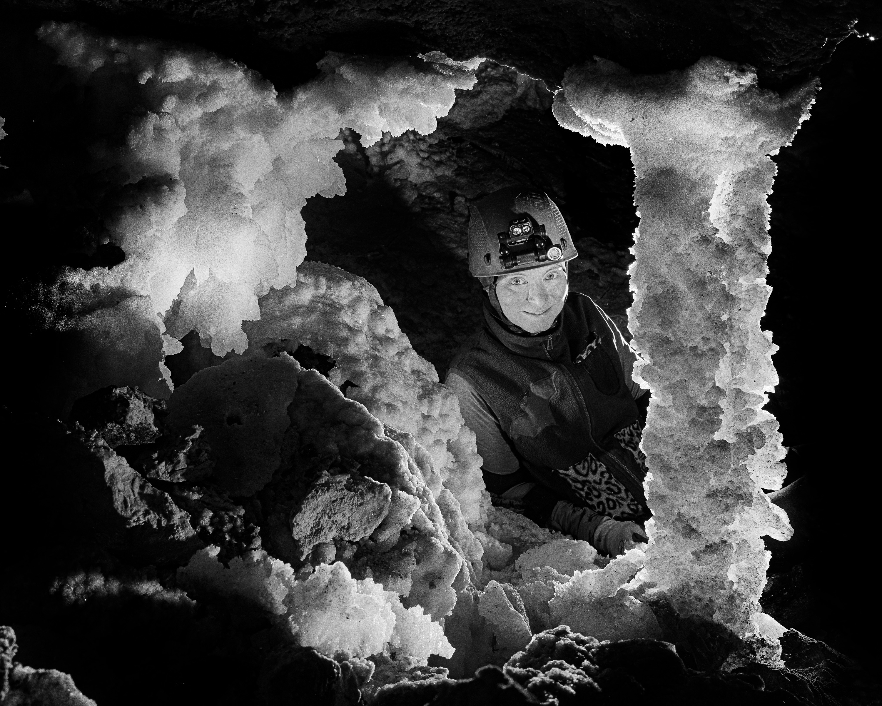
Trip Report: Bighorn-Horsethief Cave System
Surveying and photography during the August 2025 project weekend.
Published on: Wednesday, 01 October 2025 at 11:55 UTC
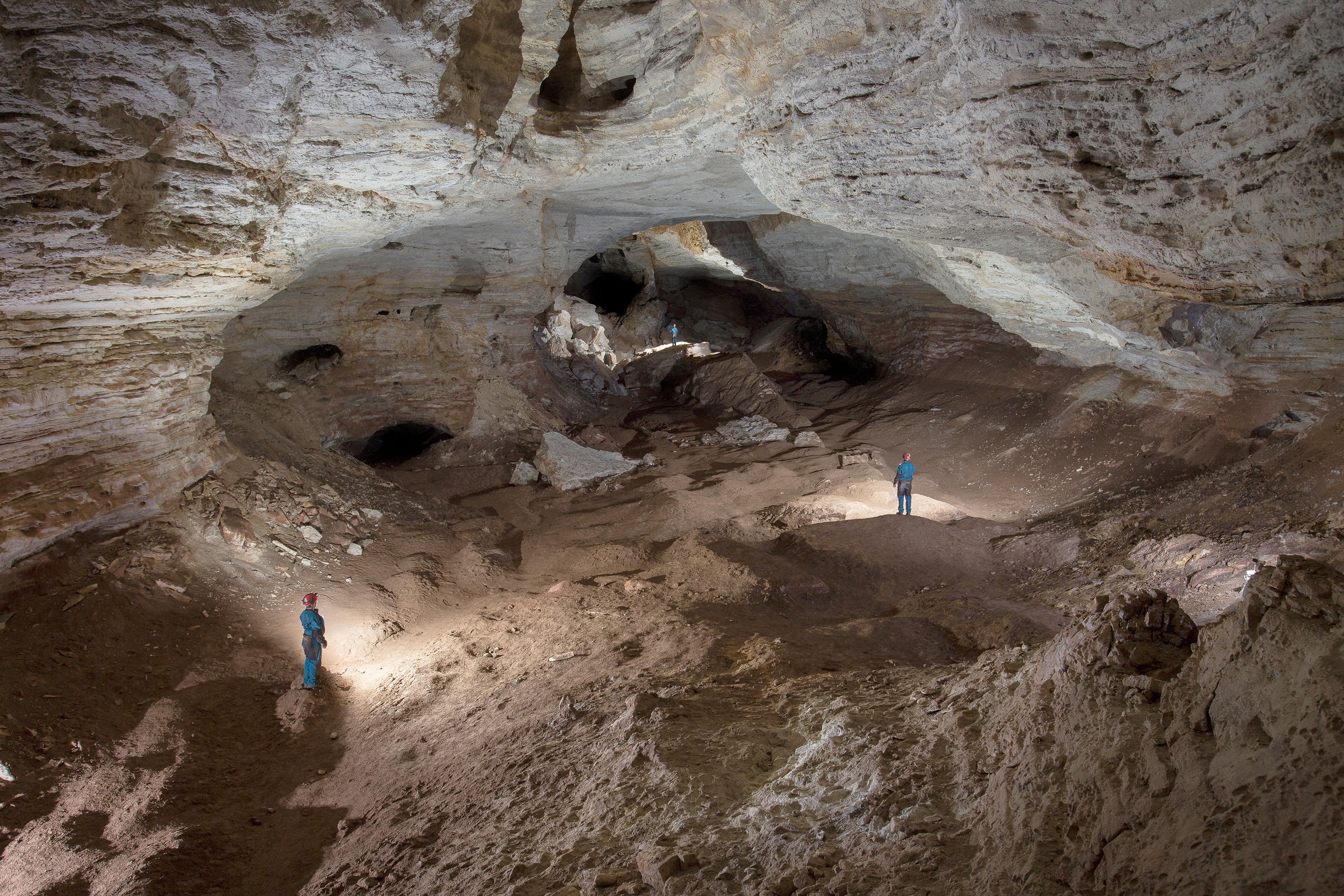
Bighorn-Horsethief Cave System
An introduction to the longest known cave in Wyoming and Montana
Published on: Tuesday, 23 September 2025 at 11:55 UTC
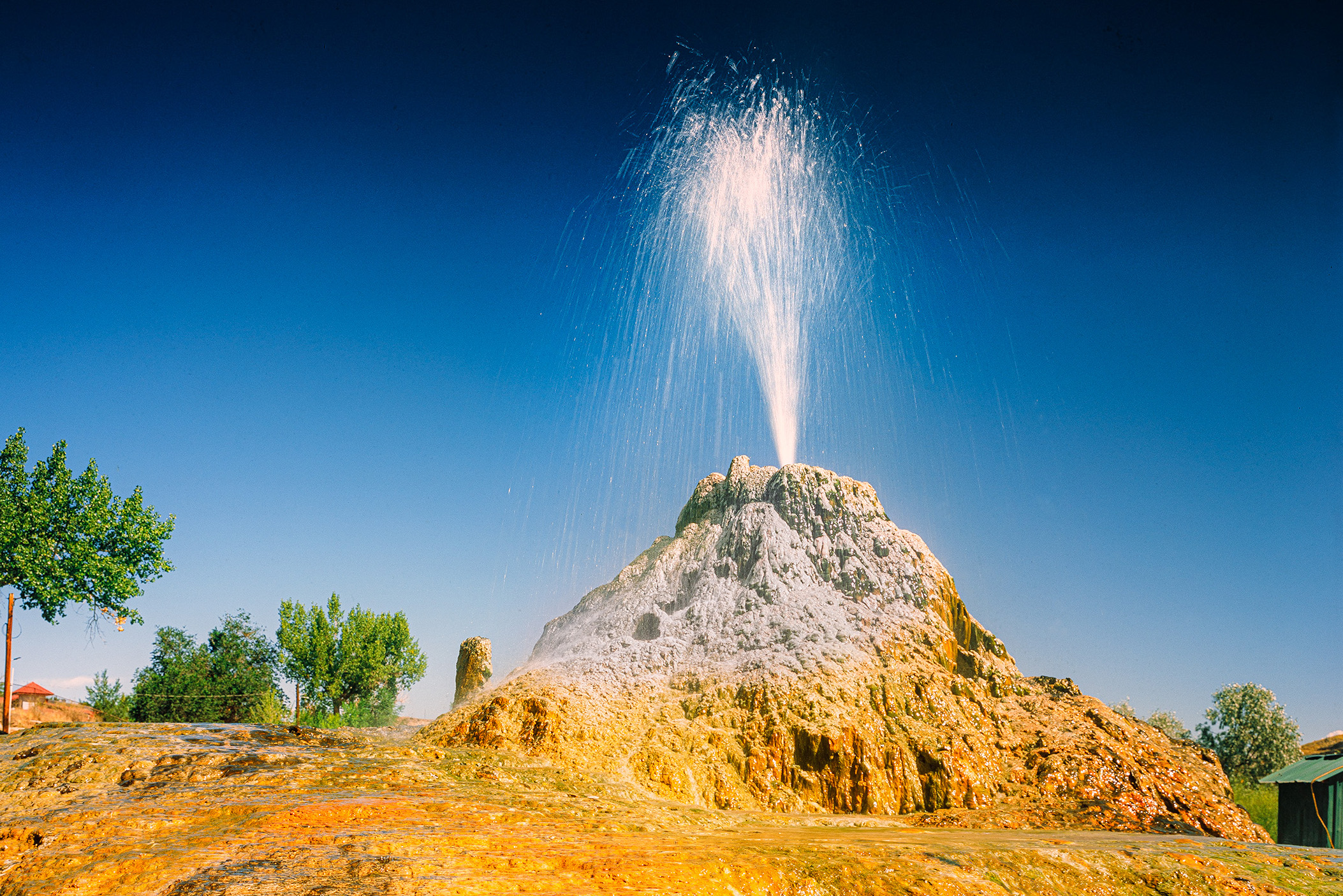
Thermopolis, WY, August 2025
Large travertine hot springs in central Wyoming
Published on: Friday, 19 September 2025 at 11:55 UTC
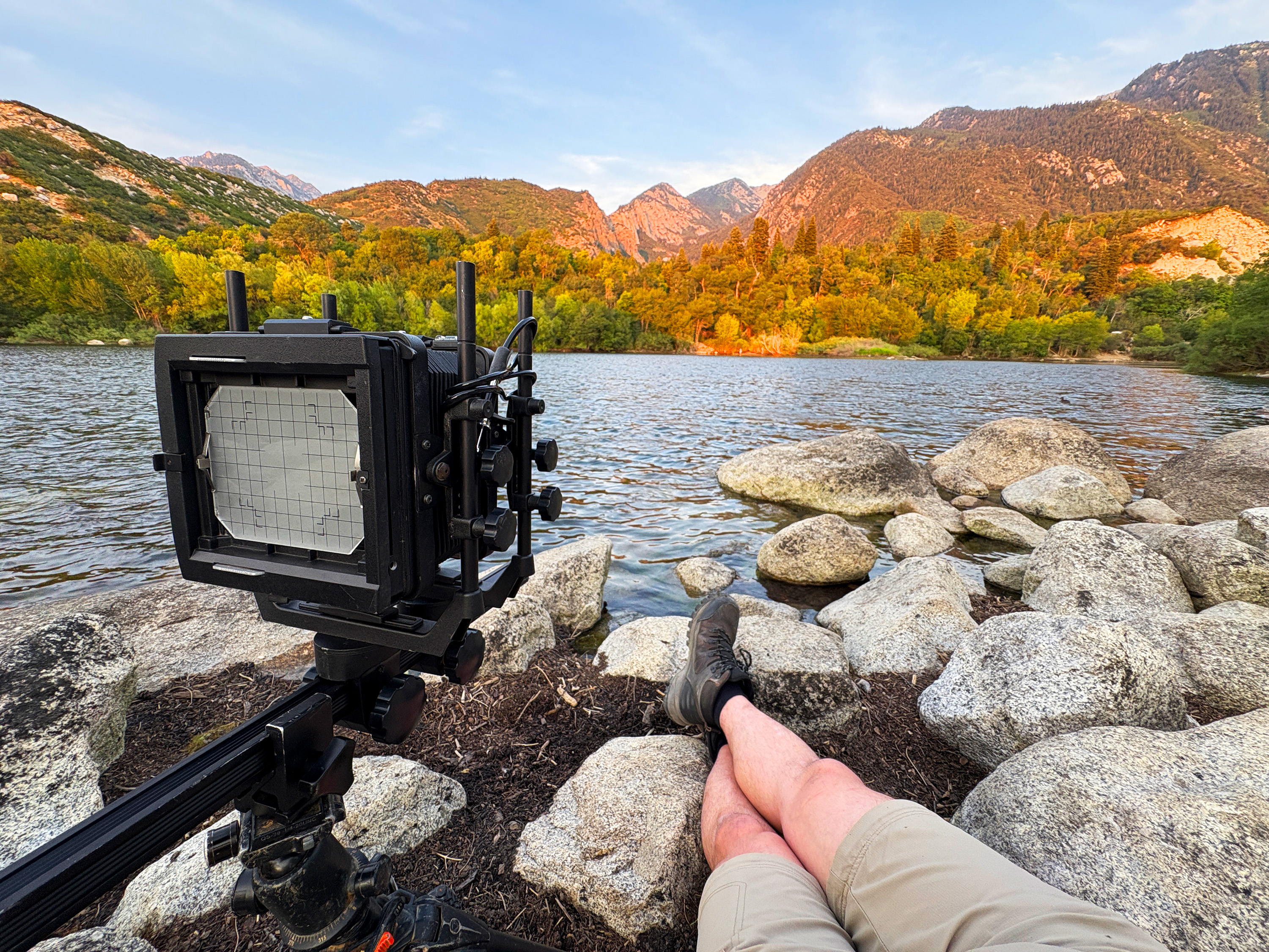
Lazy Photography in the Wasatch Range
Easy hiking and drive up sunsets from suburban Salt Lake City
Published on: Thursday, 11 September 2025 at 12:26 UTC
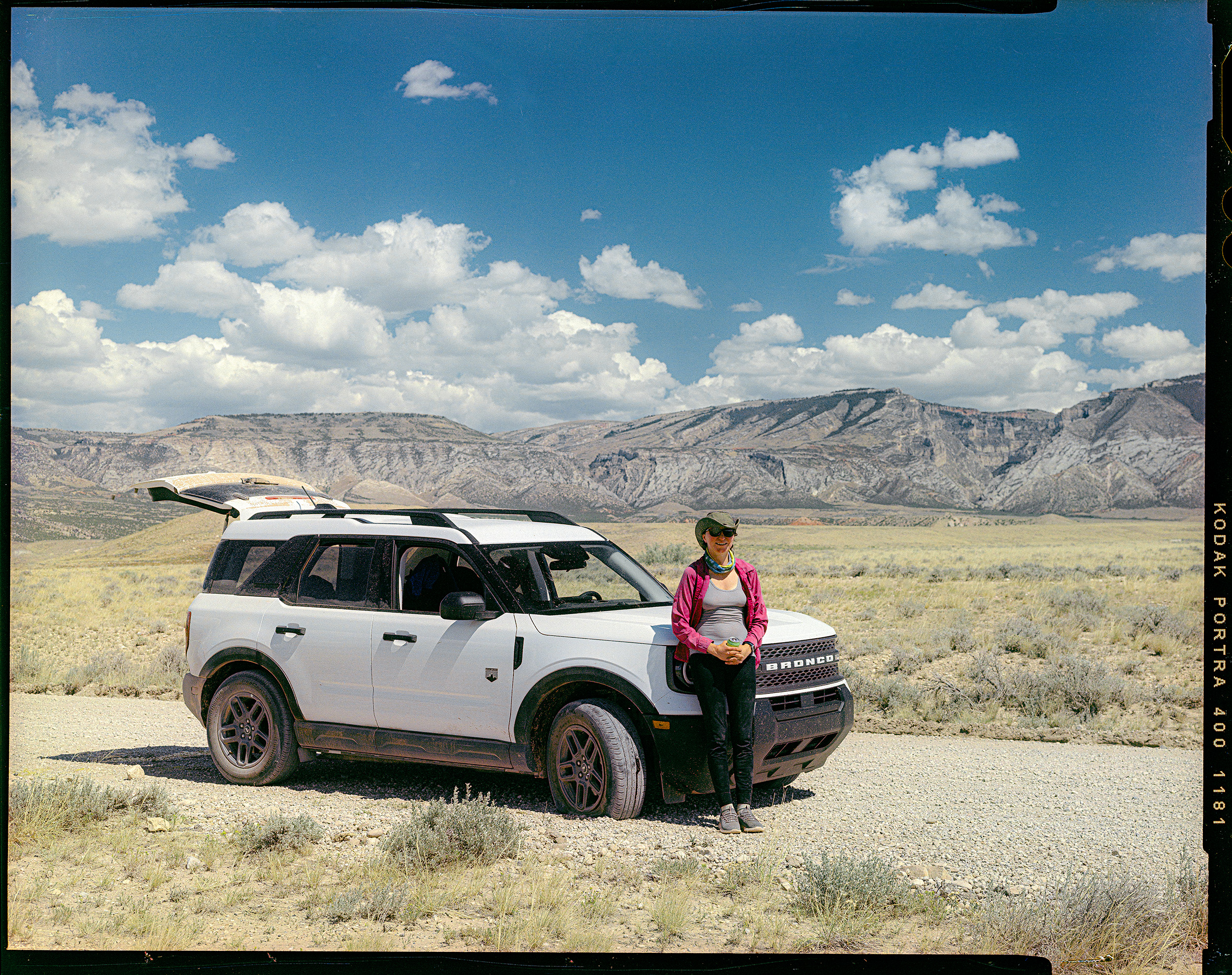
Car Review: 2026 Ford Bronco Sport
1500 miles of driving and camping with the 2026 Ford Bronco Sport
Published on: Wednesday, 10 September 2025 at 11:55 UTC
Wyoming, August 2025
Logistics and gear for eleven days of caving and photography in Big Sky Country
Published on: Wednesday, 10 September 2025 at 11:55 UTC
.jpg)
Tonto Natural Bridge
Massive travertine formation in central Arizona
Published on: Wednesday, 29 November 2023 at 11:55 UTC

Building This Website
Part 1: Lessons learned in mentally herding cats.
Published on: Friday, 14 July 2023 at 19:48 UTC
Trip Report: Bighorn-Horsethief Cave System
Surveying and photography during the August 2025 project weekend.
Published: Wednesday, 01 October 2025 at 11:55 UTC
Contents:
Hope and I rolled into Lovell, Wyoming, early in the afternoon of August 8. From there, we wound our way up the BLM roads toward Armpit City. Getting onto the plateau means driving up John Blue Canyon and then tackling Ball Bearing Hill—two long, steep stretches of gravel road.
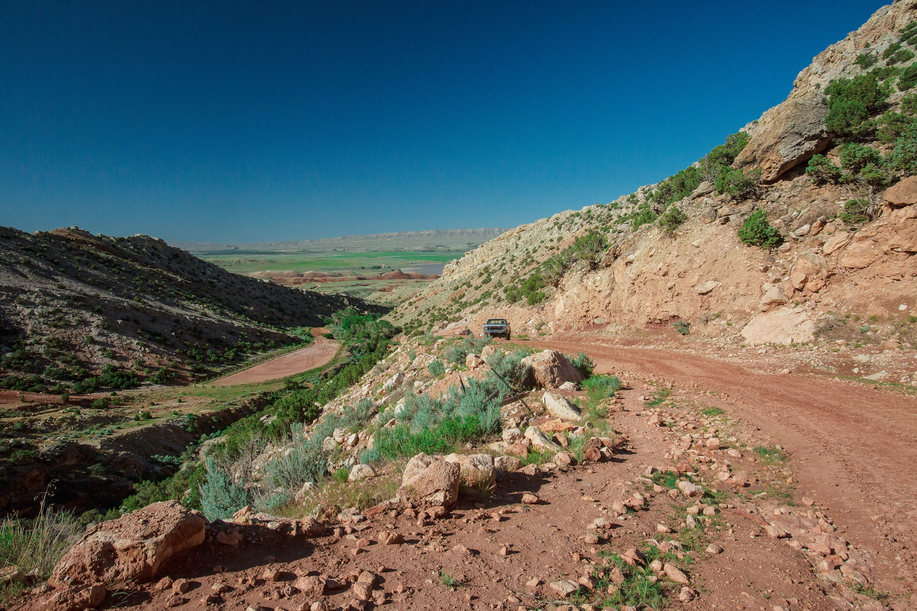
Back in 2018, these roads were deeply rutted and rough. Since then, the BLM has graded them and installed water-deflection barriers. The surface is flatter now, but the barriers add their own challenge—like crossing oversized speed bumps. Too fast and your gear goes airborne; too slow and you stall out. On one side of the road looms a steep hillside, and on the other drops a canyon nearly 200 feet deep.
Once you crest the second hill—the steeper of the two—you arrive on the Little Mountain Karst Plateau. The land opens into miles of sagebrush plains, wide and seemingly endless. It’s beautiful even from behind the wheel. In dry conditions, though, the roads kick up massive clouds of red dust, trailing behind like the exhaust plume of a rocket.
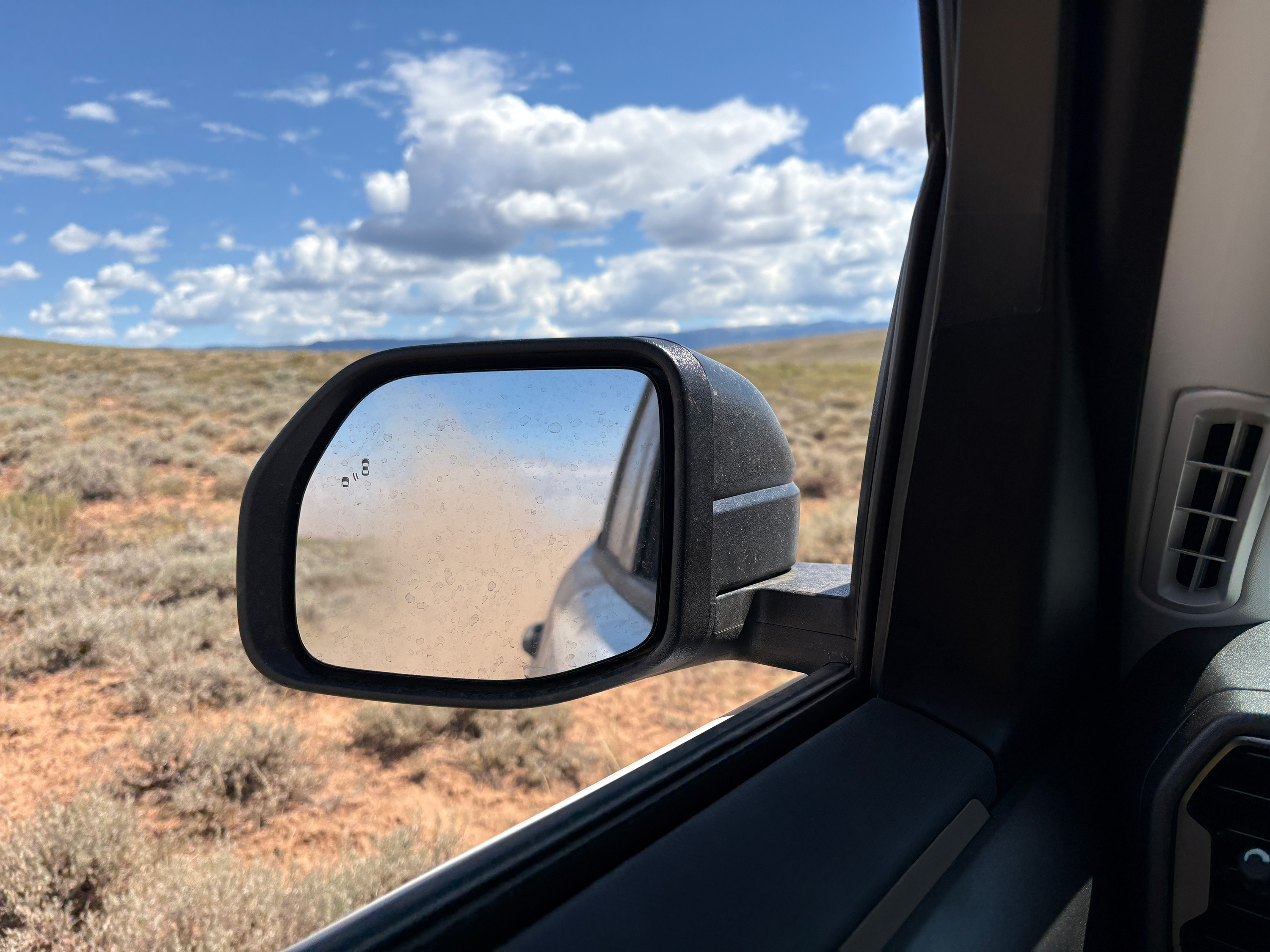
Driving across the top of Little Mountain you leave a dust cloud behind you that makes you feel like you are driving a rocket.
The road eventually curves over a few hills into Armpit City, a name that’s more tongue-in-cheek than literal. This “city” sprang up in the 1950s during the uranium mining boom. Today, what remains are just two weathered clapboard cabins, a half-functional outhouse, and the letters AP carved into a nearby hillside. As cavers like to say: It ain’t much to look at, but it’s got one hell of a basement.
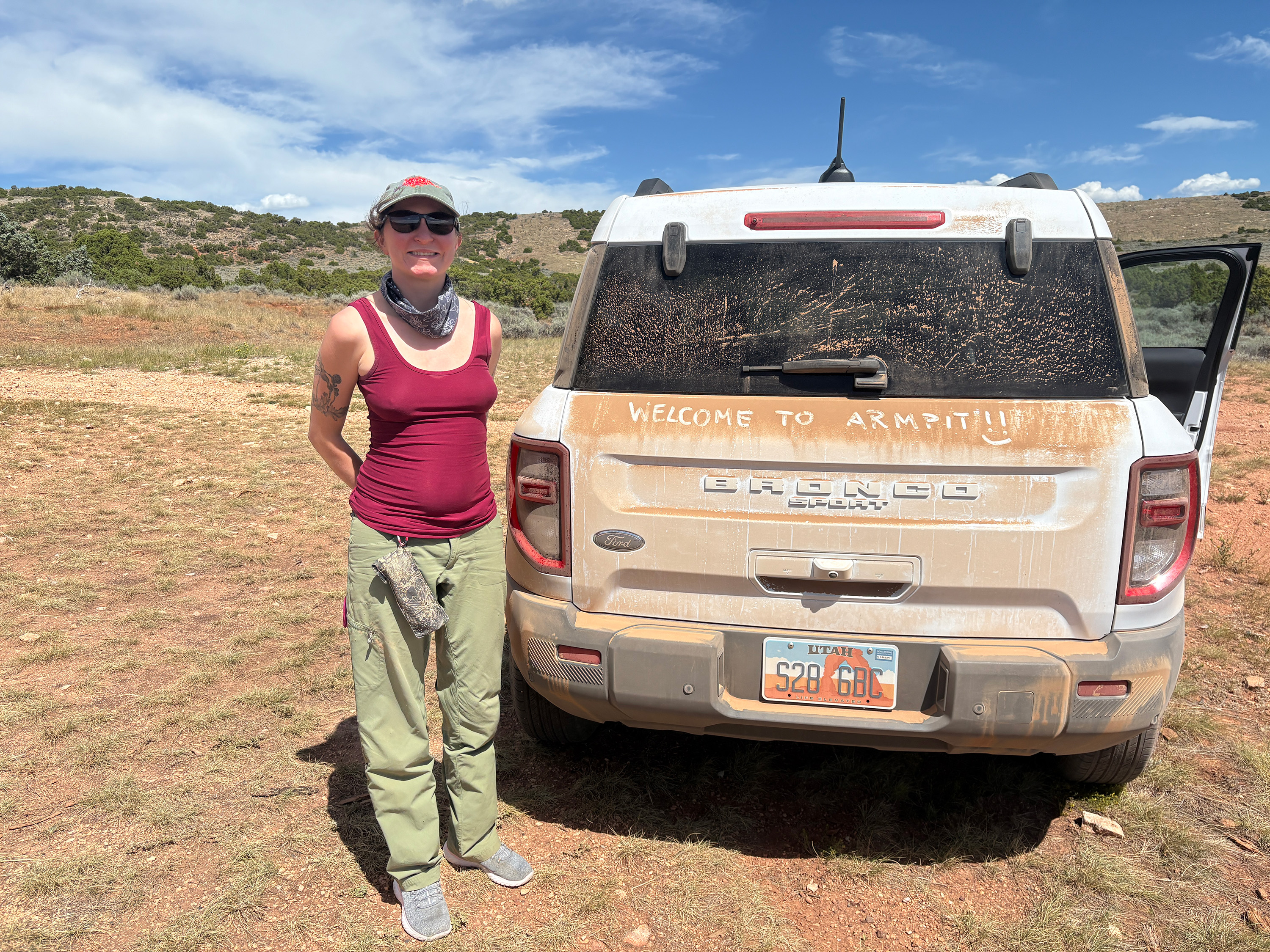
Welcome to Armpit City, embrace the dust.
Getting Started
The Bighorn–Horsethief Project is led by Will Boekel, with a small team of cavers. I joined as co-cartographer and data manager alongside Katey Bender. This was my first trip in that role, and I had a packed list of tasks to squeeze into just 36 hours on the mountain.
We arrived at Armpit City around 3:30 p.m., already covered head-to-toe in red dust. Mara Reed was at camp, and Jason Forberg arrived shortly afterward with his family. With someone now holding down camp, we headed to Horsethief Cave to calibrate our Distos. Thus began Trip 107 of the Bighorn–Horsethief Project at 5:40 p.m.
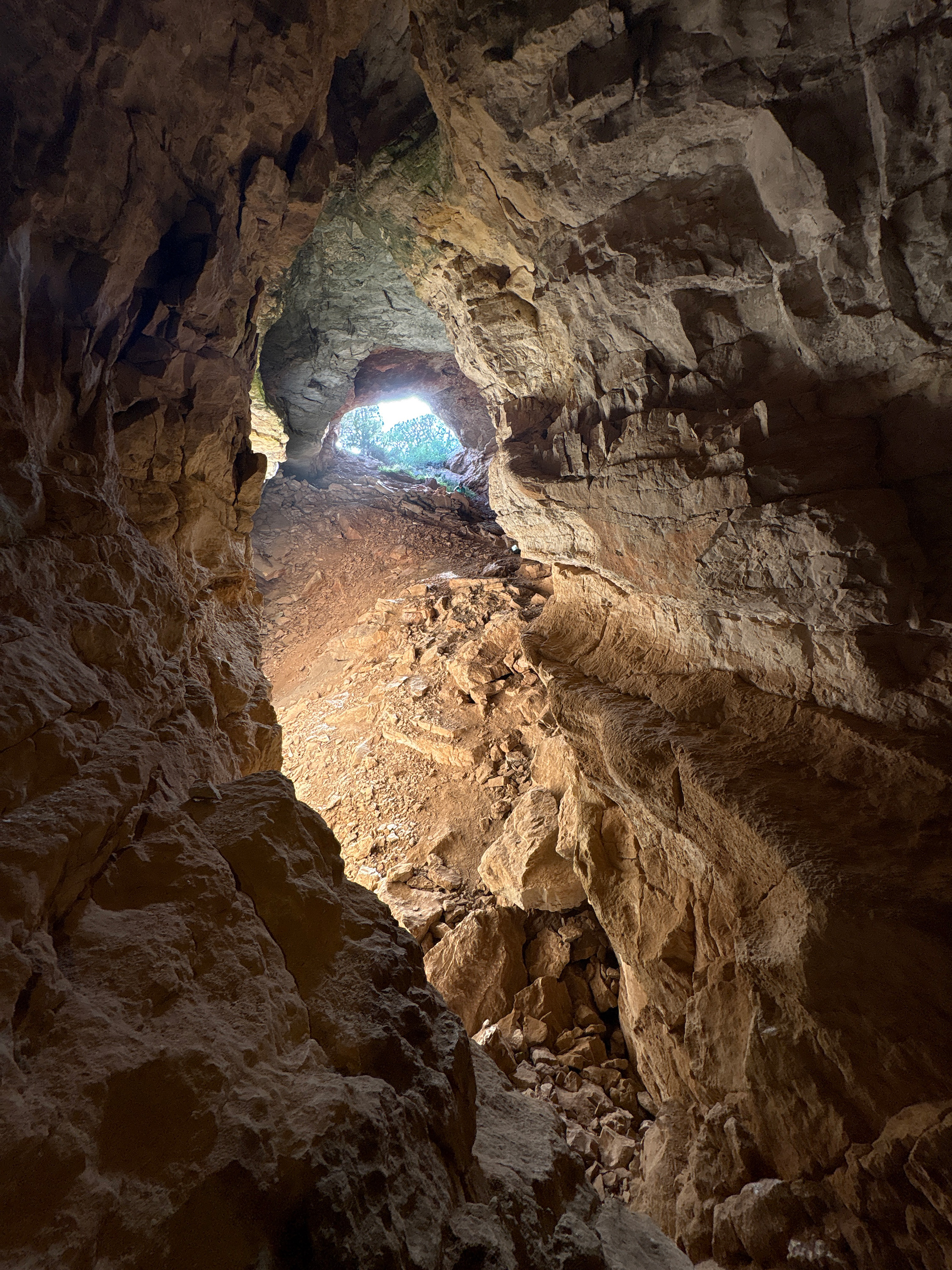
Calibration went surprisingly smoothly—maybe because I stripped to my underwear and found the only non-magnetic spot near the entrance. Mara wasn’t so lucky; her BRIC 5 unit gave her constant trouble, and neither Hope nor I had enough experience with it to help.
While working, I noticed several small details in the entrance area that had been overlooked in earlier sketches. The entrance is deceptively complex: collapsed surface passages, hidden side channels, and subtle openings. I grabbed survey gear, resketched the entrance, and added over 300 feet of new passage to the map.
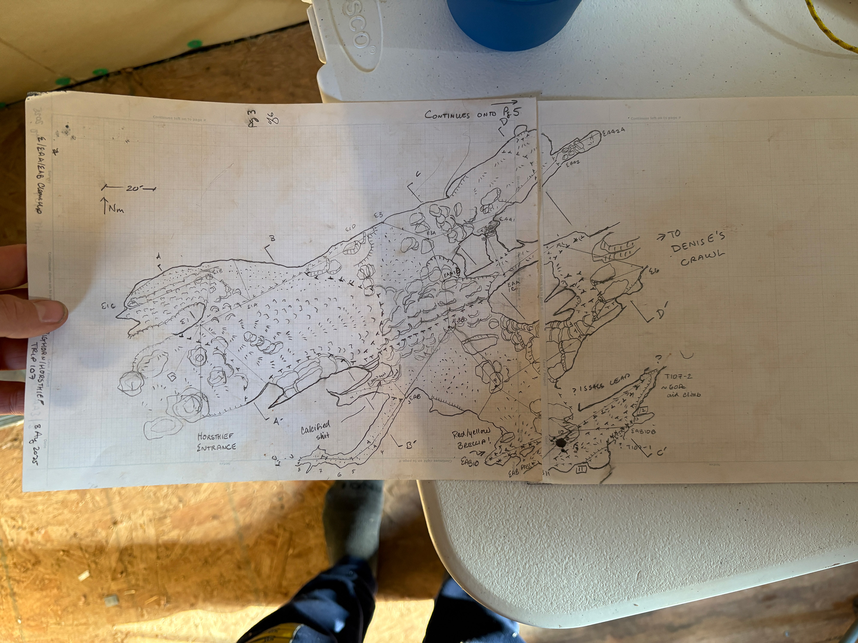
Entrance complex sketch from our survey trip on Friday night.
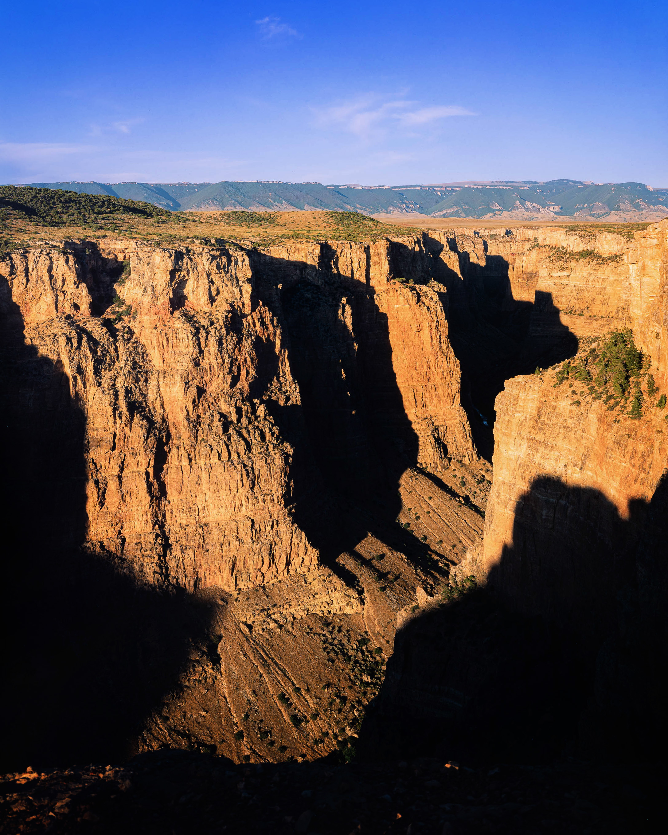
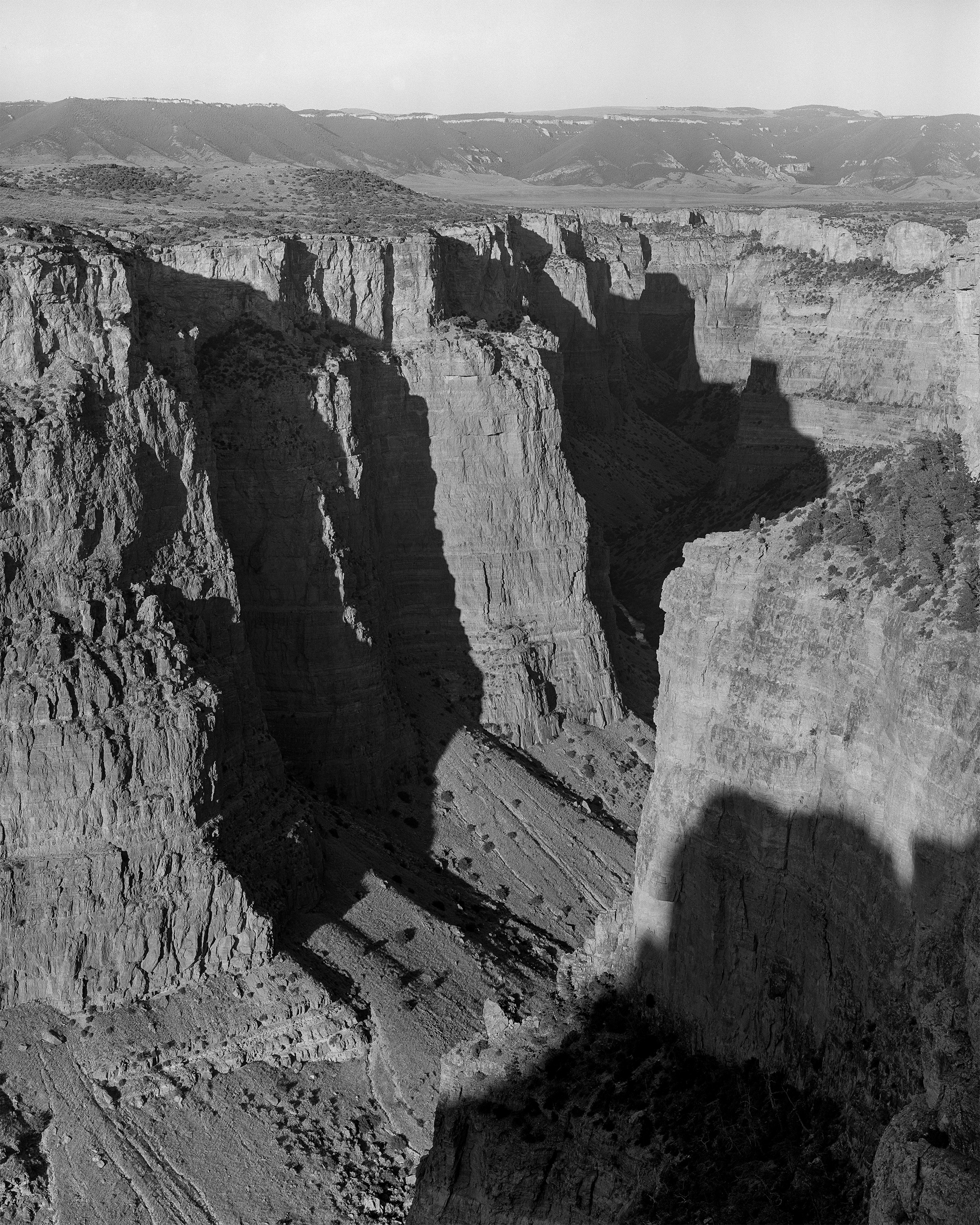
We wrapped up just in time to catch a spectacular sunset. I drove Hope to Devil’s Canyon Overlook, where the evening sun poured down the canyon’s eastern arm. I fired off a few black-and-white negatives and a sheet of Fuji Provia. While exploring the rim, I stumbled upon a small cave at the cliff edge—probably tectonic in origin, though it showed signs of solutional features and exhaled a steady breeze. In keeping with local naming traditions, I dubbed it Devil’s Crack Cave—one more for the BHHT project.
Back at camp, Jason’s family had hamburgers waiting for us. Around the table, we decided to abandon a planned photo trip to Titan Cave. Instead, Hope, Will, and I set out to survey between the Titan and Horsethief entrances, tying into a drill hole that supposedly intersected Horsethief’s southeastern reaches.
We began at 9:00 p.m. and trekked more than a mile across the moonlit sagebrush plateau, shooting survey lines up to 180 feet long. After an hour of battling the wind and shouting back and forth, we reached the drill hole, exhausted. By the end of our first twelve hours on the mountain, we had logged more than 2,600 feet of survey—2,300 of which were above ground.
Into the Cave
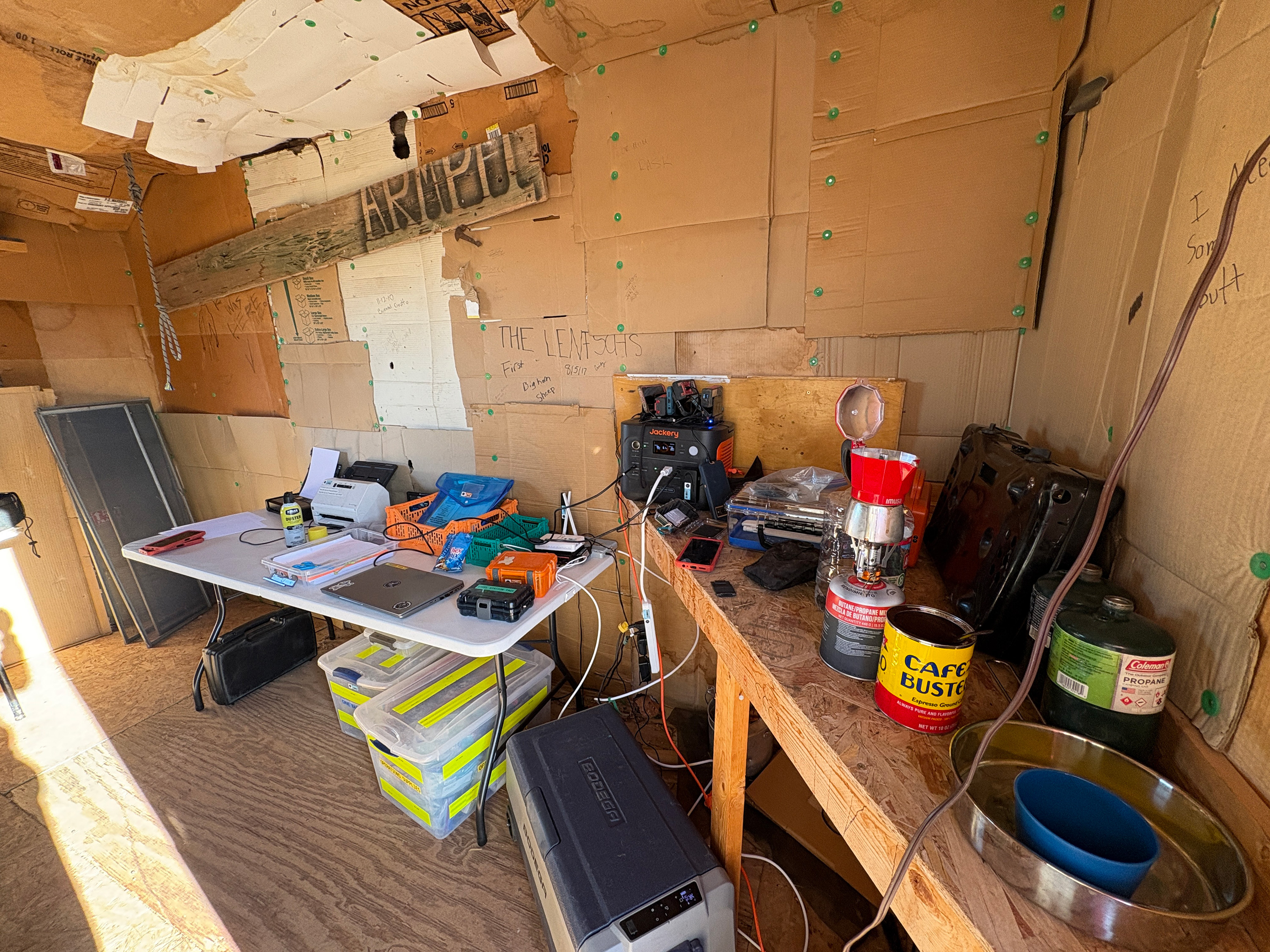
A typical morning in the Crotch, one of the cabins at Armpit City and base of operations during a survey weekend.
Morning came early. More cavers arrived around 8:00, and by 9:30 we were on our way to the cave. Morning light on Little Mountain is spectacular—the sagebrush glows, and the Pryor Mountains shine in golden tones. It’s a surreal contrast with the roadside warnings about hazardous uranium mine remnants. Radon levels inside both Bighorn and Horsethief are elevated, though safe within the 200-hour annual exposure limit.
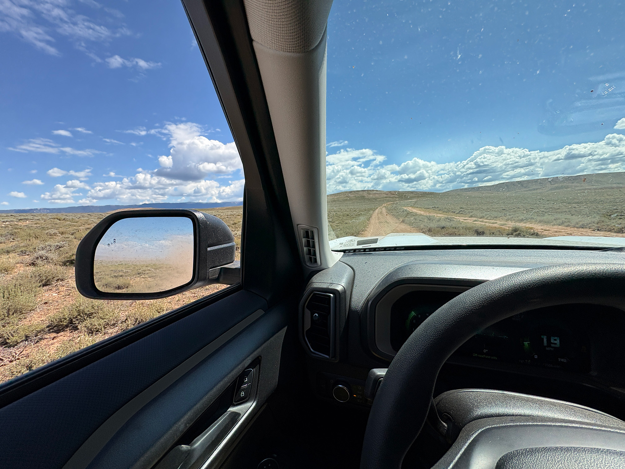
Out across Little Mountain to the caves.
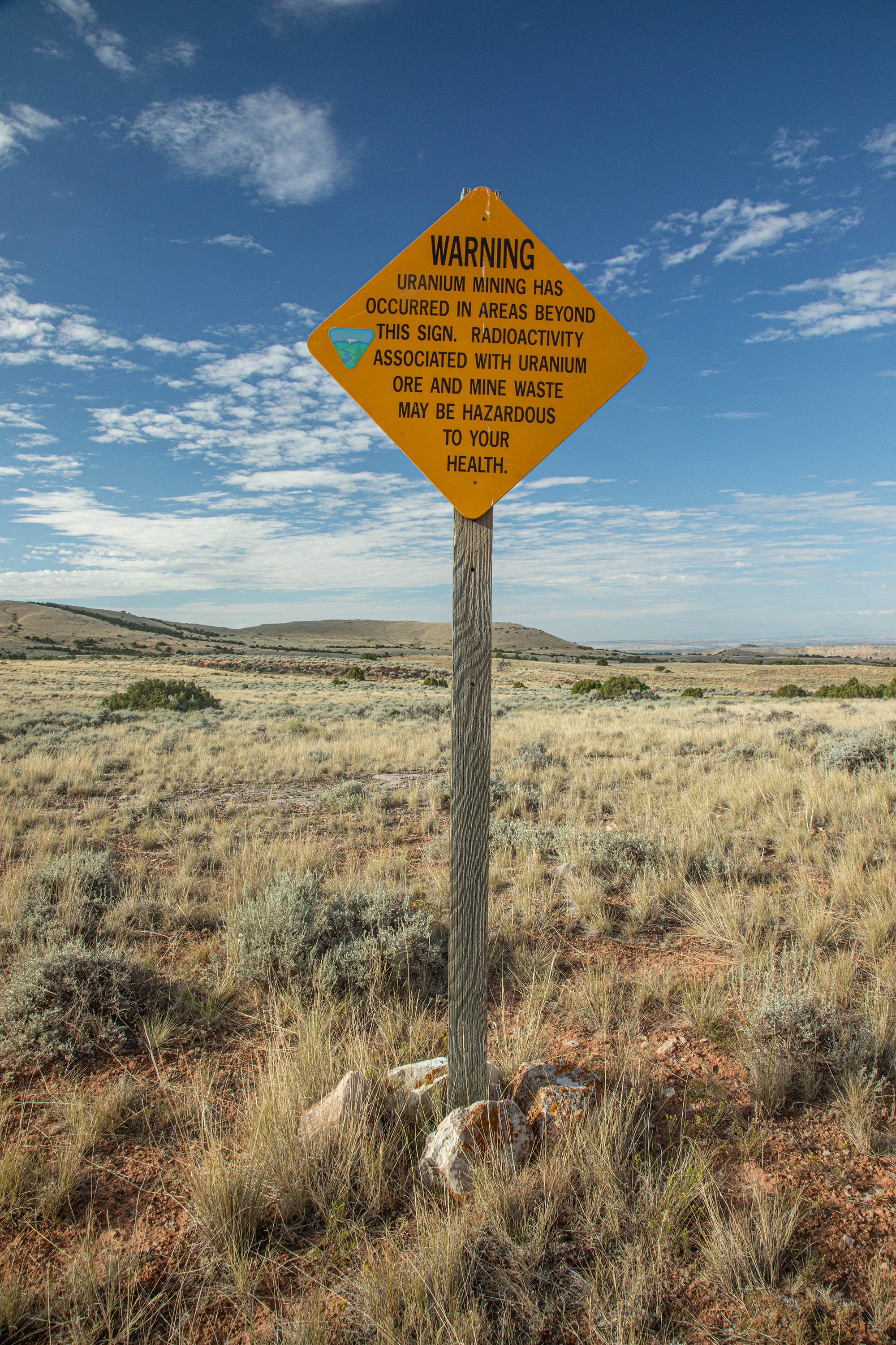
Not the most comforting sign to see when planning on going underground.
This weekend was all about Bighorn Cave. My task list included survey cleanups near the K and G lines, and a push into the chaotic B line passage network southwest of the entrance. I also wanted to revisit the Pillar Room to re-photograph a massive gypsum column I’d last seen in 2018.
Before anyone else even descended, I snagged a lead near the entrance canyon that ran about 50 feet to an unclimbable pit.
Then we went over to the end of the entrance canyon and began surveying that way. Almost immediately we were faced with a multi-passage junction going in four different directions. We went down and to the right first, which opened into a room at the bottom of the pit left in the passage before. Hope and I surveyed through this room and the few side leads off of it – all which ended in 100ft or less except for one lead which ended in a 20ft climbable dome that opened into the passages above. By this time, Mara and Jason went off to scout somethings way out past the K line – Hope and I kept on surveying until we would hit our meet up time at 14:00. We surveyed up above the lower room into flat out borehole maze with subway sized tunnels going everywhere. I am stickler for comprehensive survey and this comes back to bite me in the ass in places like this. We looped around to tie into the dome we left in the lower room and then made a point to leave a good tie in station in each of the branching passages. One of them devolved into a myriad complex of lower levels which all ended in relative short order, so we surveyed all of those.
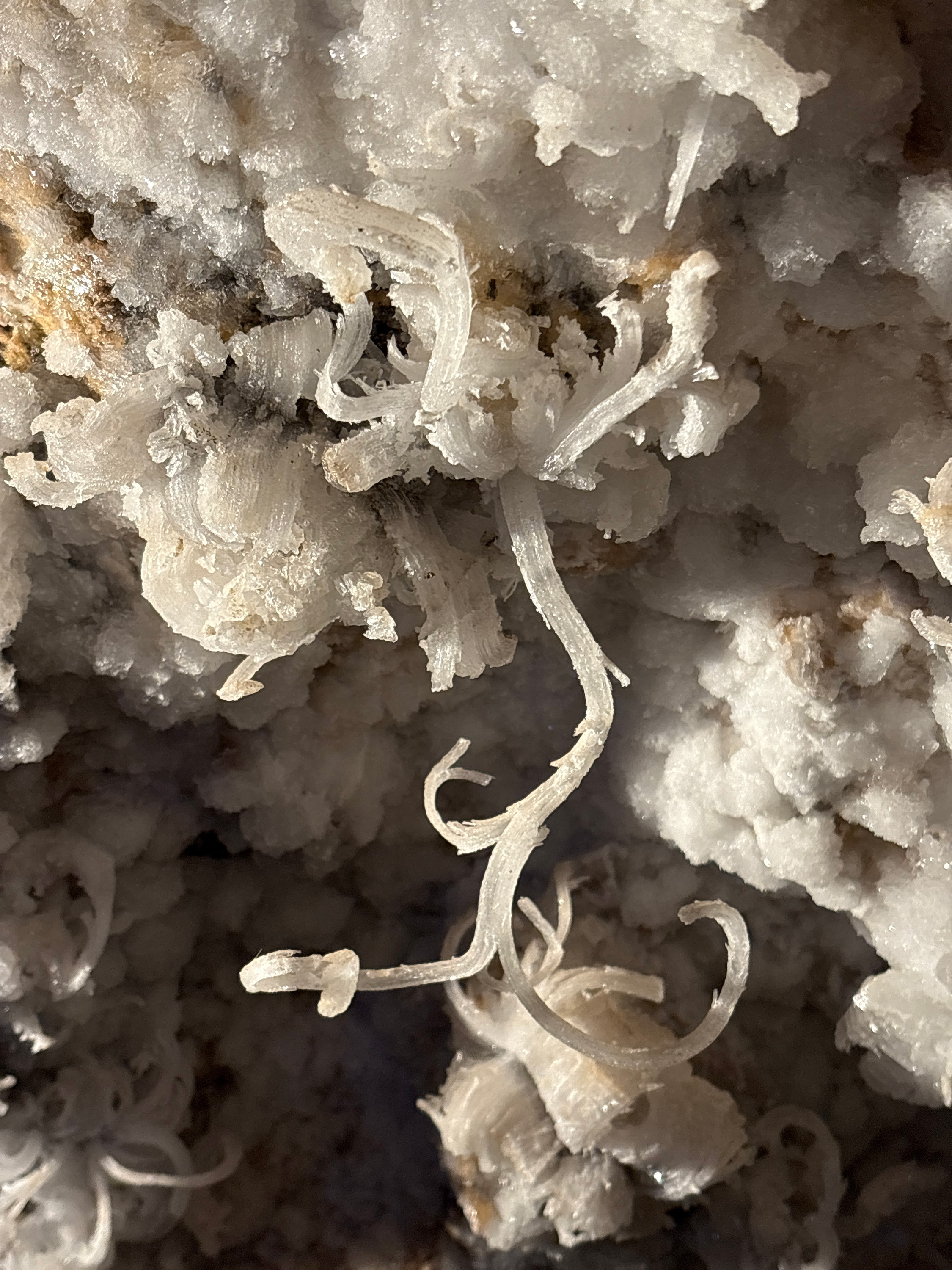
By this time we were nearing the time to meet Mara and Jason back at the Cloak Room by the entrance pit, so we moseyed over there. We couldn’t recall if we said “meet in 3hrs” (14:00) or “meet at 3pm”. So we were a bit early. We decided to move in the general direction of where they went to go find the gypsum column in the Pillar Room. We left the survey gear behind and took the photo gear with us eastward down the A line, and then up over through the Keyhole into what I thought was the Pillar Room. My memory from 2018 was a bit fuzzy, and I recalled the column being near the Keyhole, before the K line. So Hope and I spent about 25 minutes going in circles looking for the column. We found all kinds of gorgeous gypsum and aragonite, but no gypsum column. Even found a passage with red and white flowers! We left the photo gear there and went back to the Cloak Room, it was now closer to 15:00, the time we figured our meet up actually was.
We sat down for lunch and while doing so I started poking around the large room right in the entrance. There were a few leads missed, and the ones left in the room were limited enough in extent that I started surveying them. Around this time we calculated our survey footage for the day to be in the range of 1,100ft. We knew from data management from the day before that 2,000ft would put the combined system length at over 5 miles – so we put our heads down and started towards that.
Soon after we started, Jason and Mara showed up. We surveyed down the side leads off the entrance room. I was sketching, Hope was on point, and Jason was scouting leads and side passages. Mara continued in vain to calibrate her BRIC. In a few hours we had surveyed closer to 1,800 feet of cave. Jason was ready to go topside, and Mara had to relieve herself – so they exited. Hope and I tried in vain once again to find the gypsum column in the Pillar Room. We settled for photographing the red and white gypsum flowers. I took time to photograph a set of pink, orange, and white anthodites that we found near the end of one of the side passages that we named Hope and the Amazing Technicolor Anthodites.
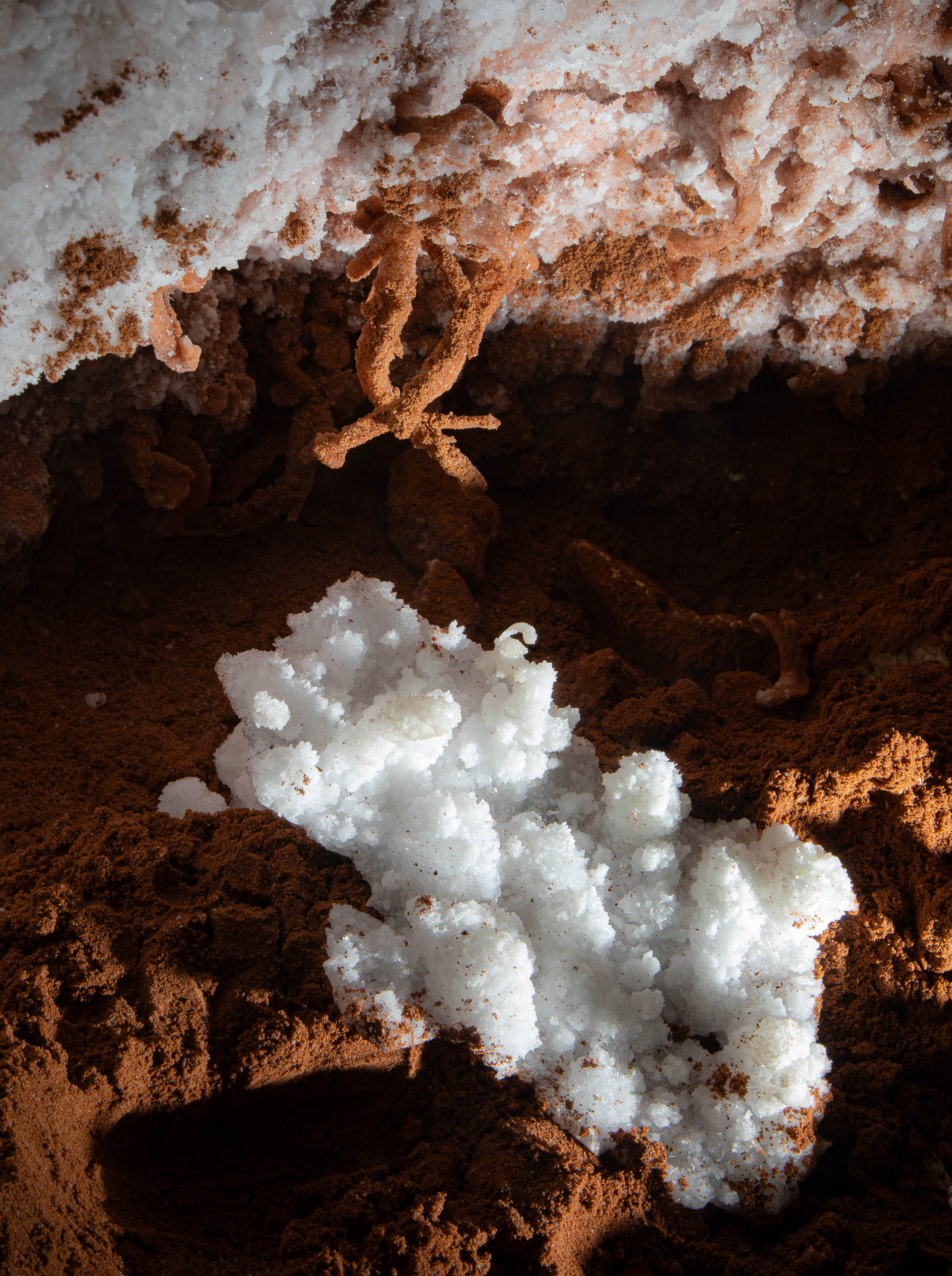
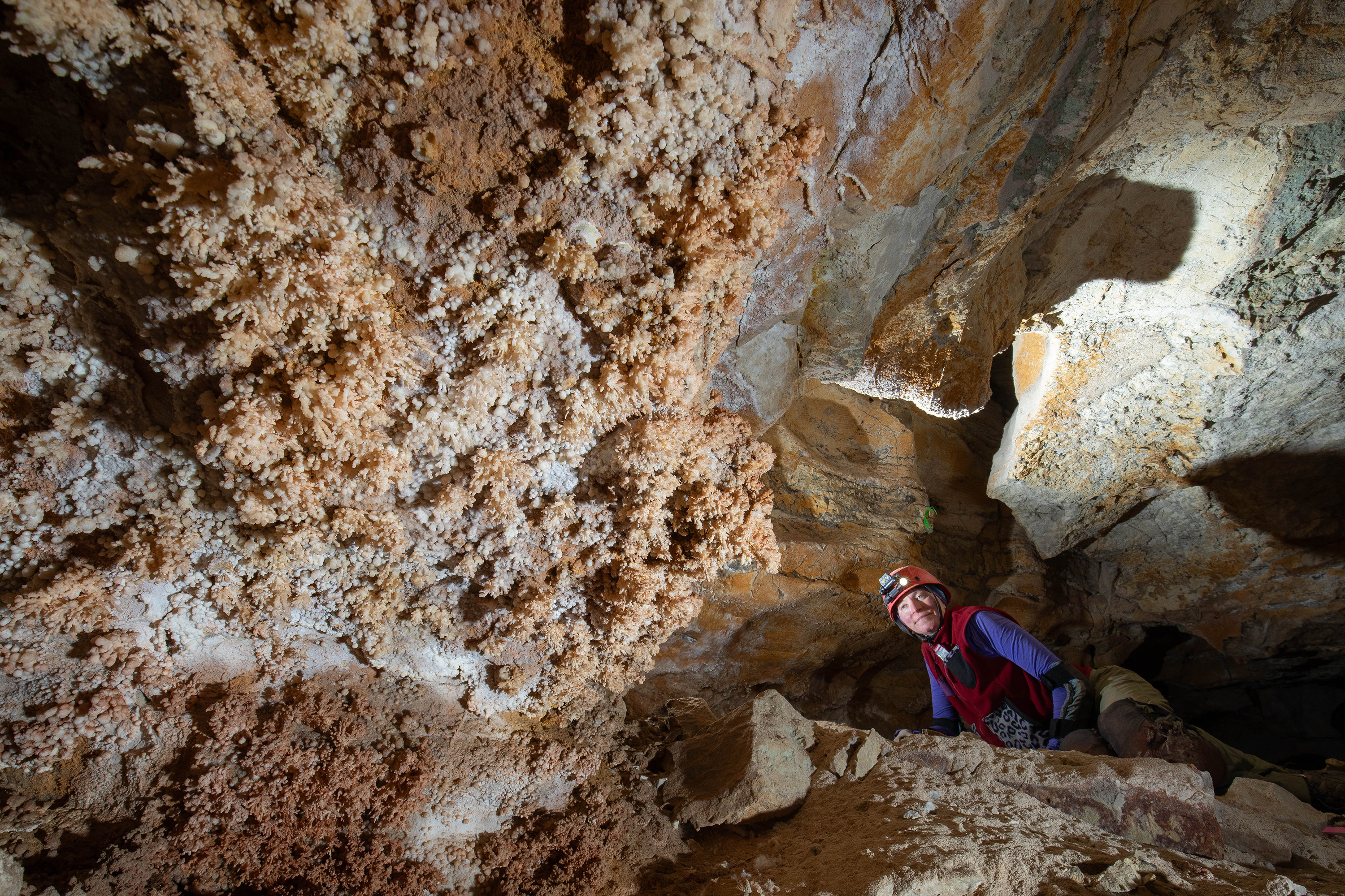
We were so close to a round 2,000ft of survey for the day that we decided to go down the B line proper and clean up some of the survey stuff there that I had on my list. This got us up to 2,200ft. By this time we were near, or past, what we thought was Will’s team’s callout time. We moseyed in their general direction – they were out the W line about 50 minutes into the cave. We went about halfway there to the start of the K and G lines where I had more survey clean up to do. Mara scouted ahead to check for Will’s group while Hope and I started surveying this area. Mara returned and noted that she did not see Will’s group, and was starting to be a bit concerned about their potential lateness. We were nearing our limit for the day anyways. By this point Hope and I had surveyed something like 180 shots for a total of 2,300ft. I had a wicked eye-strain headache, we were out of food, and none of us would be in any shape to help out Will’s team if there was an issue with one of the newer folks.
We decided to exit the cave, and leave a note at the entrance saying we would stay topside until around 20:00 (an hour past what we thought was the out time), then we would come back in, look for them, and then take more action if needed. Once again, the cave gods took this hint. I got 5 feet up the entrance pit when Will’s group arrived.
I exited the cave at 19:30, after a roughly 9 hour trip, to a wonderful late evening sunset. Will told me his group surveyed a few hundred feet, so we were confident we passed the 5 mile mark.
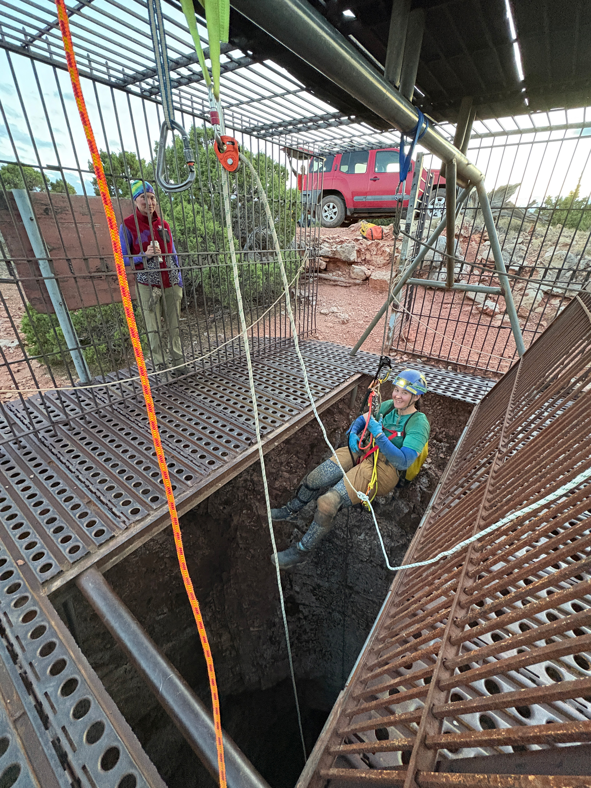
Mara exited last, and we used my heavy photo pack as a practice patient to see what rescue rigging Bighorn would be like. Will wanted to take photos, I insisted that this was a proof-of-concept and that no documentation should be done at all that could be construed as an actual plan.
We returned to camp at 20:45. While munching down hamburgers I entered data from both of our trips. It took me nearly an hour to enter it all. My eyes were crossing, but it confirmed we did in fact pass 5 miles.
Closing Out the Weekend
The next morning, Will explained that the Pillar Room had been mislabeled on the new map—no wonder we couldn’t find the gypsum column. At 8:30, the three of us went back in, this time to the right spot.
My mind managed to blank out on the fact that there is a crawlway past the Keyhole to go through before entering the Pillar Room. I am glad Will was there to lead us to the column because I never would have found it tucked away in its alcove in a non-descript corner of the Pillar Room.
The column was just as impressive as I remembered – but I forgot about the gypsum chandeliers all around it and the huge gypsum flowers sprouting from the wall. What a spectacular place!
I set up the 4x5 to take a photo of Hope at the column – one of my only personal goals for this trip. I used a Sofirn Q8 flashlight to backlight the column – the same light used in The Thing From Coeymans Dome. I used two smaller lamps to cross light the foreground and a couple of strobes to light up Hope. This all metered out to 1 second at f16 for Ilford FP4, and 1 second at f27 for HP5. I knew I wouldn’t be back this way in the future, so I ended up making 8 exposures, half with HP5 and four with FP4. This turned out to be a good idea, in some of them Hope moved. In others the focus was missed. In the end there were two good exposures, and now we have a wonderful 16x20 of the print hanging up in our house.
We exited at 11:00 and finally locked the cave after a very productive weekend. Hope and I began down the mountain at 12:30 and made it nearly to pavement before we popped a tire on the rental – an adventure detailed in this earlier trip report.
By 2:00 p.m., the Bighorns were fading behind us, and the Absaroka Mountains—eastern sentinels of Yellowstone—rose ahead, carrying us into the next phase of the trip.

 v.2026.11.12.A
%20--%3e%3cdefs%3e%3cstyle%3e%20.st0%20{%20fill:%20%23fff;%20}%20%3c/style%3e%3c/defs%3e%3cg%3e%3cpath%20class='st0'%20d='M55.7,107.69h-11.41l-2.1,5.82h-3.6l9.46-26.01h3.94l9.42,26.01h-3.6l-2.1-5.82ZM54.73,104.91l-4.73-13.21-4.73,13.21h9.46Z'/%3e%3cpath%20class='st0'%20d='M80.79,100.43c-1.49,1.44-3.76,2.16-6.81,2.16h-5.03v10.92h-3.42v-26.16h8.45c2.95,0,5.2.71,6.74,2.14,1.54,1.43,2.31,3.27,2.31,5.52s-.74,3.98-2.23,5.42ZM78.19,98.53c.9-.83,1.35-2,1.35-3.53,0-3.23-1.85-4.84-5.56-4.84h-5.03v9.61h5.03c1.9,0,3.3-.41,4.2-1.24Z'/%3e%3cpath%20class='st0'%20d='M102.53,100.43c-1.49,1.44-3.76,2.16-6.81,2.16h-5.03v10.92h-3.42v-26.16h8.45c2.95,0,5.2.71,6.74,2.14,1.54,1.43,2.31,3.27,2.31,5.52s-.74,3.98-2.23,5.42ZM99.92,98.53c.9-.83,1.35-2,1.35-3.53,0-3.23-1.85-4.84-5.56-4.84h-5.03v9.61h5.03c1.9,0,3.3-.41,4.2-1.24Z'/%3e%3cpath%20class='st0'%20d='M112.66,112.85c-1.36-.61-2.43-1.46-3.21-2.55-.78-1.09-1.18-2.35-1.2-3.77h3.64c.13,1.23.63,2.26,1.52,3.1.89.84,2.18,1.26,3.88,1.26s2.91-.41,3.85-1.22c.94-.81,1.41-1.86,1.41-3.13,0-1-.28-1.81-.83-2.44s-1.24-1.1-2.06-1.43c-.83-.32-1.94-.68-3.34-1.05-1.73-.45-3.11-.9-4.15-1.35s-1.93-1.16-2.66-2.12c-.74-.96-1.11-2.26-1.11-3.88,0-1.43.36-2.69,1.09-3.79.72-1.1,1.75-1.95,3.06-2.55,1.31-.6,2.82-.9,4.52-.9,2.45,0,4.46.61,6.02,1.84,1.56,1.23,2.45,2.85,2.65,4.88h-3.75c-.13-1-.65-1.88-1.58-2.65-.93-.76-2.15-1.14-3.68-1.14-1.43,0-2.59.37-3.49,1.11s-1.35,1.77-1.35,3.1c0,.95.27,1.73.81,2.33.54.6,1.2,1.06,1.99,1.37.79.31,1.9.67,3.32,1.07,1.73.48,3.12.94,4.17,1.41,1.05.46,1.95,1.18,2.7,2.14s1.13,2.27,1.13,3.92c0,1.28-.34,2.48-1.01,3.6-.68,1.13-1.68,2.04-3,2.74-1.33.7-2.89,1.05-4.69,1.05s-3.27-.31-4.64-.92Z'/%3e%3c/g%3e%3cpath%20class='st0'%20d='M115.19,16.11C105.67.35,85.18-4.71,69.42,4.8c-15.76,9.52-20.82,30.01-11.31,45.77s30.01,20.82,45.77,11.31c15.76-9.52,20.82-30.01,11.31-45.77ZM81.9,49.87c0,1.65-1.34,2.98-2.98,2.98h-8.89c-1.65,0-2.98-1.34-2.98-2.98v-8.89c0-1.65,1.34-2.98,2.98-2.98h8.89c1.65,0,2.98,1.34,2.98,2.98v8.89ZM81.9,24.92c0,1.65-1.34,2.98-2.98,2.98h-8.89c-1.65,0-2.98-1.34-2.98-2.98v-8.89c0-1.65,1.34-2.98,2.98-2.98h8.89c1.65,0,2.98,1.34,2.98,2.98v8.89ZM107.24,49.87c0,1.65-1.34,2.98-2.98,2.98h-8.89c-1.65,0-2.98-1.34-2.98-2.98v-8.89c0-1.65,1.34-2.98,2.98-2.98h8.89c1.65,0,2.98,1.34,2.98,2.98v8.89ZM107.24,24.92c0,1.65-1.34,2.98-2.98,2.98h-8.89c-1.65,0-2.98-1.34-2.98-2.98v-8.89c0-1.65,1.34-2.98,2.98-2.98h8.89c1.65,0,2.98,1.34,2.98,2.98v8.89Z'/%3e%3c/svg%3e)


