- Geological Context
- Human History and Exploration
- A Recent Discovery?
- Where It Goes from Here
- References
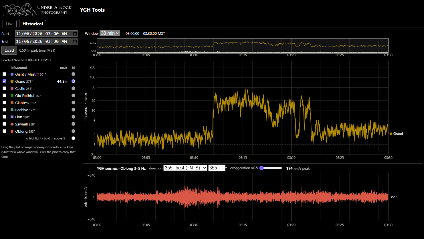
YGH Monitor App - Pt. 3: Use Cases
A living document showcasing examples of verified eruptions and their YGH traces
Published on: Thursday, 12 November 2026 at 00:55 UTC
YGH Monitor App - Pt. 2: How to Use the Tools
Instructions on how to navigate and use the YGH Monitor App for various forms of geyser gazing.
Published on: Saturday, 07 November 2026 at 00:55 UTC
YGH Monitor App - Pt. 1: Introduction
A new instrument in Yellowstone can be used for geyser gazing
Published on: Saturday, 07 November 2026 at 00:55 UTC
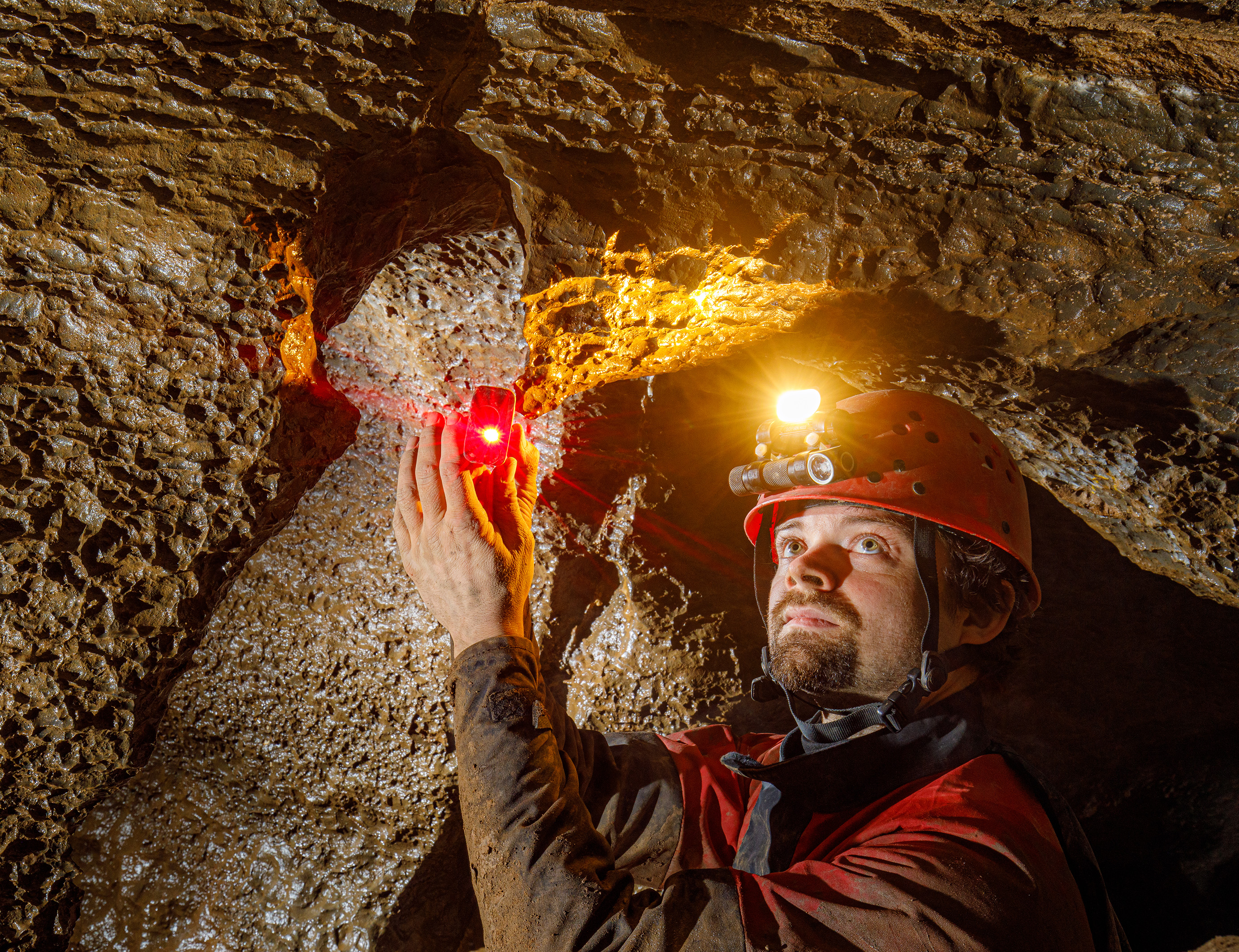
Sofirn's HS22 and SP40A Headlamps
For cavers, this is like having a sub-$150 Scurion
Published on: Wednesday, 17 December 2025 at 11:55 UTC
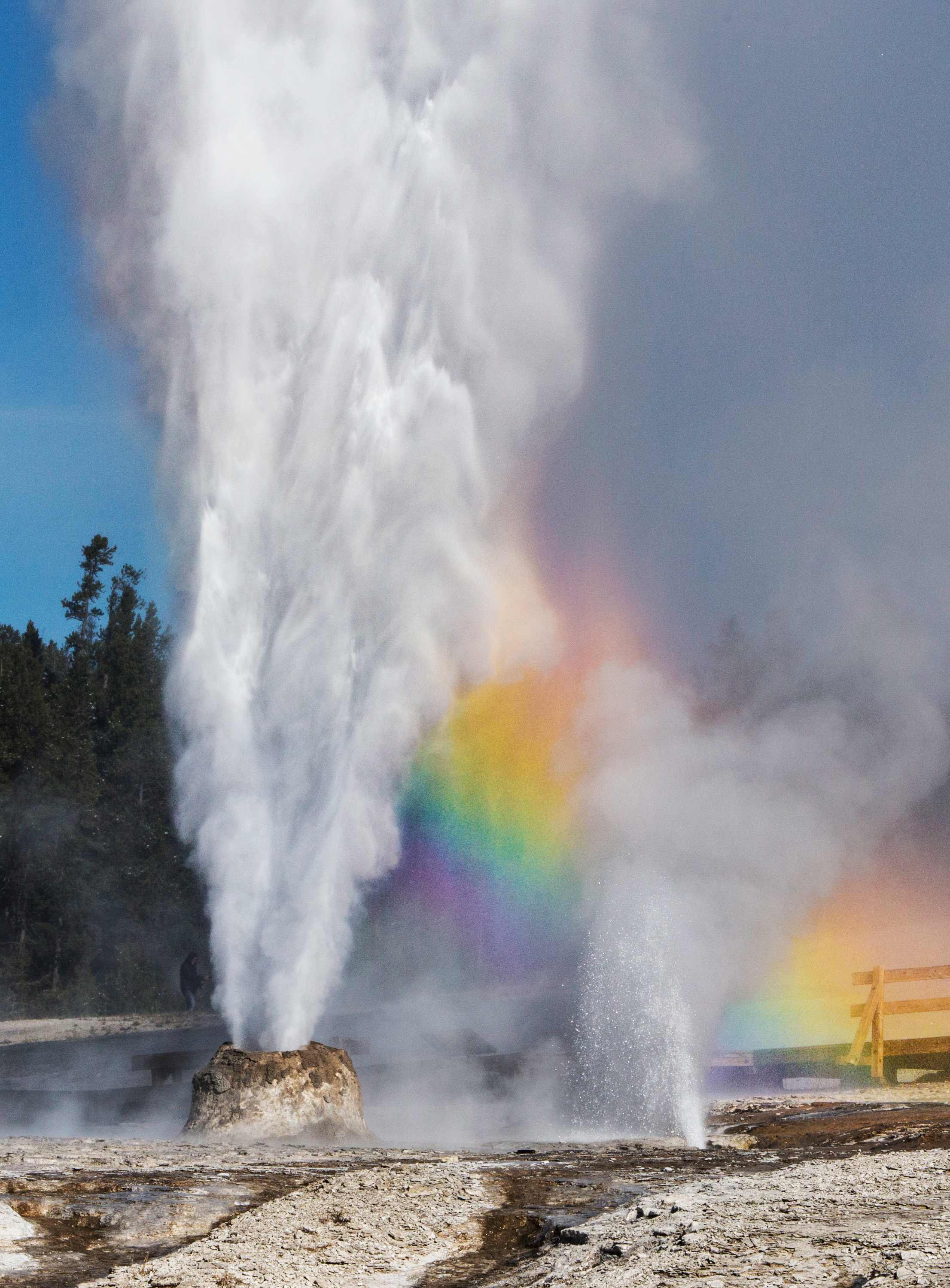
The Thermals Features of Yellowstone
Just over 3,000 words you didn't know you wanted to read.
Published on: Tuesday, 07 October 2025 at 11:55 UTC
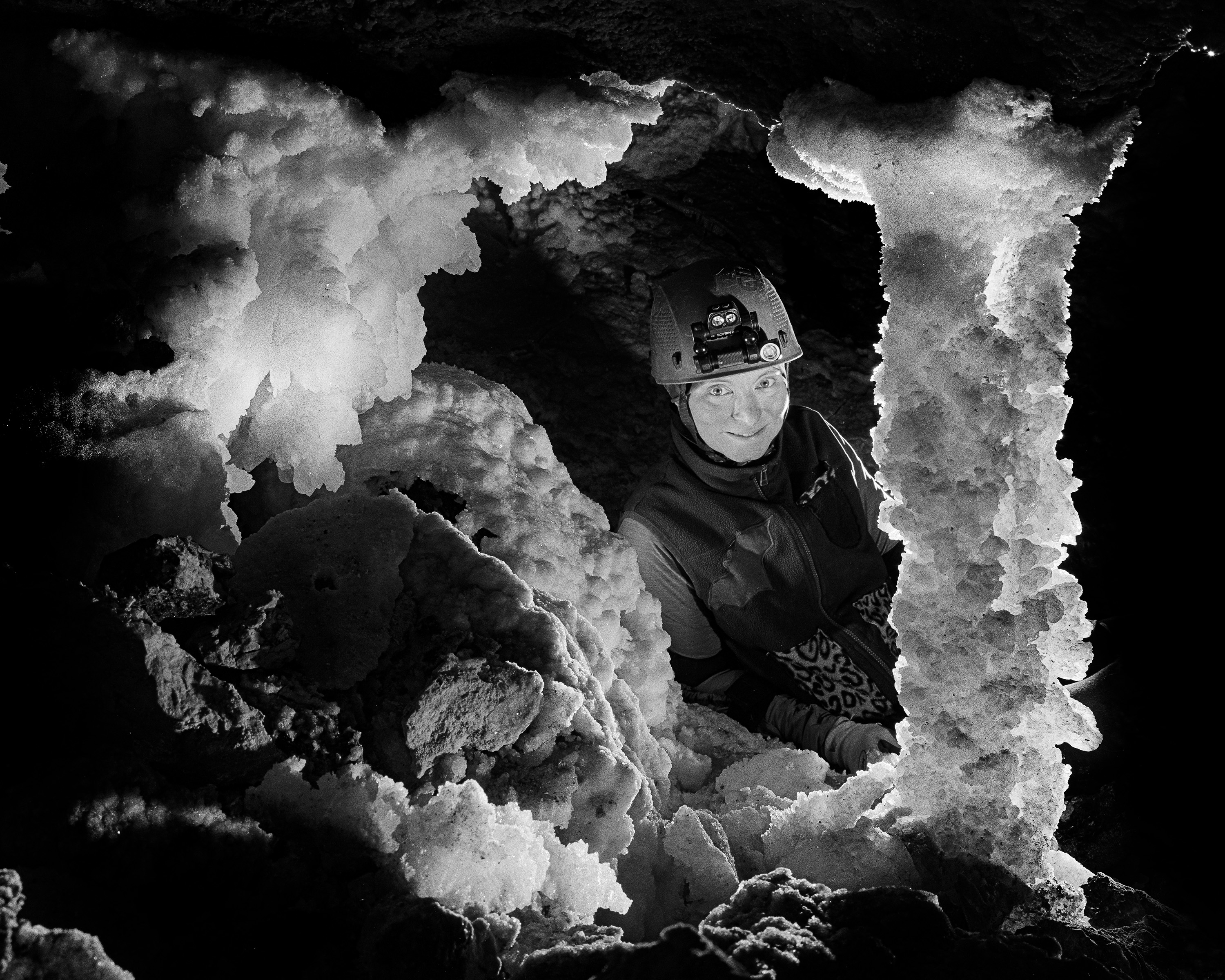
Trip Report: Bighorn-Horsethief Cave System
Surveying and photography during the August 2025 project weekend.
Published on: Wednesday, 01 October 2025 at 11:55 UTC
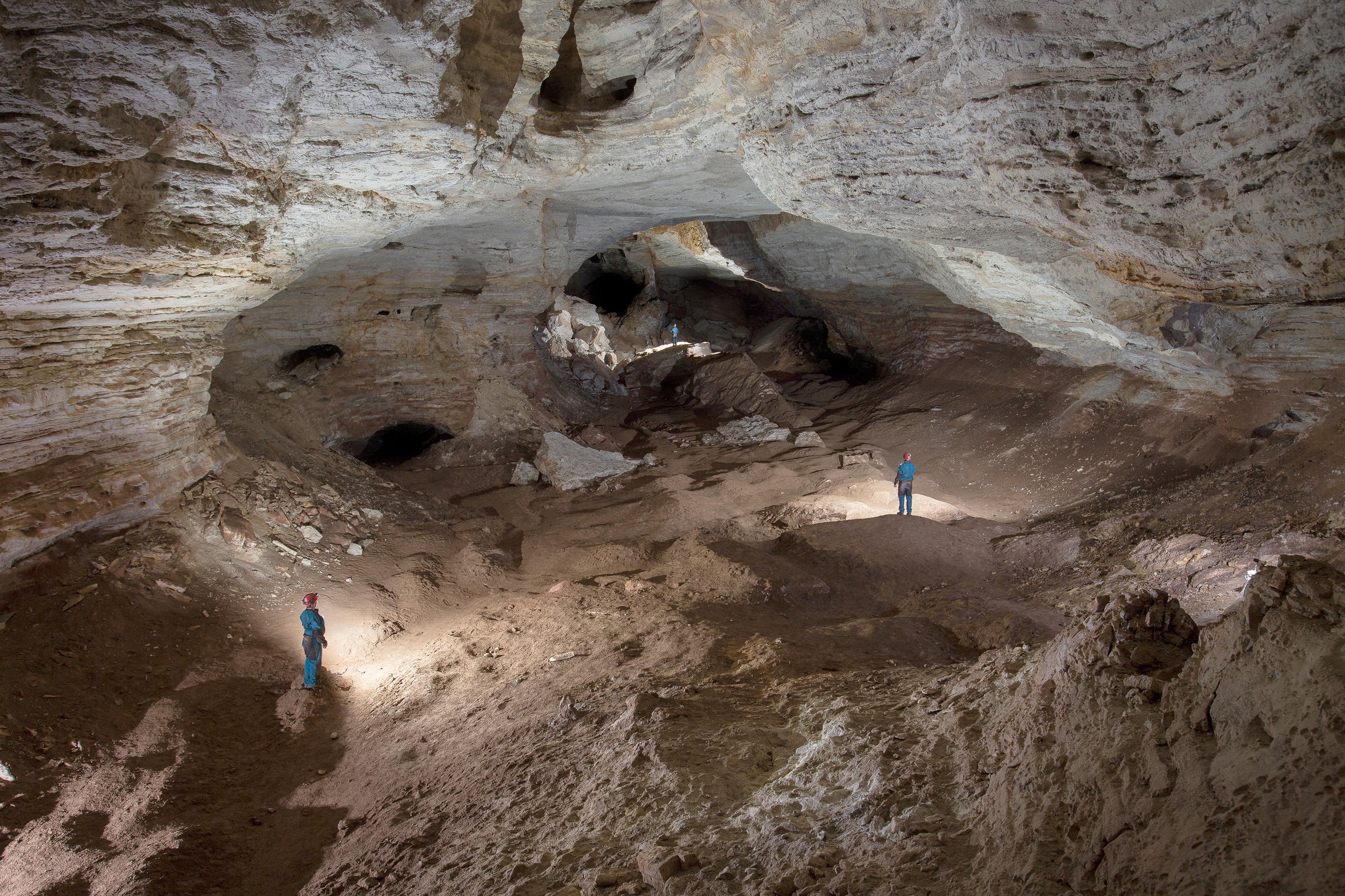
Bighorn-Horsethief Cave System
An introduction to the longest known cave in Wyoming and Montana
Published on: Tuesday, 23 September 2025 at 11:55 UTC
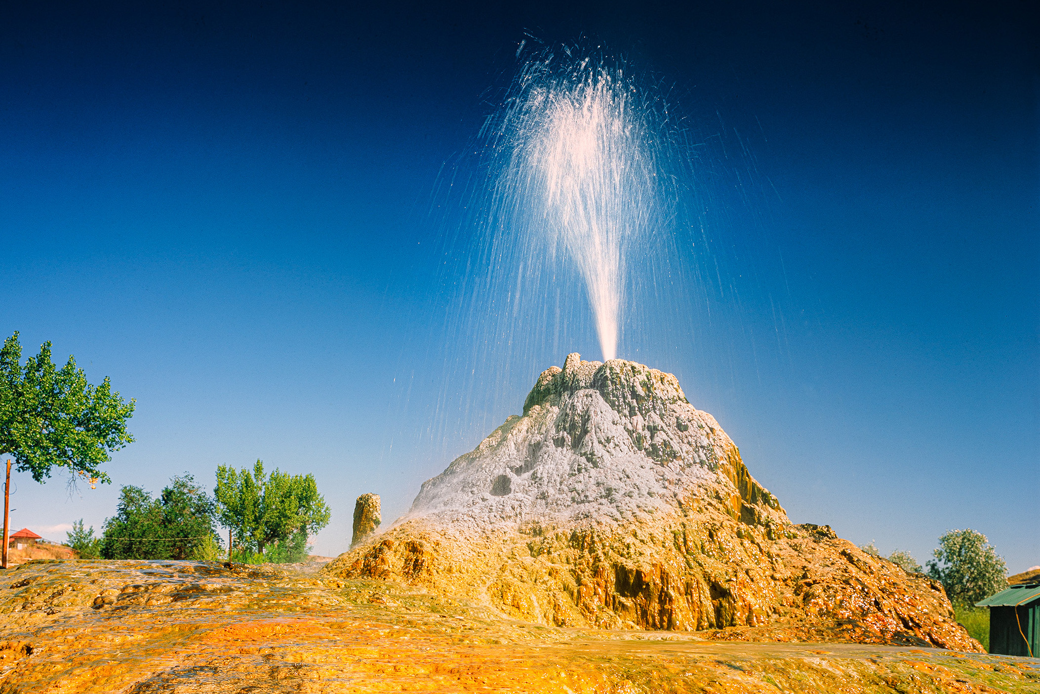
Thermopolis, WY, August 2025
Large travertine hot springs in central Wyoming
Published on: Friday, 19 September 2025 at 11:55 UTC
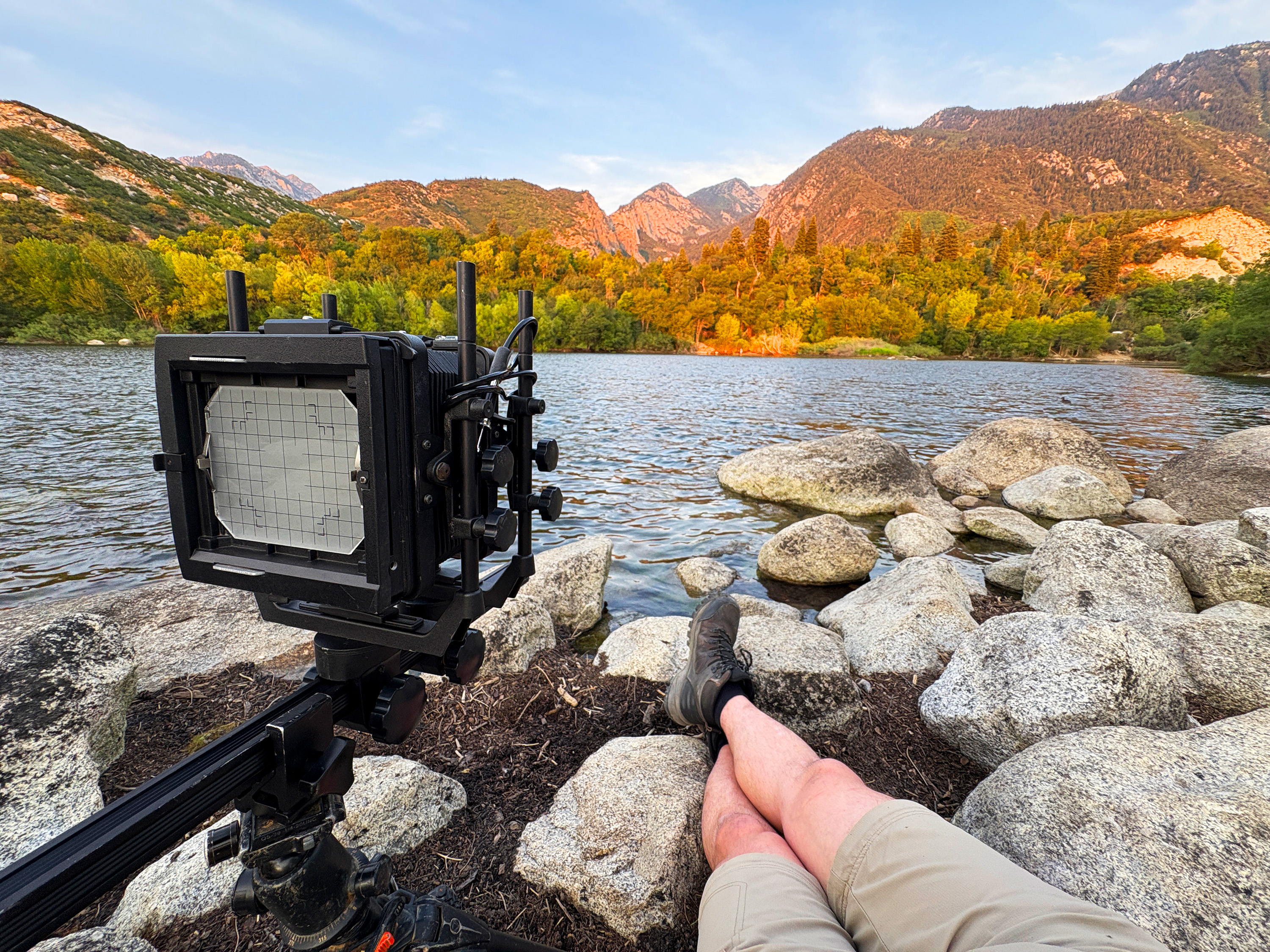
Lazy Photography in the Wasatch Range
Easy hiking and drive up sunsets from suburban Salt Lake City
Published on: Thursday, 11 September 2025 at 12:26 UTC
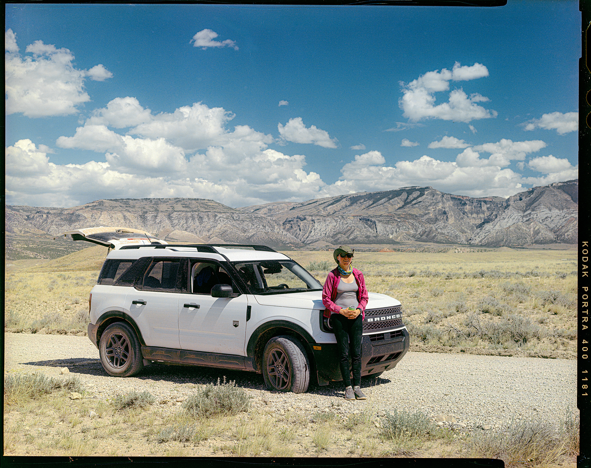
Car Review: 2026 Ford Bronco Sport
1500 miles of driving and camping with the 2026 Ford Bronco Sport
Published on: Wednesday, 10 September 2025 at 11:55 UTC
Wyoming, August 2025
Logistics and gear for eleven days of caving and photography in Big Sky Country
Published on: Wednesday, 10 September 2025 at 11:55 UTC
.jpg)
Tonto Natural Bridge
Massive travertine formation in central Arizona
Published on: Wednesday, 29 November 2023 at 11:55 UTC

Building This Website
Part 1: Lessons learned in mentally herding cats.
Published on: Friday, 14 July 2023 at 19:48 UTC
Bighorn-Horsethief Cave System
An introduction to the longest known cave in Wyoming and Montana
Published: Tuesday, 23 September 2025 at 11:55 UTC
Contents:
Please note that all caves mentioned here are owned and managed by federal agencies. they are all gated and access is only through the activities of the Bighorn-Horsetheif Resurvey Project. This protection is only reason I am mentioning these caves by name. For getting involved, please visit the Northern Rocky Mountain Grotto.
Our next stop on our trip through Wyoming was the combined cave system of Bighorn and Horsethief, located near the border of Wyoming and Montana. I first visited these caves in 2018. Will Boekel and I spent several hours exploring both sides of the system, venturing as far as five hours from the entrance to see places like the Carpet Room, the Crack Where Water Comes Down, and the famous gypsum chandeliers and columns in Bighorn.
That summer was before my deeper involvement in cave surveying and cartography, but even then, I recognized that both caves needed updated maps. It was already apparent that the combined system had the potential to exceed 30 miles in total length. I told Will at the time that if I lived within eight hours of the cave, I’d dedicate myself to the project.
In 2021, a coordinated effort began to resurvey the system—already known to exceed 13 miles in length. A year and a half ago, I joined the project as the cartographer, and this trip marked my first return as an official team member.
Geological Context
The Bighorn–Horsethief system is the northernmost of a series of extensive caves found along the western slopes of the Bighorn Mountains. These mountains were uplifted around 60 million years ago during the Laramide Orogeny, exposing formations like the Mississippian-aged Madison Limestone and the Ordovician-aged Bighorn Dolomite.
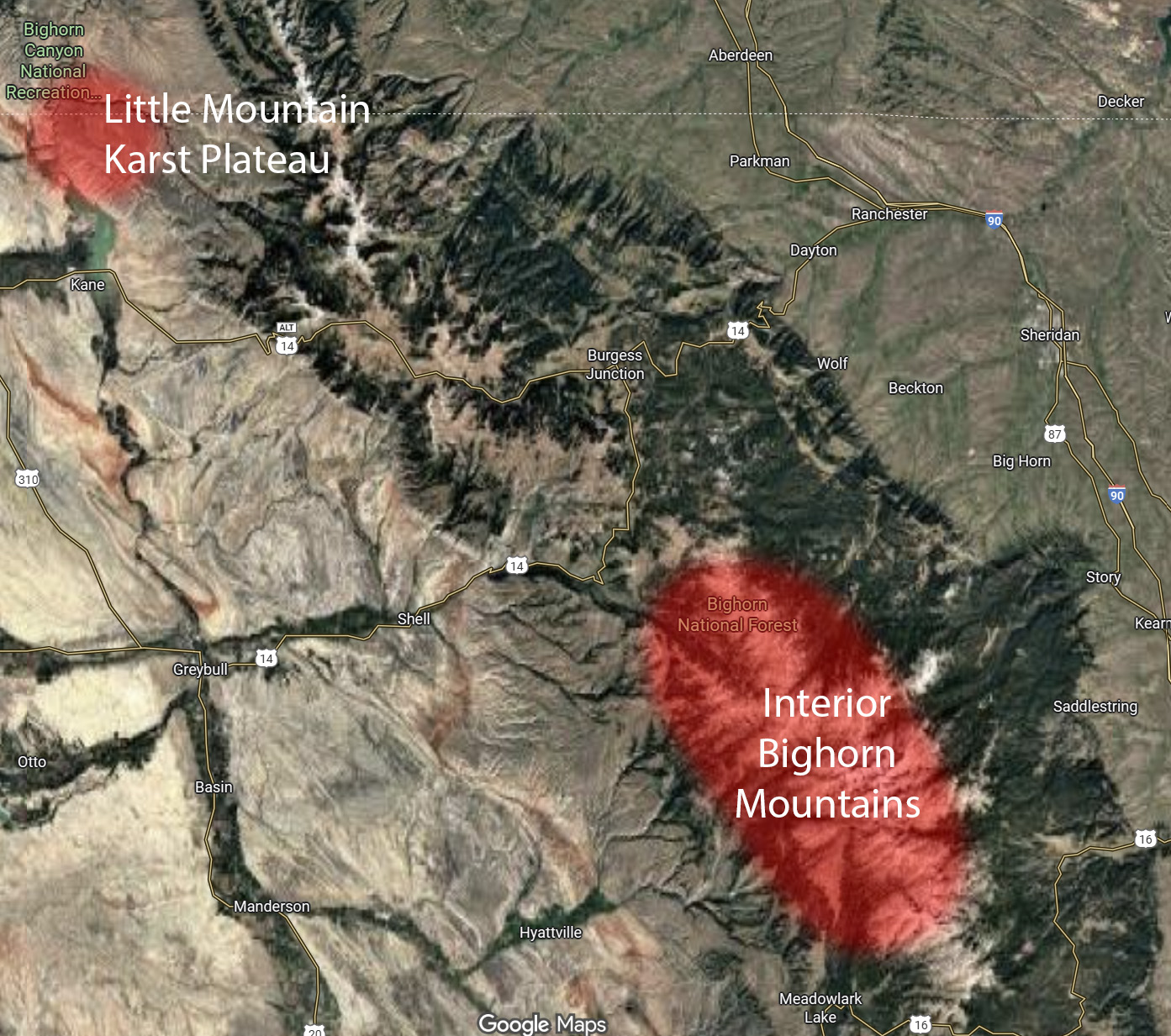
Broad overview of the two main karst regions in the Bighorn Mountains with the Little Mountain Karst Plateau to the north and the interior alpine caves to the south. The karst regions are the result of where different carbonates are exposed to the surface to form caves and are a function of elevation. In reality the Bighorn Dolomite, which dominates the interior karst, is exposed in a band running along both sides of the Bighorn Range near the middle peaks. The Madison Limestone, which forms the LMKP, is exposed along the lower elevations all along both sides of the Range.
Generally, as one travels south into the heart of the range, caves tend to form where the Bighorn Dolomite captures surface streams. Classic alpine caves like Great X, Tres Charros, and Bad Medicine are formed this way. In contrast, farther north—on a raised plateau called Little Mountain—the Bighorn Dolomite dips below the surface, and the Madison Limestone becomes the dominant cave-forming unit.
Little Mountain itself is a dissected karst plateau, bordered by Devils Canyon to the north, Bighorn Canyon to the west and south, and the Bighorn Mountains to the east.
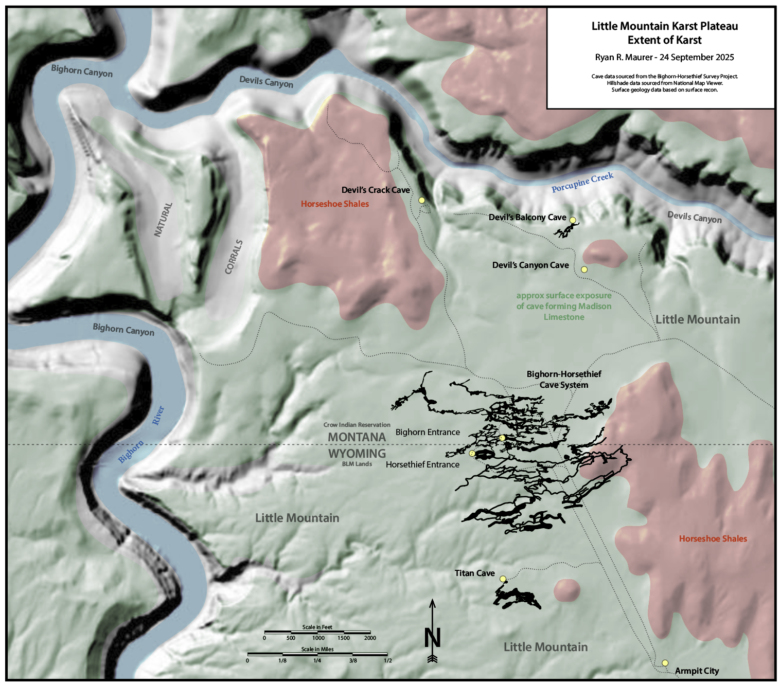
Overview of the karst of northern Little Mountain in the vicinity of Bighorn and Horsethief. The green area roughly indicates the extent of cave forming limestone, showing the vast potential of this region.
The Madison Limestone here is about 900 feet thick. After its deposition, it was exposed for around 10 million years, during which extensive cave development occurred in a zone about 300 feet below the top of the formation1. During the Laramide Orogeny, faulting and rifting collapsed many of these early caves, which were then filled with debris from the surface. This collapse created an irregular bedding surface visible in Devils Canyon, where many cave entrances are now located.
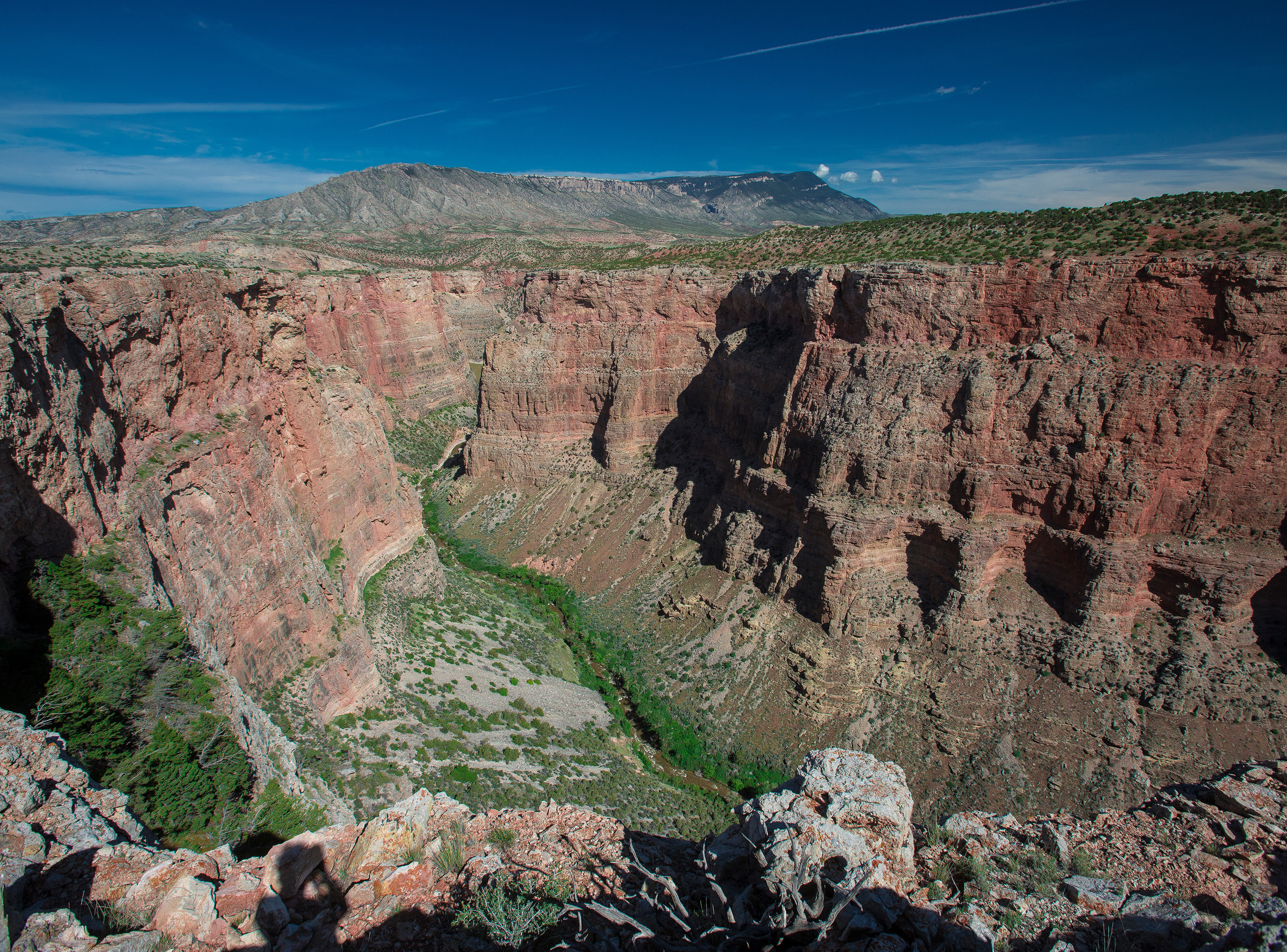
Today, Bighorn–Horsethief is formed primarily within a middle zone of the Madison Limestone—between the collapsed lower layers and the irregular upper surface that includes shale intermixing from the overlying Horseshoe Shale.
Modern cave development occurred as the Bighorn River and associated aquifers flowed through the upper Madison, dissolving phreatic passages along shallow bedding planes (around a 5° dip to the northwest)2. Vertical fissures later allowed surface material—dirt, shale, and even volcanic ash from the 640,000-year-old Lava Creek eruption of the Yellowstone Supervolcano—to fall into the system, forming large sediment mounds known as buddhas3.
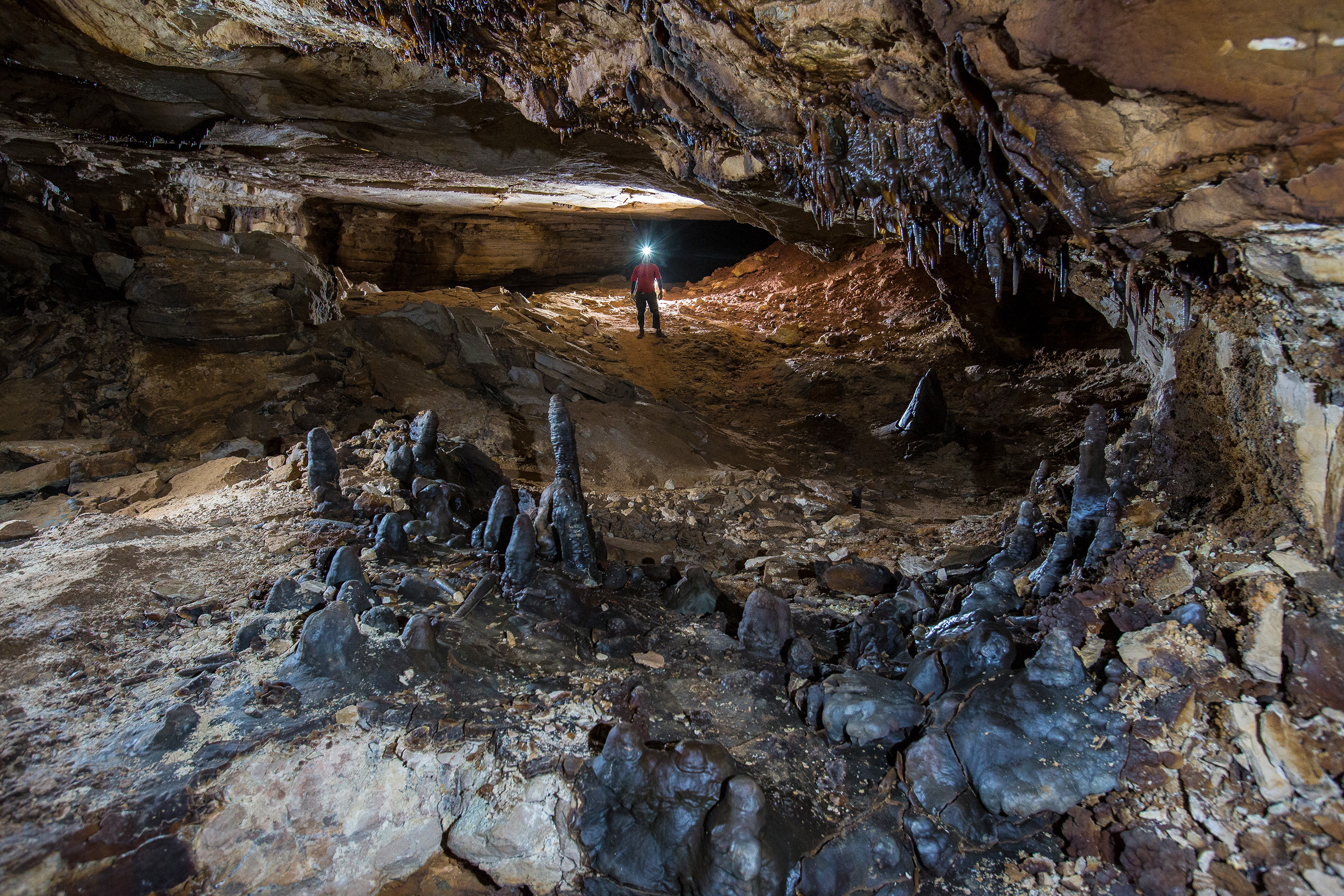
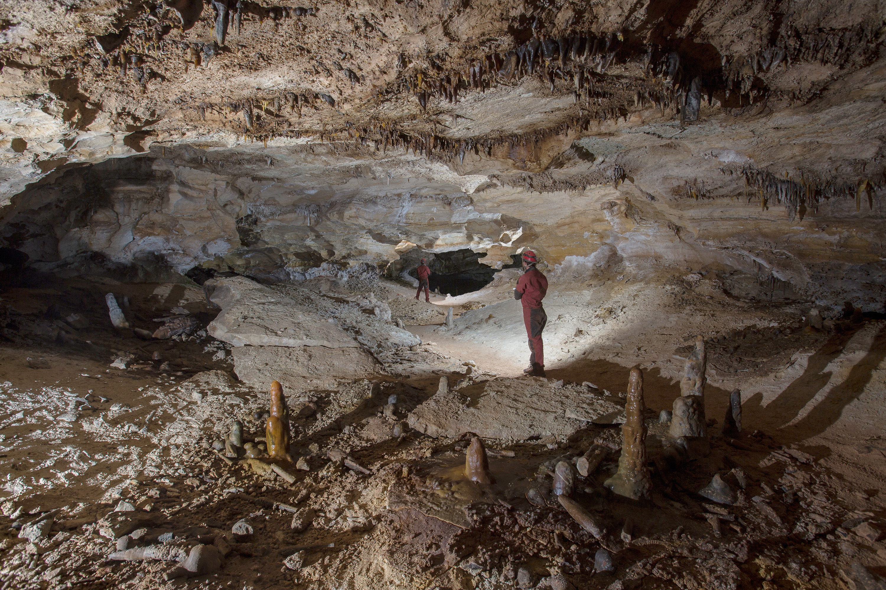
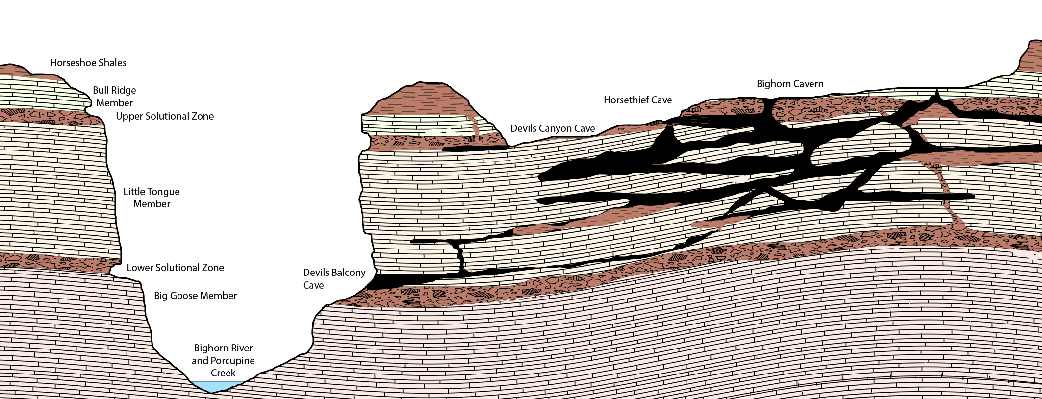
Generalized diagram of Little Mountain Karst Plateau caves and karst with relation to local strata and the Bighorn River. Note that the Bighorn River (and Porcupine Creek) are much lower in elevation than shown here.
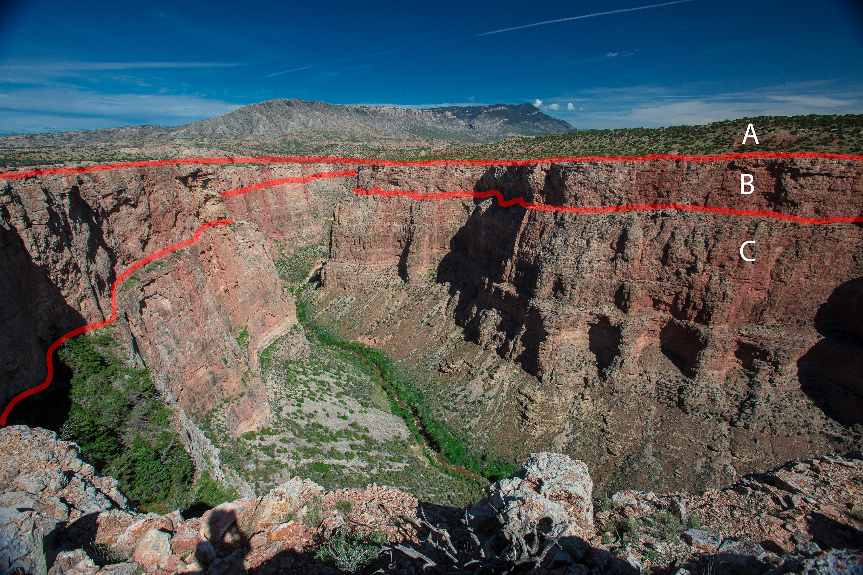
Here the upper and lower solutional zones are marked in red. Zone A is the Bull Ridge Member, Zone B is the Little Tongue Member, and Zone C is the Big Goose Member. Zone B is where almost all cave development occurs.
Some fissures have sealed shut, while others remain partially open. One such fissure forms the pit entrance to Bighorn Cavern. Evidence suggests this entrance may have collapsed open quite recently—perhaps even in the late 1950s.
Human History and Exploration
Human interaction with the system begins with Native American presence—specifically the Crow Tribe, who have occupied and managed the area for the last 200 years in cooperation with the BLM (which manages Horsethief) and the NPS (which manages Bighorn).
The earliest written account appears in 1880, when Rollin Reeves’ Original Land Survey Field Notes for the Northern Boundary of Wyoming Territory mentioned a “cave entrance, 40 feet square,” just north of the state line. This almost certainly describes Horsethief Cave. At the time, survey inaccuracies placed the entrance just over the border in Montana. Later revisions to the state boundary survey corrected this placement, and Horsethief is now definitively within Wyoming4.
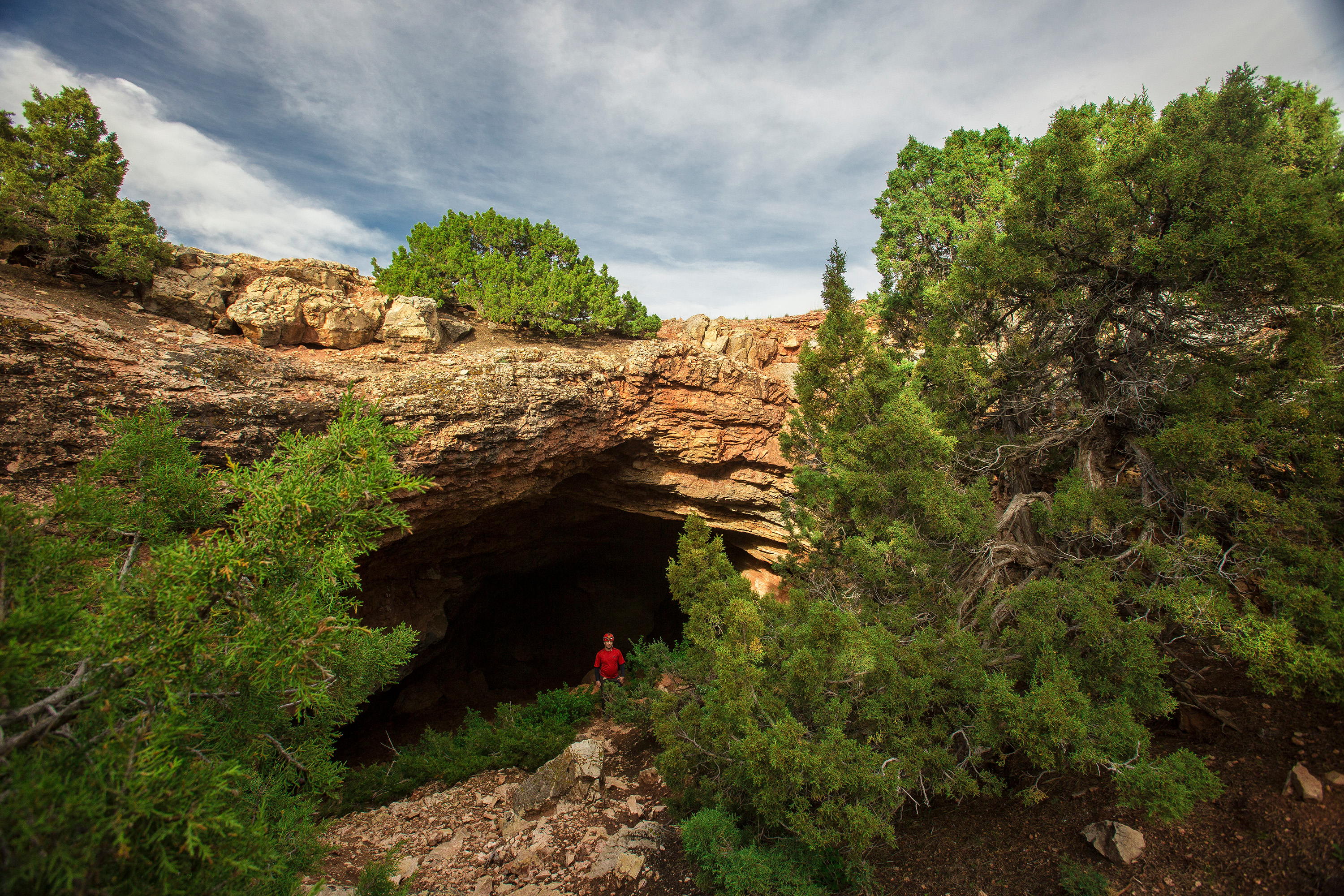
Curiously, there was no mention of a second entrance—what would later be known as Bighorn Cavern—despite the fact that uranium was actively being mined nearby during the late 1950s. This omission is notable, given the presence of the Armpit mining claim, which established a landing strip for B-26 aircraft and became the namesake for the area.
Today, that historic mining claim survives in name and location as Armpit City—a pair of old, weather-beaten huts that now serve as field stations for the modern survey project.
In the 1930s, local rancher Steve Meaker explored Horsethief Cave and reported thousands of feet of passage. His claims, however, were largely ignored5. It wasn’t until 1961 that BLM survey crews informed Royce Tillet (of the Treasure State Speleological Society, an early forerunner to the Northern Rocky Mountain Grotto) of a second entrance—what would become known as Bighorn Cavern.
Tillet and others entered the new pit entrance in June 1961, initially calling it the Glory Hole, then Cave X, and eventually Bighorn Cavern. Remarkably, they found cairns and string in what is now known as the B-Line, suggesting a connection between the two caves that had previously been hinted at in Meaker's 1930s reports.
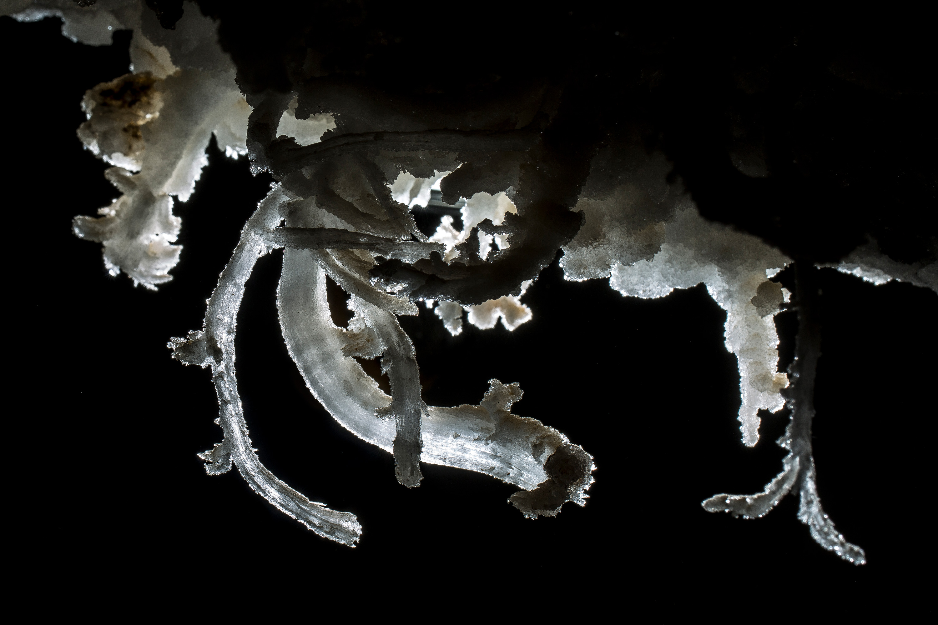
During this period of exploration, a local caver pushed through the 600 foot long series of crawling passages beyond the known end of Horsetheif Cave to emerge into miles or large and decorated trunk passage. This series of crawls serves as a natural barrier to the delicate heart of Little Mountain.
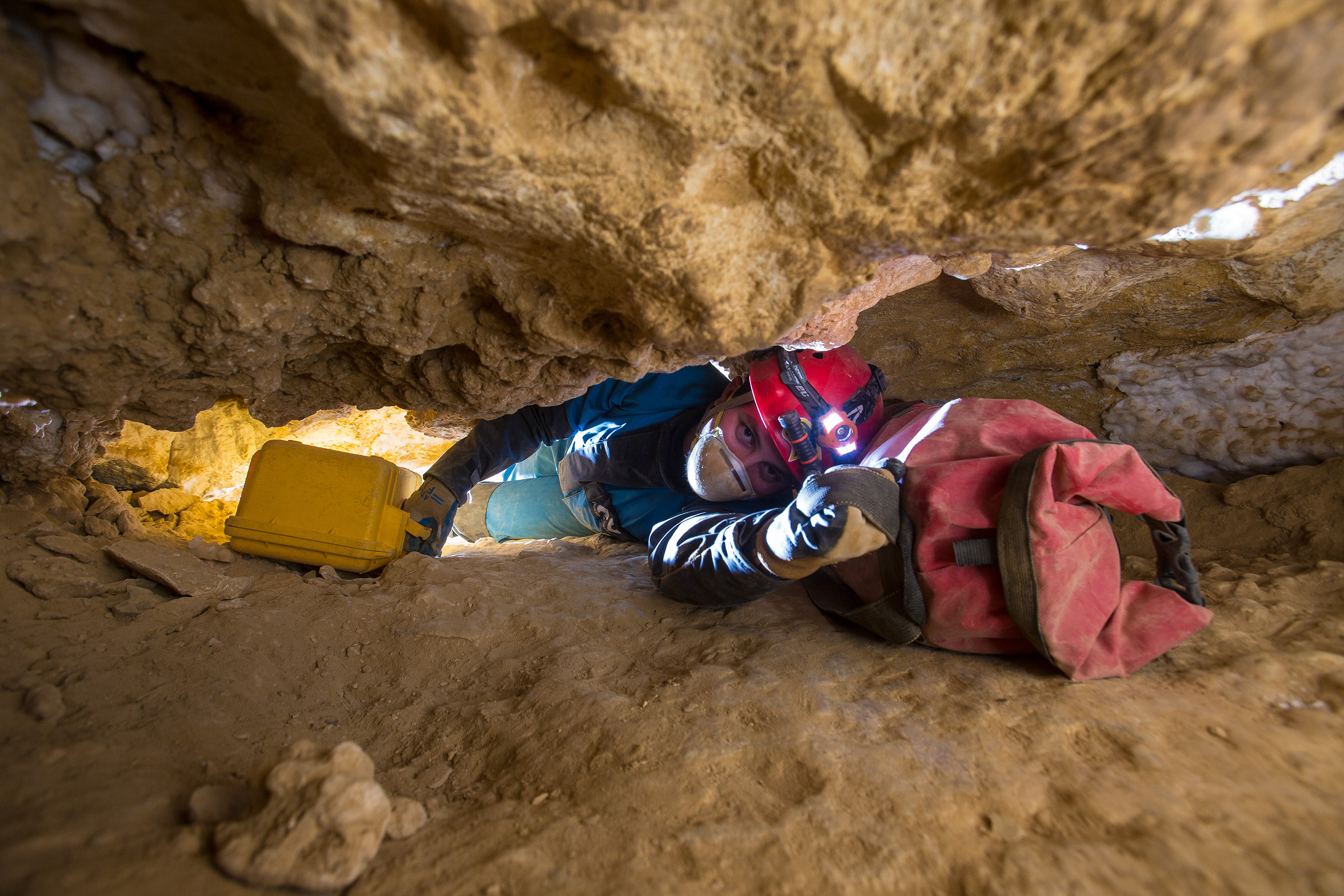
The physical connection between Horsethief and Bighorn was rediscovered in 1968, then later plugged shut in the early 1970s to protect the sensitive interior.
During the 1960s and 70s, the TSSS mapped large portions of both caves. In the 1970s, access restrictions began to appear—largely to protect Bighorn’s gypsum formations. A gate was installed in Denise’s Crawl (in Horsethief), and an elevated platform was constructed over the Bighorn entrance. After cavers returned from a trip to find their ropes had been untied, the platform was later enclosed to prevent tampering6.
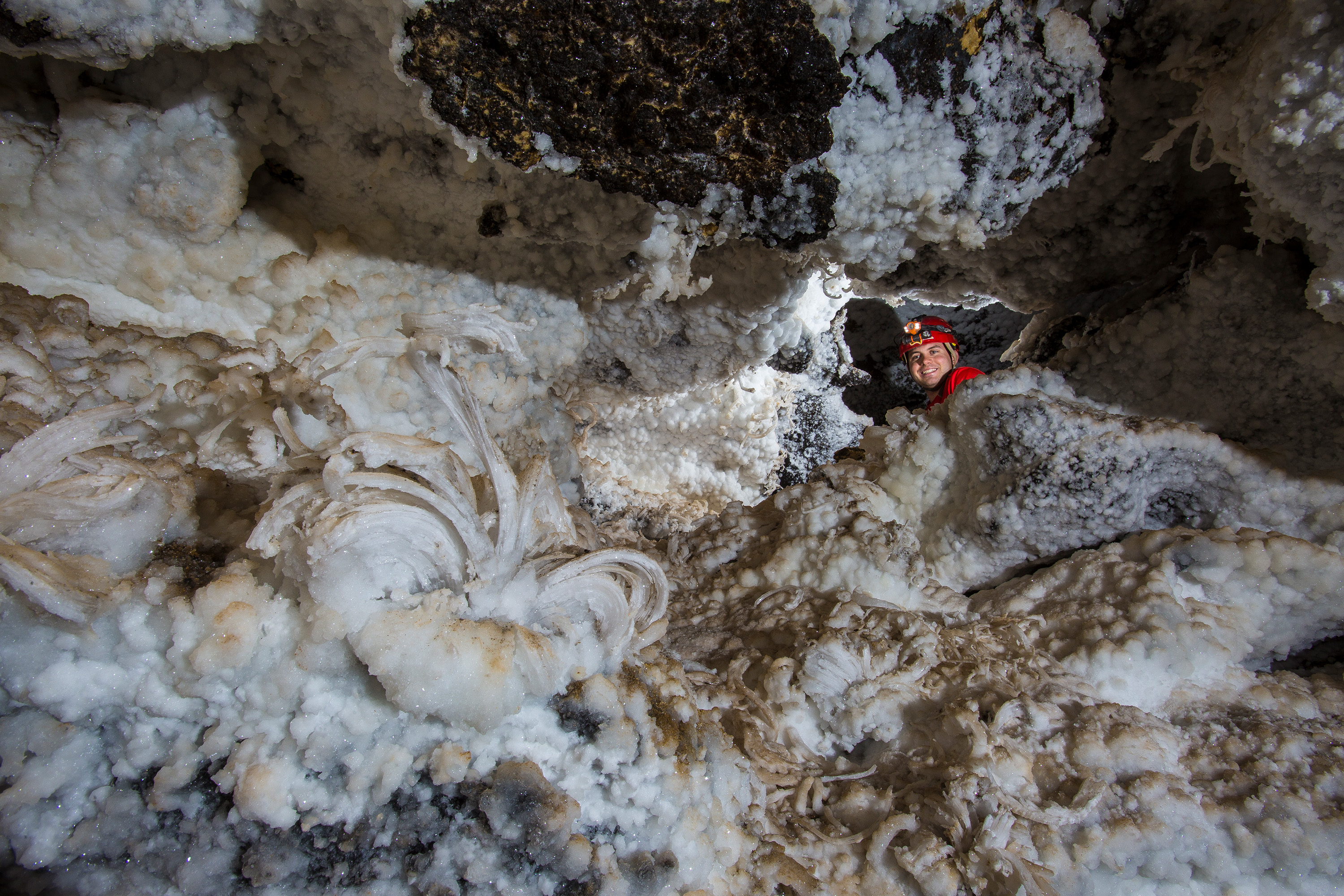
In 1985, the Northwest Cave Research Institute launched the most recent major survey effort prior to today’s project, ultimately producing length estimates of over 10 miles of surveyed passage7.
A Recent Discovery?
So why was Bighorn Cavern not documented until 1961? My belief is that the entrance pit itself did not exist prior to that time—it is likely a collapse feature that opened sometime between 1959 and early 1961, during a period of low visitation following the uranium mining era.
The passages directly below the pit contain fresh surface debris and sediments, and the top of the pit still hosts a seasonal streambed that carries water into the cave during storms. This streambed has not yet cut down to bedrock, and the surrounding apron of soil and sediment remains largely intact—unlike the clean, washed entrance of Natural Trap Cave farther south.
Where It Goes from Here
These geological questions—and others related to the system’s total extent—are a key reason behind the current resurvey project, which began in 2021. So far, just over 5 miles of passage have been remapped with modern techniques. But the cave lies in the heart of the Little Mountain karst plateau, which extends unbroken to the north, south, and east.
It is geologically likely that Titan Cave to the south and the Devil's Canyon caves to the north were once part of the same unified cave system as Bighorn and Horsethief—now separated only by sediment plugs and collapsed fissures. Whether those connections can be physically rediscovered remains to be seen.
References
Bighorn Research Project Report, page 97
Bighorn Research Project Report, page 125
Bighorn Research Project Report, page 125
Bighorn Research Project Report, page 126

 v.2026.11.12.A
%20--%3e%3cdefs%3e%3cstyle%3e%20.st0%20{%20fill:%20%23fff;%20}%20%3c/style%3e%3c/defs%3e%3cg%3e%3cpath%20class='st0'%20d='M55.7,107.69h-11.41l-2.1,5.82h-3.6l9.46-26.01h3.94l9.42,26.01h-3.6l-2.1-5.82ZM54.73,104.91l-4.73-13.21-4.73,13.21h9.46Z'/%3e%3cpath%20class='st0'%20d='M80.79,100.43c-1.49,1.44-3.76,2.16-6.81,2.16h-5.03v10.92h-3.42v-26.16h8.45c2.95,0,5.2.71,6.74,2.14,1.54,1.43,2.31,3.27,2.31,5.52s-.74,3.98-2.23,5.42ZM78.19,98.53c.9-.83,1.35-2,1.35-3.53,0-3.23-1.85-4.84-5.56-4.84h-5.03v9.61h5.03c1.9,0,3.3-.41,4.2-1.24Z'/%3e%3cpath%20class='st0'%20d='M102.53,100.43c-1.49,1.44-3.76,2.16-6.81,2.16h-5.03v10.92h-3.42v-26.16h8.45c2.95,0,5.2.71,6.74,2.14,1.54,1.43,2.31,3.27,2.31,5.52s-.74,3.98-2.23,5.42ZM99.92,98.53c.9-.83,1.35-2,1.35-3.53,0-3.23-1.85-4.84-5.56-4.84h-5.03v9.61h5.03c1.9,0,3.3-.41,4.2-1.24Z'/%3e%3cpath%20class='st0'%20d='M112.66,112.85c-1.36-.61-2.43-1.46-3.21-2.55-.78-1.09-1.18-2.35-1.2-3.77h3.64c.13,1.23.63,2.26,1.52,3.1.89.84,2.18,1.26,3.88,1.26s2.91-.41,3.85-1.22c.94-.81,1.41-1.86,1.41-3.13,0-1-.28-1.81-.83-2.44s-1.24-1.1-2.06-1.43c-.83-.32-1.94-.68-3.34-1.05-1.73-.45-3.11-.9-4.15-1.35s-1.93-1.16-2.66-2.12c-.74-.96-1.11-2.26-1.11-3.88,0-1.43.36-2.69,1.09-3.79.72-1.1,1.75-1.95,3.06-2.55,1.31-.6,2.82-.9,4.52-.9,2.45,0,4.46.61,6.02,1.84,1.56,1.23,2.45,2.85,2.65,4.88h-3.75c-.13-1-.65-1.88-1.58-2.65-.93-.76-2.15-1.14-3.68-1.14-1.43,0-2.59.37-3.49,1.11s-1.35,1.77-1.35,3.1c0,.95.27,1.73.81,2.33.54.6,1.2,1.06,1.99,1.37.79.31,1.9.67,3.32,1.07,1.73.48,3.12.94,4.17,1.41,1.05.46,1.95,1.18,2.7,2.14s1.13,2.27,1.13,3.92c0,1.28-.34,2.48-1.01,3.6-.68,1.13-1.68,2.04-3,2.74-1.33.7-2.89,1.05-4.69,1.05s-3.27-.31-4.64-.92Z'/%3e%3c/g%3e%3cpath%20class='st0'%20d='M115.19,16.11C105.67.35,85.18-4.71,69.42,4.8c-15.76,9.52-20.82,30.01-11.31,45.77s30.01,20.82,45.77,11.31c15.76-9.52,20.82-30.01,11.31-45.77ZM81.9,49.87c0,1.65-1.34,2.98-2.98,2.98h-8.89c-1.65,0-2.98-1.34-2.98-2.98v-8.89c0-1.65,1.34-2.98,2.98-2.98h8.89c1.65,0,2.98,1.34,2.98,2.98v8.89ZM81.9,24.92c0,1.65-1.34,2.98-2.98,2.98h-8.89c-1.65,0-2.98-1.34-2.98-2.98v-8.89c0-1.65,1.34-2.98,2.98-2.98h8.89c1.65,0,2.98,1.34,2.98,2.98v8.89ZM107.24,49.87c0,1.65-1.34,2.98-2.98,2.98h-8.89c-1.65,0-2.98-1.34-2.98-2.98v-8.89c0-1.65,1.34-2.98,2.98-2.98h8.89c1.65,0,2.98,1.34,2.98,2.98v8.89ZM107.24,24.92c0,1.65-1.34,2.98-2.98,2.98h-8.89c-1.65,0-2.98-1.34-2.98-2.98v-8.89c0-1.65,1.34-2.98,2.98-2.98h8.89c1.65,0,2.98,1.34,2.98,2.98v8.89Z'/%3e%3c/svg%3e)


